Chapman, Pennsylvania facts for kids
Quick facts for kids
Chapman, Pennsylvania
|
|
|---|---|
|
Borough
|
|

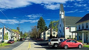
Main Street in Chapman, May 2014
|
|

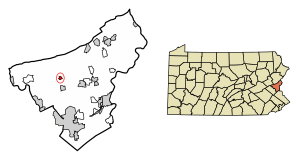
Location of Chapman in Northampton County, Pennsylvania (left) and of Northampton County in Pennsylvania (right)
|
|
| Country | |
| State | |
| County | Northampton |
| Area | |
| • Borough | 0.36 sq mi (0.93 km2) |
| • Land | 0.33 sq mi (0.85 km2) |
| • Water | 0.03 sq mi (0.07 km2) |
| Elevation | 705 ft (215 m) |
| Population
(2020)
|
|
| • Borough | 223 |
| • Density | 675.76/sq mi (261.26/km2) |
| • Metro | 865,310 (US: 68th) |
| Time zone | UTC-5 (EST) |
| • Summer (DST) | UTC-4 (EDT) |
| ZIP Code |
18014
|
| Area code(s) | 610 and 484 |
| FIPS code | 42-12656 |
| Primary airport | Lehigh Valley International Airport |
| Major hospital | Lehigh Valley Hospital–Cedar Crest |
| School district | Northampton Area |
| Website | chapmanborough.com |
Chapman is a small town, called a borough, located in Northampton County, Pennsylvania. In 2020, about 223 people lived there. Chapman is part of a larger area known as the Lehigh Valley, which is home to over 860,000 people.
Contents
History of Chapman
Chapman was named after a man named William Chapman. He owned slate quarries in the area. William Chapman was born in 1816 in Brussels, Belgium. His mother had gone there to care for his father, who was hurt in the Battle of Waterloo.
When William was seven, he started working in slate quarries in Cornwall, England, just like his father. At age 26, he moved to the United States. He first rented land in Northampton County, then bought it. This is where he started the Chapman Slate Company.
The slate quarries first opened in 1850. The company officially became a business in 1864. It was a big quarry, measuring about 700 to 800 feet long and 200 feet wide. It was also very deep, about 300 feet! William Chapman passed away in Bethlehem, Pennsylvania in 1903 when he was 86 years old.
Geography of Chapman
Chapman is located at 40°45′42″N 75°24′15″W / 40.76167°N 75.40417°W. The borough covers a total area of about 0.4 square miles (about 1 square kilometer). Most of this area is land. The Monocacy Creek flows through Chapman and eventually drains into the Lehigh River. The town is surrounded by Moore Township.
Getting Around in Chapman
In 2007, Chapman had about 2.53 miles (4.07 kilometers) of public roads. Some roads are kept up by the Pennsylvania Department of Transportation (PennDOT), and others are maintained by the borough itself.
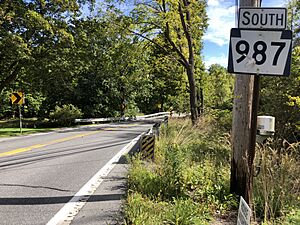
Route 987 runs along Chapman's southwestern edge. It is also known as Monocacy Drive. The other main streets in Chapman are Fifth Street, which runs east-to-west, and Main Street, which runs north-to-south.
People of Chapman
| Historical population | |||
|---|---|---|---|
| Census | Pop. | %± | |
| 1870 | 388 | — | |
| 1880 | 382 | −1.5% | |
| 1890 | 392 | 2.6% | |
| 1900 | 319 | −18.6% | |
| 1910 | 253 | −20.7% | |
| 1920 | 228 | −9.9% | |
| 1930 | 232 | 1.8% | |
| 1940 | 248 | 6.9% | |
| 1950 | 285 | 14.9% | |
| 1960 | 237 | −16.8% | |
| 1970 | 191 | −19.4% | |
| 1980 | 255 | 33.5% | |
| 1990 | 254 | −0.4% | |
| 2000 | 234 | −7.9% | |
| 2010 | 199 | −15.0% | |
| 2020 | 223 | 12.1% | |
| Sources: | |||
In 2000, there were 234 people living in Chapman, making up 89 households. Most people living in Chapman were White.
About 31.5% of the households had children under 18. Many households (59.6%) were married couples living together. The average household had about 2.63 people.
The population was spread out by age. About 25.6% of the people were under 18, and 10.7% were 65 or older. The average age in Chapman was 38 years.
Schools in Chapman
The schools in Chapman are part of the Northampton Area School District. Students in grades nine through 12 attend Northampton Area High School in Northampton.
See also
 In Spanish: Chapman (Pensilvania) para niños
 | Emma Amos |
 | Edward Mitchell Bannister |
 | Larry D. Alexander |
 | Ernie Barnes |


