Chardown Hill facts for kids
Quick facts for kids Chardown Hill |
|
|---|---|

Chardown Hill
|
|
| Highest point | |
| Elevation | 194 m (636 ft) |
| Prominence | 68 m (223 ft) |
| Parent peak | Hardown Hill |
| Listing | Tump |
| Geography | |
| Location | Dorset, England |
| Parent range | South Dorset Downs |
| OS grid | SY396936 |
| Topo map | OS Landranger 193 |
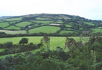
Chardown Hill is a beautiful, rounded hill located in the county of Dorset in southern England. It stands tall at 194 meters (about 636 feet) and is found just southwest of the village of Morcombelake. From its top, you can enjoy fantastic views of the Dorset coast, which is only about 1.5 kilometers (less than a mile) to the south.
This hill is special because of its "prominence," which is how much it rises above the land around it. With a prominence of 63 meters, Chardown Hill is listed as a "Tump." A Tump is a hill that has a certain amount of prominence, making it stand out from other hills nearby. Chardown Hill is part of the South Dorset Downs, a lovely area known for its rolling hills.
Exploring Chardown Hill
The very top of Chardown Hill is an open space, perfect for exploring. A special path called a bridleway crosses this area, running from north to south. A bridleway is a path that can be used by walkers, horse riders, and cyclists.
Paths and Views
Just south of the highest point, another path joins the bridleway. This is a public footpath that comes from Stonebarrow Hill, which is a western part of Chardown Hill. A public footpath is a path that anyone can use to walk and enjoy nature.
If you follow the coastline, you'll find the famous South West Coast Path. This long-distance walking trail passes right along the bottom of Chardown Hill, just above the coastal cliffs. It's a great spot to see the stunning views where the land meets the sea.
 | Aaron Henry |
 | T. R. M. Howard |
 | Jesse Jackson |

