Chateaugay (village), New York facts for kids
Quick facts for kids
Chateaugay
Châteaugay (French)
|
|
|---|---|
|
Village
|
|

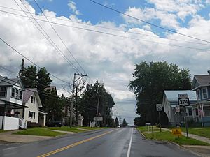
NY 374 in Chateaugay.
|
|
| Country | United States |
| State | New York |
| County | Franklin |
| Town | Chateaugay |
| Named for | Châteaugay, France |
| Area | |
| • Total | 1.08 sq mi (2.81 km2) |
| • Land | 1.08 sq mi (2.81 km2) |
| • Water | 0.00 sq mi (0.00 km2) |
| Elevation | 945 ft (288 m) |
| Population
(2020)
|
|
| • Total | 735 |
| • Density | 678.67/sq mi (261.95/km2) |
| Time zone | UTC-5 (Eastern (EST)) |
| • Summer (DST) | UTC-4 (EDT) |
| ZIP code |
12920
|
| Area code(s) | 518 |
| FIPS code | 36-13981 |
| GNIS feature ID | 0946443 |
Chateaugay (which is Châteaugay in French) is a small village in Franklin County, New York, in the United States. In 2020, about 735 people lived there. The village is part of the larger town of Chateaugay. It is located northeast of the city of Malone. Both the village and the town get their name from a village near Lyon in France. This French village's name was also given to a large piece of land in Canada long ago.
History of Chateaugay
The village of Chateaugay officially became a village in 1868. Even though it has faced three big fires that caused a lot of damage throughout its history, the village has always rebuilt and kept going.
Geography of Chateaugay
Chateaugay village is located right in the middle of the town of Chateaugay. You can find it near the northeastern part of Franklin County. Its exact location is 44°55′32″N 74°4′41″W / 44.92556°N 74.07806°W.
The United States Census Bureau says that the village covers about 2.8 square kilometers (1.08 square miles). All of this area is land, with no water.
A small stream called Bailey Brook flows north through the village. It then turns west and joins the Chateaugay River.
Important roads meet in the village. U.S. Route 11 crosses New York State Route 374. US-11 goes southwest for about 13 miles to Malone. It also goes east for about 33 miles to Interstate 87 at Champlain. NY-374 heads north for about 4.5 miles to the Canada–US border.
Population and People
| Historical population | |||
|---|---|---|---|
| Census | Pop. | %± | |
| 1880 | 680 | — | |
| 1890 | 1,172 | 72.4% | |
| 1900 | 973 | −17.0% | |
| 1910 | 1,045 | 7.4% | |
| 1920 | 1,291 | 23.5% | |
| 1930 | 1,169 | −9.5% | |
| 1940 | 1,183 | 1.2% | |
| 1950 | 1,234 | 4.3% | |
| 1960 | 1,097 | −11.1% | |
| 1970 | 976 | −11.0% | |
| 1980 | 869 | −11.0% | |
| 1990 | 845 | −2.8% | |
| 2000 | 798 | −5.6% | |
| 2010 | 833 | 4.4% | |
| 2020 | 735 | −11.8% | |
| U.S. Decennial Census | |||
Based on the census from 2000, there were 798 people living in the village. These people lived in 338 households, and 209 of those were families. The village had about 740 people per square mile. There were 390 houses or apartments.
Most people in the village were White (98.25%). A small number were Black (0.50%), Native American (0.63%), or from other backgrounds. About 0.50% of the population was Hispanic or Latino.
In 2000, about 27.8% of households had children under 18 living there. About 44.7% were married couples. About 12.4% were single mothers. And 37.9% were not families. About 32.5% of all households had only one person living there. About 14.8% of households had someone aged 65 or older living alone. The average household had 2.33 people. The average family had 2.90 people.
The population was spread out by age. About 23.6% were under 18 years old. About 8.6% were between 18 and 24. About 28.2% were between 25 and 44. About 23.3% were between 45 and 64. And 16.3% were 65 years or older. The average age was 39 years. For every 100 females, there were about 90.9 males.
In 2000, the average income for a household in the village was $34,000. For families, the average income was $35,750. The average income per person in the village was $16,436. About 16.3% of all people lived below the poverty line. This included 23.1% of those under 18 and 16.9% of those 65 or older.
See also
 In Spanish: Chateaugay (villa) para niños
 | Charles R. Drew |
 | Benjamin Banneker |
 | Jane C. Wright |
 | Roger Arliner Young |


