
Chelmer and Blackwater Navigation facts for kids
Quick facts for kids Chelmer and Blackwater Navigation |
|
|---|---|

The Navigation from Colchester Road, Maldon
|
|
| Specifications | |
| Length | 13.75 miles (22.13 km) |
| Maximum boat length | 60 ft 0 in (18.29 m) |
| Maximum boat beam | 16 ft 0 in (4.88 m) |
| Locks | 12 |
| Status | Navigable |
| Navigation authority | Essex Waterways |
| History | |
| Original owner | Chelmer and Blackwater Navigation Co |
| Principal engineer | John Rennie |
| Other engineer(s) | Richard Coates |
| Date of act | 1793 |
| Date completed | 1797 |
| Geography | |
| Start point | Chelmsford |
| End point | Heybridge, Maldon |
| Connects to | Blackwater estuary |
The Chelmer and Blackwater Navigation is a special waterway in Essex, England. It was created by making parts of the River Chelmer and River Blackwater suitable for boats. This process is called canalisation.
The navigation is about 13.75 miles (22.13 km) long. It stretches from Springfield Basin in Chelmsford to the sea lock at Heybridge Basin, near Maldon. When it was first planned, people in Maldon were against it. So, the builders decided to end the navigation at Heybridge instead of Maldon. It opened in 1797.
There were some early problems, and the engineer John Rennie had to come back to suggest fixes. Unlike many canals, railways did not affect this one as much. This was because there was no direct railway line between Chelmsford and Maldon. The sea lock at Heybridge was made bigger after World War II. However, trade slowly stopped by 1972.
The Chelmer and Blackwater Navigation was not taken over by the government in 1948. It stayed under the control of its original company. In 1973, leisure boats started using it. This happened when the Inland Waterways Association held a boat event in Chelmsford. Springfield Basin was fixed up in 1992. In 2003, the company faced money troubles. After two years, Essex Waterways Ltd, part of the Inland Waterways Association, took over managing the navigation. The original owners still own it.
Essex and Suffolk Water uses water from the navigation for Hanningfield Reservoir. Because of this, they must keep the outer gates at Heybridge sea lock working. This stops salty sea water from getting into the drinking water supply. They did big repair work at the lock in 2016-2018. This included replacing the outer sea gate with a new design.
For a long time, people have wanted to make it easier for boats to reach Chelmsford town centre. A plan to connect Springfield Basin was stopped by new road building. But in 2020, a new idea was suggested. This plan would replace a weir below Chelmsford Town Centre with a new structure. This new structure would include a lock for boats.
Contents
Exploring the Waterway: The Route
The Chelmer and Blackwater Navigation starts at Springfield Basin in Chelmsford. It ends at the sea lock in Heybridge Basin, near Maldon. Along its path, there are six bridges. The waterway drops about 75 feet (23 m) through 12 locks from the basin to the sea.
There are also flood gates at Beeleigh. These gates stop water from the River Blackwater from flooding the path to Heybridge Basin. The navigation generally flows from west to east. It passes through farmland and near villages. However, these villages are usually set back from the water.
Before the navigation was built, people had been suggesting the idea for almost 120 years. The port of Maldon always opposed it. They worried that their trade would suffer if boats could go directly to Chelmsford.
Early Ideas and Opposition
The first idea came in 1677 from Andrew Yarranton. Maldon objected, and nothing happened. In 1733, John Hore suggested two plans. One was to make the river navigable, and the other was to build a new canal. Hore preferred the canal, even though it cost more. He thought it would cause fewer problems with mill owners. Again, Maldon objected, and the plan was dropped.
In 1762, engineers John Smeaton and Thomas Yeoman surveyed possible routes. Yeoman created a second plan in 1765. This plan was presented to Parliament. Maldon tried to find an engineer to argue against it, but many famous engineers were too busy. An Act of Parliament was passed in 1766. It said the work had to be done within 12 years. But the project failed because enough money was not raised.
Finally, Construction Begins
In 1792, people in Chelmsford decided to try again. They chose to avoid Maldon completely. Instead, the navigation would end at Heybridge. This new route was about 2 miles (3.2 km) longer. John Rennie helped survey the route.
Despite strong objections from Maldon, a new law was passed on June 17, 1793. This law created The Company of the Proprietors of the Chelmer and Blackwater Navigation. They could raise £40,000 for the project. Work started soon after. John Rennie was the main engineer, but Richard Coates managed the project day-to-day.
Maldon then tried to improve their own river to compete. But the Navigation Company stopped their plans. The first part of the navigation opened in April 1796. The whole navigation was open by June 3, 1797. The total cost was about £50,000.
When it was finished, the navigation was 13.8 miles (22.2 km) long. It had 12 locks that lowered the water level by 75 feet (23 m). These locks stretched from Springfield Basin in Chelmsford to Heybridge Basin. There was also a special stop lock at Beeleigh. This lock protected the new canal section from floods.
At Beeleigh, the navigation left the River Chelmer and joined the River Blackwater. Then, it entered the final 2.5 miles (4.0 km) section to Heybridge Basin. The navigation was built with only 2 feet (0.61 m) of water depth. This was the shallowest depth allowed for commercial waterways in England. Boats could be up to 60 by 16 feet (18.3 by 4.9 m) and carry about 25 tons. They were pulled by horses until the 1960s, when diesel motors were added.
A small community grew around Heybridge Basin. People like sawyers and coal merchants bought land there. The Navigation Company built a granary to store goods. Rope-makers and boat builders also set up businesses. Soon, a pub and a brewery appeared, and the area grew steadily.
Early Challenges and Trade
The navigation had some early problems. Floods in 1797 created shallow areas, making it hard for barges to pass. Rennie was called back in 1799 and again in 1805 to fix these issues. Trade slowly grew.
The first inland gasworks in Britain was built in Chelmsford in 1819. It used coal brought up the navigation. Besides coal, bricks, stone, timber, and other goods were carried from Heybridge to Chelmsford. The main cargo going the other way was grain and flour. At its busiest in the mid-1800s, the canal carried over 60,000 tons of goods each year.
There are twelve locks on the Chelmer and Blackwater Navigation. They help boats move up and down the different water levels.
| Lock name | Lock number | Fall (or rise) of lock,
feet & inches (metres) |
OS Grid Ref | Distance from Springfield Basin, miles (km) |
| Springfield Lock | 1 | 3’ 9” (1.14 m) | TL716063 | 0.3 (0.5 km) |
| Barnes Mill Lock | 2 | 5’ 6” (1.68 m) | TL729064 | 1.0 (1.6 km) |
| Sandford Mill Lock | 3 | 7’ 0” (2.13 m) | TL739063 | 1.9 (3.1 km) |
| Cuton Lock | 4 | 4’ 0” (1.22 m) | TL743077 | 2.85 (4.6 km) |
| Stoneham's Lock | 5 | 5’ 0” (1.52 m) | TL752082 | 3.75 (6.0 km) |
| Little Baddow Mill Lock | 6 | 6’ 0” (1.82 m) | TL758083 | 4.4 (7.1 km) |
| Paper Mill Lock | 7 | 6’ 4” (1.93 m) | TL776089 | 5.7 (9.2 km) |
| Rushe's Lock | 8 | 6’ 3” (1.91 m) | TL795089 | 7.1 (11.4 km) |
| Hoe Mill Lock | 9 | 8’ 3” (2.51 m) | TL807083 | 8.2 (13.2 km) |
| Rickett's Lock | 10 | 6’ 0” (1.83 m) | TL827087 | 9.4 (15.1 km) |
| Beeleigh Lock | 11 | 5’ 6” (1.68 m) | TL838083 | 10.3 (16.6 km) |
| Beeleigh flood gate | – | – | TL840083 | 10.4 (16.7 km) |
| Heybridge Sea Lock | 12 | 14’ 10” (4.52 m) | TL871068 | 13.75 (22.1 km) |
The Decline of Commercial Use
The railway reached Chelmsford in 1843 and Maldon in 1848. However, there was never a direct railway line between the two towns. So, the railway's impact on the canal was less severe than on many other waterways.
After World War II, the sea lock at Heybridge Basin was made bigger. It was extended to 107 by 26 feet (32.6 by 7.9 m). This allowed larger ships carrying timber from other countries to enter the basin. They could then transfer their cargo to barges.
However, commercial traffic slowly decreased. The very last load of timber was delivered in 1972. Even though commercial use stopped, the navigation still made money. It earned money from water being taken for reservoirs and from selling wood from the willow trees along its banks. These willow trees were planted in the 1880s. Their wood is used for making cricket bats.

The navigation is special because it was not taken over by the government in 1948. Most other waterways in the United Kingdom were. It remained under the control of its original owners, the Company of Proprietors of the Chelmer & Blackwater Navigation Ltd.
A New Chapter: The Leisure Era
Before 1972, pleasure boats were not allowed to use the locks. For a short time, only company work boats and canoes used the navigation. But in 1973, leisure boats used it for the first time. This happened during a boat event organized by the Inland Waterways Association (IWA) in Chelmsford.
Later, leisure boats were moored at Paper Mill Lock and Hoe Mill Lock. Springfield Basin became unusable in the late 1970s after vandals damaged the gates. It slowly filled with mud. The basin was restored in 1992. The IWA helped coordinate different groups to do the work.
The National Rivers Authority cleaned out the basin. Essex County Council fixed the lock bridge. Property owners repaired wharves. Volunteers from the IWA and the Waterway Recovery Group fixed the lock and its water supply system. A boat event was held in 1993, and the project won an award.
New homes and restaurants were built around Springfield Basin. This made the basin open to the public for the first time. A marina was also built just above Springfield Lock. However, the Navigation Company faced financial difficulties and went into administration in 2003.
British Waterways did not want to take over the navigation. After talks, the Inland Waterways Association (IWA) signed an agreement in 2005. They took over running the navigation through a company called Essex Waterways Ltd.
Essex Waterways manages the navigation day-to-day. But the Company of Proprietors still owns it. The path along the canal from Maldon to Chelmsford is a public footpath and is kept in good condition. Narrow boats can be rented from Paper Mill Lock. The canal's facilities are being improved.
It is only possible to enter the navigation from the River Blackwater at certain times of the tide. You need to book in advance to use the sea lock. Almost the entire canal is now a conservation area. This means it is protected for its natural beauty and history.
Future Plans for Chelmsford
In 2016, people discussed extending the canal closer to Chelmsford town centre. The idea was to create a new 180-yard (160 m) cut from the basin. This would avoid a weir and low bridge. It would rejoin the river system where the River Can and Chelmer meet. A new waterside area would be built in the town centre.
This idea of a better destination for the navigation has been a long-standing dream. It was first suggested in 1985. However, in 2020, this plan became less likely. This was due to decisions to build a new road and housing in the area.
Another option is to use the existing course of the River Chelmer. Currently, a large weir structure prevents boats from passing. This weir was built in the 1960s to help with flood control. It keeps water levels high in the city's rivers.
Chelmsford City Council studied the idea of replacing the automatic gates of the weir. They proposed building a new lock for boats next to the new structure. This project would take about two years and cost around £6 million. Much of the money would come from new housing developments nearby.
Volunteer Efforts
Many local volunteers help maintain the navigation. Volunteers from the Waterway Recovery Group, which is part of the IWA, also help. Regular work parties keep the waterway, including the towpath, locks, and other structures, in good condition. Many recent improvements have been done by these volunteers.
For example, in 2016, volunteers upgraded 700 yards (640 m) of towpath near Papermill Lock. They used 150 tons of recycled road material to create an all-weather surface. This material was donated by Essex Highways.
Heybridge Sea Lock: A Special Responsibility
The navigation connects to the tidal River Blackwater through Heybridge Sea Lock. Its maintenance is unusual. Northumbrian Water Group is legally required to maintain the gates at the eastern end of the lock.
This responsibility comes from the construction of Hanningfield Reservoir in 1950. Water from the navigation is pumped to the reservoir. So, the water companies, now part of Essex and Suffolk Water, must ensure the water is not contaminated with salt.
The lock was originally built with stone. In the mid-1960s, it was extended. A steel gate was installed in a concrete structure. This gate weighed 58 tons. Over time, the steel rusted, and the moving parts stopped working. In 2014, Northumbrian Water decided it was too old to repair.
They decided to manage the replacement project themselves. The lock is a Grade II listed structure. The area is also a Site of Special Scientific Interest, a Special Protection Area, a Ramsar site, and next to a Marine Conservation Zone. These protections made the work more complex.
The old sea gate was taken apart in 2015. A new gate was designed to fit the existing space. The new gate is lighter, weighing 26 tons. It uses hydraulic rams instead of chains to move. Its seals are easier to replace. The gate moves along a rail instead of rollers. It also has a higher hand-rail for better protection from waves.
A temporary dam was built to isolate the lock during installation and for future maintenance. While the lock was isolated, the upper timber gates were also replaced. New gates were made from sustainably sourced oak and other strong wood. Each new gate weighed 5.5 tonnes. They were put in place in February 2017. The lock reopened in March 2018 after the new sea gate and other gates were fully installed and tested.
Points of Interest Along the Way
| Point | Coordinates (Links to map resources) |
OS Grid Ref | Notes |
|---|---|---|---|
| Chelmsford basin | 51°43′53″N 0°28′53″E / 51.7315°N 0.4813°E | TL714065 | |
| Sandford lock | 51°43′43″N 0°31′03″E / 51.7285°N 0.5176°E | TL739063 | |
| Little Baddow lock | 51°44′47″N 0°32′46″E / 51.7464°N 0.5460°E | TL758083 | |
| Hoe Mill lock | 51°44′36″N 0°36′59″E / 51.7434°N 0.6163°E | TL807082 | |
| River Blackwater crossing | 51°44′38″N 0°39′49″E / 51.7440°N 0.6635°E | TL839083 | |
| Heybridge basin and sea lock | 51°43′44″N 0°42′30″E / 51.7290°N 0.7082°E | TL871068 |
Gallery
-
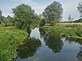
Blackwater and Chelmer Canal
-
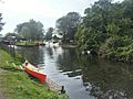
Papermill lock, Little Baddow
-

Papermill lock, Little Baddow


