
River Chelmer facts for kids
Quick facts for kids Chelmer |
|
|---|---|

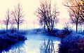
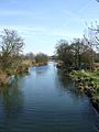
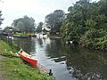
River Chelmer near Little Baddow
|
|
| Country | England |
| Region | Essex |
| City | Chelmsford |
| Physical characteristics | |
| Main source | Hamperden End 117 m (384 ft) 51°57′17″N 0°17′06″E / 51.9546°N 0.2850°E |
| River mouth | River Blackwater near Maldon 0 m (0 ft) 51°43′22″N 0°42′26″E / 51.7228°N 0.7073°E |
| Length | 65 km (40 mi) |
| Basin features | |
| River system | River Blackwater |
| Tributaries |
|
The River Chelmer is a river that flows completely through the county of Essex, England. It is about 65 kilometres (40 mi) long. The river starts in the north-west of Essex. It then flows through the city of Chelmsford. Finally, it joins the River Blackwater near Maldon.
Contents
The River's Journey
The River Chelmer begins its journey in the area of Debden in north-west Essex. There are two main streams that form the start of the river. One stream comes from the north, and the other from the west of a small village called Debden Green.
Where the River Starts
The longest part of the river's beginning is in a place called Rowney Wood. This wood is on a hill west of Debden Green. It's very close to where another river, the River Cam, starts. The River Cam flows north through Cambridge and into The Wash.
Flowing Through Essex
The River Chelmer flows past a town called Thaxted. Then it goes south through the Uttlesford area. It flows around the north-east side of Great Dunmow. The river continues to flow south-east into the area of Chelmsford.
When it reaches the city of Chelmsford, another river, the River Can, flows into it. After Chelmsford, the Chelmer flows east. It goes through the Maldon area. Eventually, it meets the River Blackwater east of Maldon. The Chelmer's water then flows into the North Sea through the Blackwater Estuary.
History of the Chelmer
The name Chelmer is not the river's original name. It actually came from the name of the town, Chelmsford. People thought the town was named after the river. But the town was actually named after a Saxon landowner called Cēolmǣr.
Older Names for the River
Before it was called the Chelmer, the river was known as the Baddow. You can still see this old name in the towns of Great and Little Baddow.
In 1793, a company called the Chelmer and Blackwater Navigation Company was created. They started building a special waterway, or "navigation." This waterway connected Chelmsford to a tidal part of the River Blackwater estuary. The work was finished in 1797.
The navigation mostly followed the path of the River Chelmer. It went from Chelmsford to Beeleigh, near Maldon. From Beeleigh, it took a short cut. Then it followed the River Blackwater to Heybridge.
Changes to the River
Edward Arthur Fitch said that the Fullbridge in Maldon used to be a shallow place to cross the river. This was before the waters of the River Blackwater joined the Chelmer at Beeleigh. After they joined, much more water flowed past the Fullbridge.
In the spring of 1812, the Chelmer above the Fullbridge was made straighter. Many important changes were made to the river bed. Some of these changes can still be seen today. For example, a map from 1777 showed an island in the middle of the river. This island was moved to fill in a curve on the north side, near where a Tesco store is now.
Further upstream, near the golf course, you can also see signs of this earthwork. From that point to Beeleigh weir, the river channel looks like a cut. This cut bypasses the river's original path.
The Old Water Mill
At Beeleigh, there was a water mill on the original path of the Chelmer. This mill worked until 1875, when it was destroyed by fire. Inside the mill, there were two areas where small boats called lighters were loaded. These boats carried flour to the port at Maldon, about a mile downstream. From Maldon, the flour was loaded onto Thames sailing barges. These barges then took the flour to London.
Part of the mill still stands today. Essex County Council has leased it. They plan to restore it so people can learn about its history.
Images for kids
-
River Chelmer near Little Baddow
-
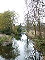
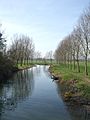
River Chelmer at Howe Street
-
River Chelmer at Howe Street
-
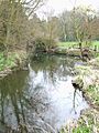
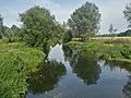
River Chelmer at Little Waltham
-
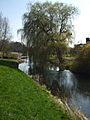
River Chelmer near Little Baddow
-
River Chelmer near Little Baddow
-
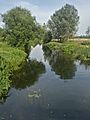
River Chelmer near Papermill Lock, Little Baddow
-
River Chelmer near Papermill Lock, Little Baddow
-
Papermill Lock, Little Baddow
-
River Chelmer at Maldon


