Cherry, Illinois facts for kids
Quick facts for kids
Cherry, Illinois
|
|
|---|---|

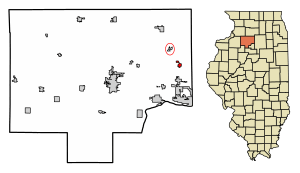
Location of Cherry in Bureau County, Illinois.
|
|

Location of Illinois in the United States
|
|
| Country | United States |
| State | Illinois |
| County | Bureau |
| Township | Westfield |
| Area | |
| • Total | 0.51 sq mi (1.3 km2) |
| • Land | 0.51 sq mi (1.3 km2) |
| • Water | 0.00 sq mi (0 km2) 0% |
| Population
(2020)
|
|
| • Total | 435 |
| • Density | 853/sq mi (329/km2) |
| Time zone | UTC-6 (CST) |
| • Summer (DST) | UTC-5 (CDT) |
| ZIP Code(s) |
61317
|
| Area code(s) | 815 & 779 |
| FIPS code | 17-12970 |
| Wikimedia Commons | Cherry, Illinois |
Cherry is a small village located in Bureau County, Illinois, in the United States. In 2020, about 435 people lived there. It is part of the Ottawa area.
Cherry is found northwest of LaSalle and Peru. It is also just a few miles north of Interstate 80. The village is about 75 miles east of the Quad Cities. Cherry is famous for a sad event called the Cherry Mine Disaster. This disaster happened in November 1909 and caused the deaths of 259 coal miners. It was one of the worst mining accidents in U.S. history.
History of Cherry
The St. Paul Coal Company started the Cherry Mine in 1905. This mine provided coal for the trains of the Chicago, Milwaukee and St. Paul Railroad. The mine was named after its first manager, James Cherry.
The Cherry Mine Disaster
The Cherry Mine Disaster happened in 1909. It was one of the most serious coal mining accidents in the history of the United States. This terrible event led to important changes in mining and labor rules in Illinois and across the U.S.
After the disaster, new laws were made to make mines safer. These laws required mines to have better fire fighting equipment. They also made sure that more fireproof materials were used in mines. The disaster also helped to make child labor laws stronger. This meant that children were better protected from dangerous jobs. The Cherry Coal Company took over the mine in 1929. It continued to operate until it closed in 1935.
Geography
Cherry is a small village, covering about 0.51 square miles (1.32 square kilometers). All of this area is land. There are no large bodies of water within the village limits.
Population and People
| Historical population | |||
|---|---|---|---|
| Census | Pop. | %± | |
| 1910 | 1,048 | — | |
| 1920 | 1,265 | 20.7% | |
| 1930 | 636 | −49.7% | |
| 1940 | 583 | −8.3% | |
| 1950 | 520 | −10.8% | |
| 1960 | 501 | −3.7% | |
| 1970 | 551 | 10.0% | |
| 1980 | 541 | −1.8% | |
| 1990 | 487 | −10.0% | |
| 2000 | 509 | 4.5% | |
| 2010 | 482 | −5.3% | |
| 2020 | 435 | −9.8% | |
| U.S. Decennial Census | |||
In 2020, the village of Cherry had 435 people living there. There were 208 households and 144 families. The population density was about 846 people per square mile.
About 21.9% of the people in Cherry were under 18 years old. About 31.7% were 65 years old or older. The average age of people in the village was 49.9 years.
See also
 In Spanish: Cherry (Illinois) para niños
 | Emma Amos |
 | Edward Mitchell Bannister |
 | Larry D. Alexander |
 | Ernie Barnes |

