Cherry Creek (hamlet), New York facts for kids
Quick facts for kids
Cherry Creek, New York
|
|
|---|---|
|
Hamlet and CDP
|
|

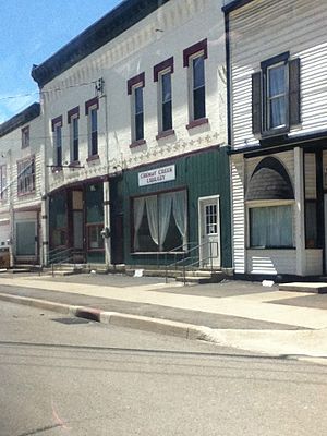
Cherry Creek Library
|
|
| Country | United States |
| State | New York |
| County | Chautauqua |
| Town | Cherry Creek |
| Area | |
| • Total | 1.36 sq mi (3.53 km2) |
| • Land | 1.36 sq mi (3.53 km2) |
| • Water | 0.00 sq mi (0.00 km2) |
| Elevation | 1,302 ft (397 m) |
| Population
(2020)
|
|
| • Total | 409 |
| • Density | 300.29/sq mi (115.91/km2) |
| Time zone | UTC-5 (Eastern (EST)) |
| • Summer (DST) | UTC-4 (EDT) |
| ZIP code |
14723
|
| Area code(s) | 716 |
| FIPS code | 36-15187 |
| GNIS feature ID | 0946509 |
Cherry Creek is a small community called a hamlet in Chautauqua County, New York, in the United States. In 2010, about 461 people lived there. This hamlet is located within the larger town of Cherry Creek, close to the eastern edge of the county. You can find it along New York State Route 83 and next to a stream also named Cherry Creek.
History of Cherry Creek
This hamlet is where the very first settlers arrived in the town back in 1815. The name "Cherry Creek" comes from a cherry tree. A surveyor named Joshua Bentley, who worked for the Holland Land Company, planted this tree to mark the center of the new town.
Cherry Creek officially became a village in 1893. However, on February 2, 2017, the people living there voted to change things. They decided, by a vote of 70 to 32, to dissolve the village and become part of the surrounding town of Cherry Creek. This change officially happened on December 31, 2017.
Geography of Cherry Creek
Cherry Creek is found in the eastern part of Chautauqua County. It is located at coordinates 42°17′40″N 79°5′50″W / 42.29444°N 79.09722°W. This spot is just east of the center of the larger town of Cherry Creek.
A stream, also called Cherry Creek, flows east through the hamlet. This stream eventually joins Conewango Creek. Conewango Creek then flows into the Allegheny River, which is part of the huge Mississippi River basin.
According to the United States Census Bureau, the area of the village in 2010 was about 3.5 square kilometers (or 1.36 square miles). All of this area is land.
Population and People
| Historical population | |||
|---|---|---|---|
| Census | Pop. | %± | |
| 1880 | 448 | — | |
| 1890 | 676 | 50.9% | |
| 1900 | 701 | 3.7% | |
| 1910 | 606 | −13.6% | |
| 1920 | 527 | −13.0% | |
| 1930 | 539 | 2.3% | |
| 1940 | 529 | −1.9% | |
| 1950 | 631 | 19.3% | |
| 1960 | 649 | 2.9% | |
| 1970 | 658 | 1.4% | |
| 1980 | 677 | 2.9% | |
| 1990 | 539 | −20.4% | |
| 2000 | 551 | 2.2% | |
| 2010 | 461 | −16.3% | |
| 2020 | 409 | −11.3% | |
| U.S. Decennial Census | |||
In the year 2000, there were 551 people living in Cherry Creek. These people lived in 198 households, and 156 of these were families. The population density was about 404.8 people per square mile.
About 40.4% of the households had children under 18 living with them. Many households were married couples living together (52.5%). Some households (16.2%) had a female head with no husband present. About 15.7% of households were single individuals.
The population was spread out by age. About 31.2% of the people were under 18 years old. Around 10.2% were 65 years or older. The average age of people in the village was 36 years.
See also
 In Spanish: Cherry Creek (villa) para niños
 | May Edward Chinn |
 | Rebecca Cole |
 | Alexa Canady |
 | Dorothy Lavinia Brown |


