Cherry Run facts for kids
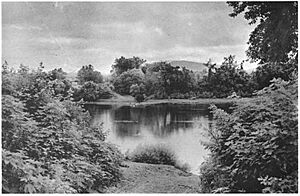
Cherry Run is a stream in West Virginia. It is about 7.2 miles (11.6 kilometers) long. This stream forms part of the border between Morgan and Berkeley counties. These counties are in the Eastern Panhandle region of West Virginia.
Cherry Run is a "meandering" stream, which means it twists and turns a lot. Most of the time, you cannot travel on it by boat. However, it has many deep spots called "pools." These pools are great for fishing and swimming. Cherry Run flows into the Potomac River. This means it is a "tributary" of the Potomac River. A tributary is a smaller stream or river that flows into a larger one. Cherry Run is part of the larger Chesapeake Bay "watershed." A watershed is an area of land where all the water drains into a common river, lake, or ocean.
Where Cherry Run Starts and Flows
Cherry Run begins high up in the mountains. It starts from natural springs on the northern side of Third Hill Mountain. This mountain is 2,172 feet (662 meters) tall. From its start, Cherry Run acts as a natural border between Morgan and Berkeley Counties.
The stream flows southeast through the Sleepy Creek Wildlife Management Area. It passes through a gap in Short Mountain, which is 1,375 feet (419 meters) tall. After this, Cherry Run changes direction and flows northeast. It follows along the eastern side of Short Mountain.
In an area called Sleepy Hollow, a dam was built on Cherry Run. This dam created Sleepy Hollow Lake. Further north, three more small streams join Cherry Run. These streams are also fed by springs. Cherry Run then turns eastward, moving away from Short Mountain. It flows under West Virginia Route 9 and past the community of Holton.
From Holton, the stream curves northeast again. It runs next to Sleepy Creek Road (County Route 5). Cherry Run then meanders eastward, flowing south of the town also named Cherry Run. Finally, after flowing under bridges for Camp Hill Road and the Baltimore and Ohio Railroad, Cherry Run empties into the Potomac River. It joins the Potomac directly across from the community of Big Pool in Maryland.
Public Access to Cherry Run
The West Virginia Division of Natural Resources owns a special area where people can easily get to Cherry Run. This public access site is located where Cherry Run meets the Potomac River. It has concrete ramps that are perfect for launching small boats. This spot is mainly used by people who want to go fishing in the stream.
 | Janet Taylor Pickett |
 | Synthia Saint James |
 | Howardena Pindell |
 | Faith Ringgold |


