
Chesapeake Beach, Maryland facts for kids
Quick facts for kids
Chesapeake Beach, Maryland
|
|||
|---|---|---|---|
| Town of Chesapeake Beach | |||
_at_Maryland_State_Route_261_(Bayside_Road)_in_Chesapeake_Beach,_Calvert_County,_Maryland.jpg) |
|||
|
|||
| Nickname(s):
"Twin Beaches"
|
|||

Location of Chesapeake Beach, Maryland
|
|||
| Country | |||
| State | |||
| County | |||
| Incorporated | 1886 (repealed 1888, reincorporated 1894) | ||
| Area | |||
| • Total | 2.78 sq mi (7.21 km2) | ||
| • Land | 2.69 sq mi (6.97 km2) | ||
| • Water | 0.09 sq mi (0.23 km2) | ||
| Elevation | 49 ft (15 m) | ||
| Population
(2020)
|
|||
| • Total | 6,356 | ||
| • Density | 2,360.19/sq mi (911.40/km2) | ||
| Time zone | UTC-5 (Eastern (EST)) | ||
| • Summer (DST) | UTC-4 (EDT) | ||
| ZIP code |
20732
|
||
| Area code(s) | 301 | ||
| FIPS code | 24-15925 | ||
| GNIS feature ID | 0589951 | ||

Chesapeake Beach is a fun town in Calvert County, Maryland, United States. It's known for its cool attractions. These include the historic Chesapeake Beach Railway Station, a fun water park, and places for boats. You can also enjoy fishing trips from here. In 2020, about 6,356 people lived in Chesapeake Beach.
Contents
Exploring Chesapeake Beach Geography
Chesapeake Beach is located at 38°41′42″N 76°32′10″W / 38.69500°N 76.53611°W. It covers about 2.78 square miles (7.21 square kilometers). Most of this area is land, with a small part being water.
Waterways and Cliffs
The town grew around where Fishing Creek meets the Chesapeake Bay. This creek has been made deeper for boats like pleasure crafts and fishing boats. It's also a special place where oysters and jellyfish called Chrysaora chesapeakei grow.
To the south, you'll find the beautiful Randle Cliffs. These tall sandstone cliffs can reach up to 110 feet high! They are always changing because of weather and waves. This creates shallow sand bars nearby, making it tricky for boats.
Parks and Boardwalks
Right in the middle of town is the Chesapeake Beach Veterans' Memorial Park. It has a very large American flag and a pretty waterfall fountain. There's also a boardwalk along the Bay. It's a great place to walk and enjoy the views.
Getting Around Chesapeake Beach
_at_Maryland_State_Route_260_(Chesapeake_Beach_Road)_in_Chesapeake_Beach,_Calvert_County,_Maryland.jpg)
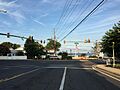
The best way to travel to and from Chesapeake Beach is by car. Two main state highways serve the town. Maryland Route 260 leads into town, connecting it to Maryland Route 2 and Maryland Route 4. MD 2 goes north to Annapolis and Baltimore. MD 4 heads towards Washington, D.C..
Maryland Route 261 also runs through Chesapeake Beach. It connects the town to other communities along the Chesapeake Bay.
Chesapeake Beach Population Facts
| Historical population | |||
|---|---|---|---|
| Census | Pop. | %± | |
| 1940 | 326 | — | |
| 1950 | 504 | 54.6% | |
| 1960 | 731 | 45.0% | |
| 1970 | 934 | 27.8% | |
| 1980 | 1,408 | 50.7% | |
| 1990 | 2,403 | 70.7% | |
| 2000 | 3,180 | 32.3% | |
| 2010 | 5,753 | 80.9% | |
| 2020 | 6,356 | 10.5% | |
| U.S. Decennial Census | |||
In 2010, about 5,753 people lived in Chesapeake Beach. There were 2,134 households, which are groups of people living together. Many households had children under 18. The average age of people in town was about 36 years old.
A Look at Chesapeake Beach History

Chesapeake Beach started as a fun resort town. It was the last stop on the Chesapeake Beach Railway, a train line from Washington, DC. In the early 1900s, it was a very popular spot. People came by train from Washington and by boat from Baltimore. During the 1920s, thousands of visitors would come on weekends!
Changes Over Time
The good times slowed down because of the Great Depression and a big hotel fire. Also, when the Bay Bridge was built in the 1950s, many visitors started going to Ocean City, Maryland instead.
Today, you can visit a museum at the old railroad station. It has many old photos and even an old passenger car from the train. This station is a historic landmark.
Modern Chesapeake Beach
In recent years, Chesapeake Beach has grown. A new boardwalk and pier have been built. There's also a fun water park with slides, a new resort spa hotel, and a seafood restaurant right on the bay. A highly-rated marina resort called Herrington Harbour is also nearby.
For a long time, public places in Chesapeake Beach were separated by race. This changed after the Civil Rights Act of 1964. This important law made sure that everyone could use public spaces, no matter their race.
Science and Nature
Chesapeake Beach is also home to a special place called the United States Naval Research Laboratory Chesapeake Bay Detachment. Scientists here test military radar systems and fire safety technology. They use the Bay to test their radars against different targets. Nearby, the Naval Air Station Patuxent River helps with these important research missions.
The town has also faced natural challenges. In 2003, Hurricane Isabel brought floodwaters to Chesapeake Beach. In 2008, a tornado caused damage to some homes.
Neighborhoods in Chesapeake Beach
Chesapeake Beach has many different areas where people live. The older parts of town have streets that are numbered (like 10th to 31st) and lettered (like B to J).
Some of the neighborhoods you might find include:
- The Highlands
- Bayview Hills
- Richfield Station
- Windward Key
- Chesapeake Station
- Randle Cliff
- Holiday Beach
Famous People from Chesapeake Beach
Some well-known people have lived in or are connected to Chesapeake Beach:
- Tom Clancy, a famous author
- Thomas V. Mike Miller, Jr., who was a president of the Maryland Senate
- Christopher Wilkinson, a screenwriter, producer, and director
Images for kids
-
View of Chesapeake Beach
-

Flag of Chesapeake Beach
-
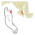
Map showing Chesapeake Beach in Calvert County
See also
 In Spanish: Chesapeake Beach (Maryland) para niños
