Cheshire (CDP), Massachusetts facts for kids
Quick facts for kids
Cheshire, Massachusetts
|
|
|---|---|

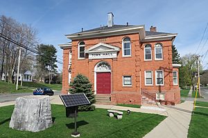
Town Hall
|
|

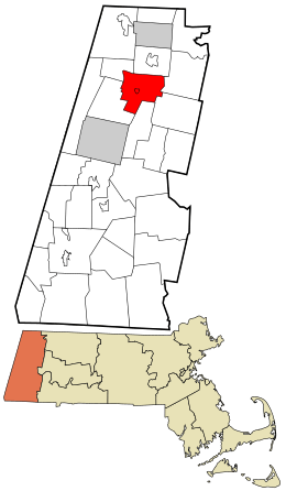
Location in Berkshire County and the state of Massachusetts.
|
|
| Country | United States |
| State | Massachusetts |
| County | Berkshire |
| Town | Cheshire |
| Area | |
| • Total | 0.38 sq mi (0.99 km2) |
| • Land | 0.38 sq mi (0.99 km2) |
| • Water | 0.00 sq mi (0.00 km2) |
| Elevation | 994 ft (303 m) |
| Population
(2020)
|
|
| • Total | 545 |
| • Density | 1,419.27/sq mi (548.62/km2) |
| Time zone | UTC-5 (Eastern (EST)) |
| • Summer (DST) | UTC-4 (EDT) |
| ZIP code |
01225
|
| Area code(s) | 413 |
| FIPS code | 25-13310 |
| GNIS feature ID | 0607347 |
Cheshire is a small community in Berkshire County, Massachusetts, in the United States. It's known as a census-designated place (CDP). This means it's a special area defined by the government for counting people. In 2020, about 545 people lived here. The larger town of Cheshire has about 3,235 residents.
Contents
Where is Cheshire Located?
Cheshire is found right in the middle of the larger town of Cheshire. You can find its exact spot using coordinates: 42°33′43″N 73°9′46″W. A main road, Massachusetts Route 8, goes through the community. This road helps people travel north to places like Adams and North Adams. It also goes south towards Pittsfield.
Rivers and Reservoirs
The Hoosic River starts here, flowing from the Cheshire Reservoir. This reservoir is an important water source. The area of Cheshire is about 1 square kilometer (or 0.38 square miles). All of this land is dry land, with no large bodies of water inside the CDP itself.
How Many People Live in Cheshire?
The population of Cheshire changes over time. The United States Census Bureau counts how many people live in different areas.
- 2010: 514 people
- 2020: 545 people
This information helps us understand how communities grow or change.
See Also

- In Spanish: Cheshire (condado de Berkshire) para niños
 | Mary Eliza Mahoney |
 | Susie King Taylor |
 | Ida Gray |
 | Eliza Ann Grier |

