Chesterfield, Illinois facts for kids
Quick facts for kids
Chesterfield, Illinois
|
|
|---|---|

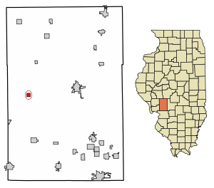
Location in Macoupin County, Illinois
|
|
| Country | United States |
| State | Illinois |
| County | Macoupin |
| Township | Chesterfield |
| Area | |
| • Total | 0.54 sq mi (1.40 km2) |
| • Land | 0.54 sq mi (1.40 km2) |
| • Water | 0.00 sq mi (0.00 km2) |
| Elevation | 595 ft (181 m) |
| Population
(2020)
|
|
| • Total | 170 |
| • Density | 314.23/sq mi (121.38/km2) |
| Time zone | UTC-6 (CST) |
| • Summer (DST) | UTC-5 (CDT) |
| ZIP code |
62630
|
| Area code(s) | 618 |
| FIPS code | 17-13165 |
Chesterfield is a small village located in Macoupin County, Illinois, in the United States. In 2020, about 170 people lived there. It's a quiet place with a history that goes back to the early 1800s.
Contents
History of Chesterfield Village
The village of Chesterfield was likely started in 1836. Two men, Jesse Peebles and Aaron Tilly, are believed to be its founders. They probably named the village after their hometown, Chesterfield in England.
A post office was built in Chesterfield in 1838. Later, in 1882, Chesterfield officially became an incorporated village. Reverend Jesse Peebles, one of the founders, was buried in Peebles Cemetery in 1864. The cemetery was named after him and his family.
Chesterfield also had its own high school for many years. It served the community from the late 1800s until 1947. After 1949, students from Chesterfield began attending classes at Carlinville High School. This happened because of changes in how schools were organized.
Where is Chesterfield Located?
Chesterfield is found in the western part of Macoupin County. Its exact location is 39°15′17″N 90°03′54″W / 39.254782°N 90.064959°W.
Illinois Route 111 goes right through the village. This road is called Main Street in Chesterfield. If you go north on Route 111, you'll reach Hettick about 7 miles away. Going southwest for about 8 miles will take you to Medora.
Carlinville, which is the main town of Macoupin County, is about 12 miles to the east. You can get there by taking Routes 111 and 108.
The village covers a total area of about 0.54 square miles (1.40 square kilometers). All of this area is land. Water from the village flows north into Bear Creek. Bear Creek then flows into Hodges Creek, which eventually joins Macoupin Creek. Macoupin Creek is part of the Illinois River watershed. A watershed is an area of land where all the water drains into a single river or lake.
Population of Chesterfield
| Historical population | |||
|---|---|---|---|
| Census | Pop. | %± | |
| 1880 | 195 | — | |
| 1890 | 374 | 91.8% | |
| 1900 | 377 | 0.8% | |
| 1910 | 364 | −3.4% | |
| 1920 | 363 | −0.3% | |
| 1930 | 325 | −10.5% | |
| 1940 | 290 | −10.8% | |
| 1950 | 272 | −6.2% | |
| 1960 | 280 | 2.9% | |
| 1970 | 262 | −6.4% | |
| 1980 | 280 | 6.9% | |
| 1990 | 230 | −17.9% | |
| 2000 | 223 | −3.0% | |
| 2010 | 188 | −15.7% | |
| 2020 | 170 | −9.6% | |
| U.S. Decennial Census | |||
According to the census from the year 2000, 223 people lived in Chesterfield. There were 86 households, and 60 of these were families. The population density was about 412 people per square mile.
Most of the people living in the village were White (97.76%). A small number were Native American (0.45%), and 1.79% were from two or more races.
In 2000, about 28.7% of the people were under 18 years old. About 19.3% were 65 years old or older. The average age in the village was 36 years.
See also
 In Spanish: Chesterfield (Illinois) para niños


