Chestnut Mountain (Caldwell County, North Carolina) facts for kids
Quick facts for kids Chestnut Mountain |
|
|---|---|

Chestnut Mountain
|
|
| Highest point | |
| Elevation | 3,314 ft (1,010 m) |
| Geography | |
| Location | Avery / Burke / Caldwell counties, North Carolina, U.S. |
| Parent range | Blue Ridge Mountains |
| Topo map | USGS Chestnut Mountain |
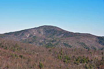
Chestnut Mountain is a cool mountain located in the western part of North Carolina, in a region known as the "High Country." It's completely inside the beautiful Pisgah National Forest. This mountain stands tall at 3,314 feet (about 1,010 meters) above sea level. It's also a special spot because it marks the meeting point of three different counties: Avery, Burke, and Caldwell.
Contents
Discover Chestnut Mountain
Chestnut Mountain is a significant natural landmark in North Carolina. It's a great place to learn about mountains and forests. The mountain is named after the chestnut trees that might have once grown there.
Where is Chestnut Mountain?
This mountain is found in the Blue Ridge Mountains, which are part of the larger Appalachian Mountains range. It's in the western part of North Carolina, an area famous for its stunning scenery and outdoor activities. The mountain's unique location means it touches three different counties.
How Tall is Chestnut Mountain?
Chestnut Mountain reaches an elevation of 3,314 feet. To give you an idea, that's taller than many skyscrapers! This height makes it a noticeable feature in the landscape. From its slopes, water flows down to create small streams. These streams eventually feed into the much larger Catawba River, which is an important river in the region.
What is the Pisgah National Forest?
Chestnut Mountain is entirely within the Pisgah National Forest. This is a huge protected area of land. It's managed by the U.S. Forest Service. National forests are important for wildlife, plants, and for people to enjoy nature. They offer places for hiking, camping, and exploring the outdoors.
 | Georgia Louise Harris Brown |
 | Julian Abele |
 | Norma Merrick Sklarek |
 | William Sidney Pittman |

