Chetumal facts for kids
Quick facts for kids
Chetumal
Chactemàal (Yucatec Maya)
|
||
|---|---|---|
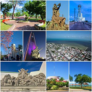
From the top to the left: Parque de los Caimanes, Monumento al Renacimiento, Faro, Catedral, Torre del Reloj y Monumento militar, Vista aérea, Alegoría del mestizaje, Congreso de Quintana Roo and Dos Mulas beach
|
||
|
||
 |
||
| Country | Mexico | |
| State | Quintana Roo | |
| Municipality | Othón P. Blanco | |
| Founded | May 5, 1898 (Othon P. Blanco) | |
| Current site | 1898 | |
| Elevation | 10 m (30 ft) | |
| Population
(2020)
|
||
| • Total | 169,028 | |
| • Demonym | Chetumaleño(a) | |
| Time zone | UTC−5 (EST) | |
| Postal code |
77000
|
|
| Area code(s) | 983, 912 | |
| Website | www.chetumal.gob.mx | |
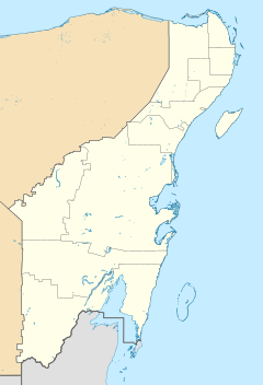
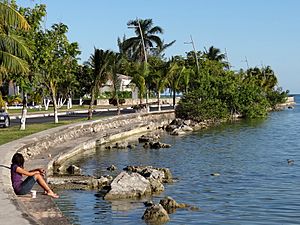
Chetumal is a city on the east coast of the Yucatán Peninsula in Mexico. Its name comes from the Yucatec Maya words "Chactemàal," meaning "Place of the Red Wood." It is the capital city of the state of Quintana Roo. In 2020, about 169,028 people lived there.
The city sits on the western side of Chetumal Bay, close to the Río Hondo. Chetumal is an important port. It is Mexico's main trading spot with its neighbor, Belize. Goods travel by road to Belize City and by ships along the coast. Chetumal also has an airport, Chetumal International Airport. Because it is on the Caribbean coast, strong storms called tropical cyclones can hit it. For example, Hurricane Janet (1955) and Hurricane Dean (2007) were very powerful storms that landed near Chetumal.
Contents
History of Chetumal
Long ago, before Europeans arrived, there was a Maya city called Chactemal. It was the capital of a Maya state. This old city was probably in what is now Belize, not where modern Chetumal is today. The Maya people of Chactemal fought against the Spanish for many years. They were finally taken over by Spain in the late 1500s.
In the 1840s, the Maya people fought against Mexican rule. This was called the Caste War of Yucatán. Many Hispanic people left the area and moved to Corozal Town in British Honduras (now Belize).
Founding the Modern City
The modern city of Chetumal was started in 1898. It was first called Payo Obispo. This new town was built as a Mexican port. Othon P. Blanco, a navy officer, helped found the city. He invited people from Belize, including those who had left during the Caste War, to live there.
The Mexican government wanted to stop the Maya revolt. They also wanted to make sure their border with British Honduras was clear. So, they decided to build a fort and customs office. This was at the spot where the Hondo River meets Chetumal Bay.
Othón P. Blanco suggested using a special boat called a pontoon. This boat could serve as a temporary base. It would help with customs and keeping watch. This pontoon was built in New Orleans. Blanco named it "Pontón Chetumal" to remember the Maya name for the area. It arrived on January 22, 1898.
Blanco quickly set up the base. He cleared the land to build a permanent town. He invited Mexicans living in Corozal to return. On May 5, 1898, Othón P. Blanco officially founded the new town. He named it Payo Obispo. This name honored Fray Payo Enríquez de Rivera, a bishop who had visited the region long ago.
Early Growth and Changes
Payo Obispo started as a small border town. Its main job was to watch the border. People mostly worked by collecting resources from the jungle, like wood and chicle (used for chewing gum). Travel to other parts of Mexico was mostly by sea.
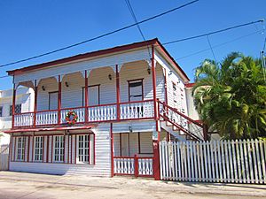
The houses in Payo Obispo were often made of wood. They looked like Caribbean-style homes found in Belize or Jamaica. They were built above the ground and painted in bright colors. People collected rainwater in tanks called cisterns for drinking.
In 1915, Payo Obispo became the capital of the Quintana Roo territory. This made the town grow. More people moved there, and more businesses started.
The name of the town was officially changed to Chetumal in 1936. This was part of a plan to remove religious names from towns.
Rebuilding After Storms
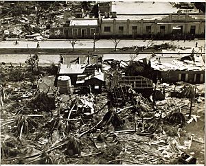
Two hurricanes in the 1940s badly damaged the town. Then, on September 27, 1955, a very strong storm called Hurricane Janet hit Chetumal. It was a Category 5 hurricane and destroyed almost the entire city. Most of the wooden buildings were ruined. About 500 people lost their lives.
After this disaster, Chetumal was rebuilt. New buildings were made with strong concrete blocks. This changed the city's look from its old wooden style.
Chetumal's population was small until the 1960s and 1970s. Then, new highways connected it to the rest of Mexico. Many people moved to Chetumal, and the city grew very fast. In 1974, Quintana Roo became a state, and Chetumal became its capital.
Chetumal's Climate
Chetumal has a tropical savanna climate. This means it has a clear wet season and a dry season. The wet season is from May to October. The dry season is from November to April.
| Climate data for Chetumal (1951–2010) | |||||||||||||
|---|---|---|---|---|---|---|---|---|---|---|---|---|---|
| Month | Jan | Feb | Mar | Apr | May | Jun | Jul | Aug | Sep | Oct | Nov | Dec | Year |
| Record high °C (°F) | 35.0 (95.0) |
36.5 (97.7) |
37.5 (99.5) |
39.5 (103.1) |
39.5 (103.1) |
37.5 (99.5) |
37.8 (100.0) |
39.0 (102.2) |
38.0 (100.4) |
36.2 (97.2) |
37.0 (98.6) |
39.0 (102.2) |
39.5 (103.1) |
| Mean daily maximum °C (°F) | 28.5 (83.3) |
29.5 (85.1) |
30.7 (87.3) |
32.1 (89.8) |
32.7 (90.9) |
32.3 (90.1) |
32.4 (90.3) |
32.8 (91.0) |
32.5 (90.5) |
31.5 (88.7) |
30.0 (86.0) |
28.8 (83.8) |
31.2 (88.2) |
| Daily mean °C (°F) | 23.4 (74.1) |
24.4 (75.9) |
26.1 (79.0) |
27.9 (82.2) |
28.7 (83.7) |
28.6 (83.5) |
28.5 (83.3) |
28.6 (83.5) |
28.3 (82.9) |
27.0 (80.6) |
25.2 (77.4) |
23.8 (74.8) |
26.7 (80.1) |
| Mean daily minimum °C (°F) | 18.3 (64.9) |
19.2 (66.6) |
21.5 (70.7) |
23.7 (74.7) |
24.6 (76.3) |
25.0 (77.0) |
24.5 (76.1) |
24.3 (75.7) |
24.0 (75.2) |
22.4 (72.3) |
20.4 (68.7) |
18.9 (66.0) |
22.2 (72.0) |
| Record low °C (°F) | 6.0 (42.8) |
5.0 (41.0) |
7.3 (45.1) |
9.0 (48.2) |
16.0 (60.8) |
18.5 (65.3) |
19.0 (66.2) |
15.0 (59.0) |
18.0 (64.4) |
12.5 (54.5) |
10.0 (50.0) |
5.5 (41.9) |
5.0 (41.0) |
| Average precipitation mm (inches) | 64.4 (2.54) |
35.9 (1.41) |
26.4 (1.04) |
36.4 (1.43) |
128.0 (5.04) |
192.7 (7.59) |
146.1 (5.75) |
143.7 (5.66) |
206.8 (8.14) |
169.0 (6.65) |
92.8 (3.65) |
65.4 (2.57) |
1,307.5 (51.48) |
| Average precipitation days (≥ 0.1 mm) | 9.1 | 5.8 | 3.8 | 3.8 | 8.0 | 13.6 | 14.0 | 13.5 | 15.8 | 14.4 | 11.1 | 10.1 | 123.0 |
| Average relative humidity (%) | 80 | 76 | 74 | 73 | 74 | 78 | 78 | 77 | 79 | 80 | 80 | 80 | 77 |
| Mean monthly sunshine hours | 211 | 231 | 259 | 272 | 276 | 218 | 225 | 236 | 204 | 218 | 206 | 205 | 2,761 |
| Source 1: Servicio Meteorológico Nacional | |||||||||||||
| Source 2: Deutscher Wetterdienst (sun, 1961–1990) | |||||||||||||
Life in Chetumal Today
Chetumal is a growing city with an international airport. It has a Museum of Maya Culture. There is also a zoo called the Payo Obispo Zoo. This zoo is known for being for the children of Quintana Roo.
Chetumal's economy is affected by its closeness to Belize. There is a special shopping area in Belize called the Corozal Free Zone. Many people visit this zone, which helps businesses in Chetumal. Chetumal itself was once a free zone. This meant people could buy goods without paying extra taxes. This helped the city's trade. Today, Chetumal still has a lot of retail stores.
The city has a large indoor mall called Plaza de las Américas. It has a modern movie theater and many stores. You can also find fast-food places and a big supermarket there.
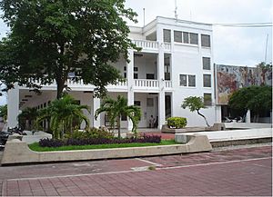
Chetumal is the capital of Quintana Roo state. This means many government offices are located here. Government workers help the local economy by buying goods and services. Tourists from Europe, Asia, and North America also visit Chetumal. Their spending helps the city's economy too.
The city has a music school. It teaches different instruments, music theory, and history. It is the main music school in the state. It is also home to the Junior Symphonic Orchestra of Quintana Roo.
Chetumal has two theaters. The "Teatro Minerva" is an outdoor theater. The "Teatro Constituyentes" is a private theater. There is also a Country Club. It has courts for tennis, football, and basketball. It also has a gym, a swimming pool, and a steam-bath.
In the early 1990s, the University of Quintana Roo was built in Chetumal. It offers many different college degrees.
Places to Visit in Chetumal
Chetumal has several interesting museums, monuments, and parks.
Museums to Explore
- Cultural Center of the Fine Arts: This center is in the middle of the city. It is in the building that used to be the first school in Quintana Roo.
- Museum of the Mayan Culture: This is the biggest museum in the state about Maya culture. It has many real and copied Maya artworks. It shows how the Maya culture grew and what their daily life was like.
- Museum of the City: This museum is connected to the Cultural Center of the Fine Arts. It shows photos, tools, and papers. These tell the story of how Chetumal was founded.
Important Monuments
- Monument to the Flag: This was the first monument built in Chetumal. It is a white tower with a clock on each side.
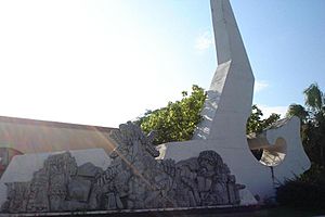
- Cradles of the Meztizaje: This monument is at the entrance of Chetumal. It looks like a Maya pyramid. It has statues of Gonzalo Guerrero, his wife Zazil Há, and their children.
- Andrés Quintana Roo Memorial: This monument honors Andrés Quintana Roo. The state was named after him.
- Monument to the Fishermen: This is one of the newer monuments. It is located in Chetumal Bay.
Fun Parks
- Ecological Park
- Cheese Park
- Biouniverzoo Zoo
See also
 In Spanish: Chetumal para niños


