Chwarel y Fan facts for kids
Quick facts for kids Chwarel y Fan |
|
|---|---|

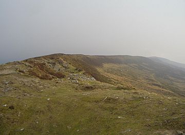
The Chwarel y Fan summit ridge
|
|
| Highest point | |
| Elevation | 679 m (2,228 ft) |
| Prominence | 72 m (236 ft) |
| Parent peak | Waun Fach |
| Listing | Hewitt, Nuttall, County top |
| Naming | |
| English translation | quarry of the beacon |
| Language of name | Welsh |
| Geography | |
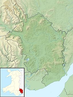
| Location | Black Mountains, South Wales |
| OS grid | SO258294 |
| Topo map | OS Landranger 161 |
Chwarel y Fan is a mountain peak located in the beautiful Black Mountains area of south-eastern Wales. It's known for being the highest point on a long ridge that stretches southeast from another peak called Rhos Dirion. This ridge continues further, leading to smaller peaks like Bal-Mawr (which has a special marker called a trig point at 607 meters above sea level) and Bal-Bach (around 520 meters high).
Chwarel y Fan is very important because it is the highest point in the historic county of Monmouthshire. It's also the highest point in the current local government area of Monmouthshire.
About Chwarel y Fan
Chwarel y Fan stands at 679 meters (about 2,228 feet) above sea level. Its name, "Chwarel y Fan," comes from the Welsh words meaning "quarry of the beacon."
The very top of Chwarel y Fan is on a narrow ridge. At the summit, you'll find a pile of stones called a cairn. Cairns are often built by hikers to mark the highest point or a special spot.
What is a Ridge?
A ridge is like a long, narrow hilltop or mountain range. Imagine the spine of a book; that's similar to how a ridge looks on a mountain. Chwarel y Fan sits on one of these long, high lines of land.
What is a County Top?
A county top is simply the highest point within a specific county or region. Chwarel y Fan holds this title for Monmouthshire, both its historic and current boundaries. This makes it a special place for hikers and people who enjoy exploring high points.
Nearby Peaks
When you stand on Chwarel y Fan, you can look across the valleys to see other mountains. To the west, you might spot Pen Twyn Mawr. To the east, you'll see Black Mountain. These peaks are all part of the stunning Black Mountains range.
 | May Edward Chinn |
 | Rebecca Cole |
 | Alexa Canady |
 | Dorothy Lavinia Brown |


