Historic counties of Wales facts for kids
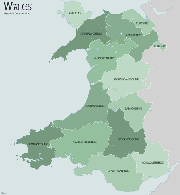
The historic counties of Wales are old ways of dividing up the country of Wales. Think of them like traditional regions that have been around for hundreds of years. While they aren't used for everyday government tasks anymore, they still help us understand the history and geography of Wales. Sometimes, people call them ancient counties.
Contents
What are the Historic Counties of Wales?
These counties were used for many different things over time. Today, Wales uses newer ways to divide its land for local government. However, some of these new areas have names and borders that are a bit like the old historic counties.
 |
|
- 1 The areas of Pembroke and Glamorgan were important even before King Edward I conquered Wales.
- 2 These counties were created in 1282, right after King Edward I's conquest.
- 3 These counties were formed in 1535 by the Laws in Wales Act, 1535. This law changed the remaining Marcher Lordships into counties.
- 4 Monmouthshire was created at the same time as the other counties. For some legal reasons, it was grouped with English counties until 1974. However, no law ever said Monmouthshire was removed from Wales. People in Wales have always seen Monmouthshire as part of Wales.
The 1535 Laws in Wales Act also got rid of the special areas called marcher lordships. These were lands controlled by powerful lords along the border of Wales. Some of these border areas became part of English counties. For example, parts of Ludlow and Montgomery became part of Shropshire in England.
Historian William Rees wrote in 1959 that the borders of modern Welsh areas are still largely based on these old divisions. He said that these ancient divisions are a "vital element" in Welsh life and help keep its history alive.
Monmouthshire's Welsh Status
The area that became Monmouthshire was once part of old Welsh kingdoms. After the Normans conquered southern Wales, it became part of the Welsh Marches. The first Laws in Wales Act in 1535 clearly stated that Monmouthshire was part of Wales.
However, a later law in 1542 placed Monmouthshire under the English legal system, not the Welsh one. Because of this, some people mistakenly thought the county had been taken by England. Later, some English historians and map-makers also thought Monmouthshire was an English county. Laws would often refer to "Wales and Monmouthshire".
This confusion finally ended with the Local Government Act of 1972. This law officially confirmed that Monmouthshire was, and always had been, part of Wales.
Vice Counties for Nature Study
Vice counties are special areas used by scientists to record where plants and animals are found. They have been used across Great Britain and Ireland since 1852. These vice counties are mostly based on the old historic county borders. They don't change, which makes it easier for scientists to study how nature changes over a long time.
See also
 In Spanish: Condados históricos de Gales para niños
 | Anna J. Cooper |
 | Mary McLeod Bethune |
 | Lillie Mae Bradford |

