Caernarfonshire facts for kids
| Caernarfonshire | |
| Motto: Cadernid Gwynedd (The strength of Gwynedd) | |
| Geography | |
| 1831 area | 370,273 acres (1,498.44 km2) |
| 1911 area | 365,986 acres (1,481.09 km2) |
| 1961 area | 364,108 acres (1,473.49 km2) |
| HQ | County Hall, Caernarfon |
| Chapman code | CAE |
| History | |
Quick facts for kids Demography |
|
|---|---|
| 1831 population - 1831 density |
66,448 0.2/acre |
| 1911 population - 1911 density |
125,043 0.3/acre |
| 1961 population - 1961 density |
121,767 0.3/acre |
| Politics | |
| Governance | Carnarvonshire County Council (1889–1926) Caernarvonshire County Council (1926–1974) |
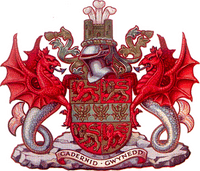 Coat of arms of Caernarvonshire County Council |
|
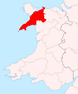
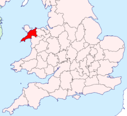
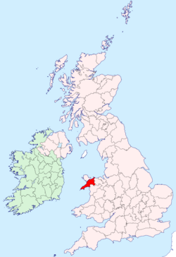
Caernarfonshire (pronounced "kar-NAR-vun-shur") was a historic county in the north-west of Wales. It was also known as Caernarvonshire or Carnarvonshire for a long time. This area was a county from 1284 until 1974.
Contents
Geography of Caernarfonshire
Caernarfonshire was surrounded by water and other counties. To the north was the Irish Sea. To the east was Denbighshire. The south had Cardigan Bay and Merionethshire. To the west were Caernarfon Bay and the Menai Strait, which separated it from Anglesey.
The county had many mountains. A big part of the Snowdonia mountain range was in the middle and south-east. This included Snowdon itself, which is the highest mountain in Wales. It stands at 1,085 meters (3,560 feet) tall.
The south-west part of the county was the Llŷn peninsula. Bardsey Island was just off its western tip. The northern part of the county, between the mountains and the Menai Strait, was flatter. The eastern part was in the Vale of Conwy, with the River Conwy forming most of the eastern border. Llandudno and the Creuddyn area formed a small peninsula to the north-east, across the Conwy river mouth.
Important places in the county included the city of Bangor and towns like Betws-y-Coed, Caernarfon, Conwy, Llandudno, Porthmadog and Pwllheli.
History of Caernarfonshire
How the County Started
Caernarfonshire was created in 1284. This happened after Edward I of England took control of the Principality of Wales. The new county was formed from older Welsh areas called cantrefi and commotes. These were like smaller regions or districts.
The county was then divided into ten areas called hundreds. These were based on the older Welsh commotes.
Changes in the 19th and 20th Centuries
The number of people living in Caernarfonshire grew a lot during the 1800s. In 1801, there were about 46,000 people. By 1901, this number had grown to around 137,000.
How it was Governed
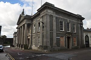
In 1888, a new law created the Carnarvonshire County Council. This was an elected group that took over running the county. The council was based at County Hall, Caernarfon.
The county and its main town were spelled "Carnarvon" until 1926. The local council decided to change the spelling to "Caernarvon". The government agreed, and the county's name officially changed on July 1, 1926.
Some towns in the county, like Caernarfon and Pwllheli, were old "boroughs" (towns with special rights). Over time, new laws changed how these towns and other areas were governed. This created different types of districts to manage local services.
A small part of the county, called Llysfaen, was separated from the rest. On April 1, 1923, Llysfaen was moved to the county of Denbighshire.
The End of the County
The administrative county of Caernarfonshire was officially ended on April 1, 1974. Its land was divided into new areas. Most of it became part of Gwynedd, along with parts of Merionethshire and Anglesey. The eastern part became part of Conwy.
In 1996, the name "Caernarfonshire" was briefly used again for a new administrative area called "Caernarfonshire and Merionethshire". However, it was quickly renamed Gwynedd.
Coat of Arms
Caernarvonshire County Council got its own coat of arms in 1949. The shield combined symbols from two important Welsh princes. The gold and red parts with lions came from Llewelyn the Last. These are now used as the arms of Wales.
A green band across the middle had three gold eagles. These eagles came from the arms of Owain Gwynedd. It is said that soldiers from Caernarfonshire carried a banner with these eagles at the Battle of Agincourt in 1415.
Above the shield was a castle, representing famous castles like Caernarfon, Conwy, and Criccieth Castle. Behind the castle was the symbol of the heir to the throne: three ostrich feathers.
The shield was held up by two Welsh dragons with fish tails. This showed that Caernarfonshire was a Welsh county by the sea. The dragons stood on rocks, representing the county's rugged coast and mountains. The motto, Cadernid Gwynedd, means "The Strength of Gwynedd".
Legacy
Flag
The Flag of Caernarfonshire was officially recognized in 2012. It shows three gold eagles on a green background. This design has been linked to the county for a long time. It is believed to have been used by Caernarfonshire soldiers at the Battle of Agincourt in 1415.
Places of Interest
- Bangor Cathedral
- Ynys Enlli / Bardsey Island
- Caernarfon Castle
- Conwy Castle
- Criccieth Castle
- Great Orme Tramway
- Gwydir Castle, near Llanrwst
- Penrhyn Castle
- Swallow Falls, Betws-y-Coed
- Snowdon Mountain Railway, Llanberis
- Ty Mawr Wybrnant
See also
 In Spanish: Caernarfonshire para niños
 | Kyle Baker |
 | Joseph Yoakum |
 | Laura Wheeler Waring |
 | Henry Ossawa Tanner |


