Caernarfon facts for kids
Quick facts for kids Caernarfon |
|
|---|---|
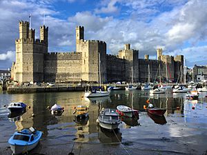 Caernarfon Castle and dock |
|
| Population | 9,852 (2011) |
| Demonym | Cofi |
| OS grid reference | SH485625 |
| • Cardiff | 171 mi (275 km) |
| Community |
|
| Principal area | |
| Ceremonial county | |
| Country | Wales |
| Sovereign state | United Kingdom |
| Post town | CAERNARFON |
| Postcode district | LL54, LL55 |
| Dialling code | 01286 |
| Police | North Wales |
| Fire | North Wales |
| Ambulance | Welsh |
| EU Parliament | Wales |
| UK Parliament |
|
| Welsh Assembly |
|
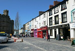
Caernarfon (/kərˈnɑːrvən, kɑːr-/; Welsh: [kaɨrˈnarvɔn]) is a special "royal town" and port in Gwynedd, Wales. It is home to about 9,852 people. The town sits on the eastern shore of the Menai Strait, which is a narrow stretch of water. Across the strait is the island of Anglesey.
Caernarfon is about 8.6 miles (13.8 km) from Bangor. To the east and south-east, you can see the beautiful mountains of Snowdonia (Eryri). People have lived here for a very long time, even before the Romans arrived. The Ordovices, a Celtic tribe, lived here during the Roman Britain period.
Around AD 80, the Romans built a fort called Segontium to control the Ordovices. The Romans stayed until 382 AD. After they left, Caernarfon became part of the Kingdom of Gwynedd. Later, in the 11th century, William the Conqueror tried to build a castle here. But Wales remained independent for a while longer.
In the 13th century, Llywelyn ap Gruffudd, the ruler of Gwynedd, refused to obey Edward I of England. This led to the English conquest of Gwynedd. After this, Caernarfon Castle was built. It is one of the biggest castles the English built in Wales. In 1284, Caernarfon became an important town. It was a county and market town, and the center of English government in north Wales.
When the Welsh House of Tudor became rulers of England, things became more peaceful. Caernarfon Castle slowly fell into disrepair. Today, Caernarfon is a busy tourist spot and the main office for Gwynedd Council. It has a lively harbor and marina. The town has grown beyond its old medieval walls. Many people here speak Welsh. In 1963, Queen Elizabeth II made Caernarfon a "Royal Borough." The castle and town walls are now a World Heritage Site. They are known as the Castles and Town Walls of King Edward in Gwynedd.
Contents
What's in a Name?
The name Caernarfon has three parts in Welsh: caer, yn, and Arfon.
- Caer means 'fortress'. This could be the Roman fort of Segontium. Or it could be the Norman castle near the mouth of the Afon Seiont river.
- Arfon means "opposite Môn" (which is the Welsh name for Anglesey).
So, the full name means "the fortress in the land opposite Anglesey."
The town's name was officially spelled "Carnarvon" until 1926. The local council decided to change it to "Caernarvon." Then, in 1975, the spelling was changed again to "Caernarfon."
A Look Back in Time
Caernarfon has a Roman fort called Segontium. A Norman castle was also built here near the mouth of the River Seiont.
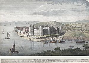
In 1283, King Edward I finished conquering Wales. He built many castles and walled towns to secure his rule. Building the stone Caernarfon Castle started right after his conquest. Edward's architect, James of St. George, might have copied the design from the walls of Constantinople.
Edward's fourth son, Edward of Caernarfon, was born at the castle in April 1284. He later became Edward II of England. In 1301, he was made Prince of Wales. A story from the 16th century says that the new prince was offered to the Welsh people. The story claimed he was "born in Wales and could speak never a word of English." However, there is no proof of this from that time.
Caernarfon became a special town in 1284. King Edward I gave it a charter. This charter made the town's mayor also the Constable of the Castle.
In 1911, David Lloyd George was a Member of Parliament for the Caernarfon area. He agreed to the British Royal Family's idea of holding the investiture of the Prince of Wales at Caernarfon Castle. The ceremony happened on July 13. The future Edward VIII was officially made Prince of Wales.
In 1955, Caernarfon was considered to be the Capital of Wales. But in a vote, Cardiff won by a large margin. So Cardiff became the Welsh capital.
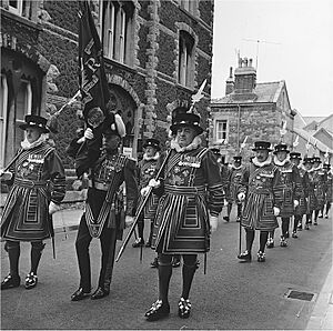
On July 1, 1969, another investiture ceremony for Charles, Prince of Wales took place at Caernarfon Castle. The ceremony went ahead peacefully.
In July 2019, Caernarfon hosted a rally for Welsh independence. Many people marched through the town center. Organizers estimated about 8,000 people joined the march.
The history of Caernarfon shows how different civilizations have risen and fallen. This is discussed in John Michael Greer's book The Long Descent. He writes about seeing the ancient Celtic earthworks, the Roman fort, Edward I’s castle, and modern jets all from one spot.
Where is Caernarfon?
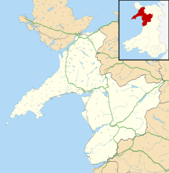
Caernarfon is on the southern bank of the Menai Strait. It faces the Isle of Anglesey. It is about 8.6 miles (13.8 km) south-west of Bangor. It is also about 8.0 miles (12.9 km) west of Llanberis and Snowdonia National Park. The River Seiont flows into the Menai Strait here, creating a natural harbor. Caernarfon Castle stands right at the mouth of the river. The A487 road goes through Caernarfon, connecting it to Bangor in the north and Porthmadog in the south.
What Does Caernarfon Do?
Caernarfon's history and famous landmarks make it a big tourist spot. Many local businesses serve visitors. You can find guest houses, hotels, restaurants, and shops. Most shops are in the town center around Pool Street and Castle Square. There are also shops at Doc Fictoria (Victoria Dock) and Cei Llechi (Slate Quay). Some shops are even inside the old Town Walls.
Doc Fictoria opened in 2008. It has homes, cafes, restaurants, an arts center, a maritime museum, and shops. It is right next to a marina with a Blue Flag beach.
Pool Street is a pedestrian street and the main shopping area. Castle Square, also called 'Maes', is the town's market square. A market is held every Saturday and on Mondays in summer. The square was updated in 2009.
Caernarfon has many old public houses, like The Four Alls and The Black Boy Inn. The Black Boy Inn is the oldest pub in town. It has been inside Caernarfon's Town Walls since the 16th century. Some people even say they have seen ghosts there!
Who Lives in Caernarfon?
In 2001, the population of Caernarfon was 9,611. People from Caernarfon are often called "Cofis." The word "Cofi" (/ˈkɒvi/) also describes the local Welsh way of speaking. This dialect has some words not used anywhere else.
Gwynedd has the highest number of Welsh speakers in Wales. The most Welsh speakers in Gwynedd live in and around Caernarfon. In 2011, 85.8% of residents were born in Wales. Also, 77.0% said their national identity was "Welsh only."
Historic Churches
St Mary's Church
This church started in 1307 as a chapel for the castle. It is built against the town wall. The Bell Tower acts as a vestry. The church was restored in the early 1800s. Its outside mostly shows this later work. But its north and west walls are from the original castle building in 1284-1290. The inside has medieval parts. It is a Grade I listed building.
St Peblig's Church
This church is named after Saint Peblig. It is built on an important early Christian site. This site was once a Roman temple. It is close to the Segontium Roman Fort. A Roman altar was found in one of the church walls during restoration work. The church you see today is mostly from the 14th century. It has a cross-shaped design. It was restored in 1894. St Peblig's is the main parish church for the town. It is also a Grade I listed building.
Famous Landmarks
Caernarfon Castle
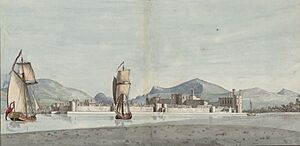
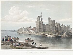
The castle you see today was built between 1283 and 1330. King Edward I ordered its construction. Its striped stone walls and many-sided towers might have been inspired by the Walls of Constantinople. The impressive outer wall, with nine towers and two gatehouses, is still mostly complete. Cadw now looks after Caernarfon Castle. It is open to visitors. The castle also has the museum of the Royal Welch Fusiliers.
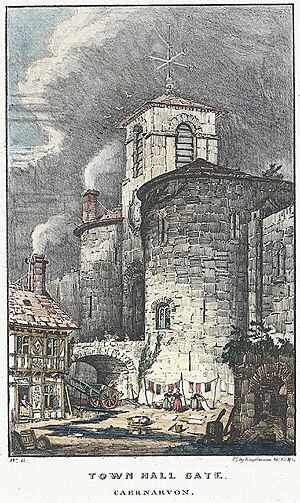
Caernarfon Town Walls
The medieval town walls were built between 1283 and 1285. They include eight towers and two gatehouses. They form a complete circle of about 800 yards (730 m) around the old town. The walls are also cared for by Cadw. Only a small part can be visited by the public. The town walls and castle are part of a World Heritage Site. UNESCO says they are "the finest examples of late 13th century and early 14th century military architecture in Europe."
Old County Hall and Police Station
The old Caernarfon County Hall and police station are two former government buildings. They stand facing the castle walls. They were built in the mid-1800s in a Neoclassical style. Both are Grade I listed buildings. They are no longer used as government offices. The old county hall is now an entertainment venue. The former police station is used for offices. Next to the old courthouse is the former Caernarfon Gaol (jail). It closed in the early 1900s and became council offices.
Statue of David Lloyd George
This statue in Castle Square was made by W. Goscombe John. It was put up in 1921. At that time, Lloyd George was the Prime Minister. David Lloyd George was the Member of Parliament for this area from 1890 to 1945.
The Old Market Hall
The Old Market Hall is on Hole-in-the-Wall Street. It was built in 1832. Its inside and roof were rebuilt later. It is a Grade II listed building. Today, it is a pub and a place for music.
Morfa Common Park
Morfa is a small Victorian urban park. It was created in 1888. It is south of the town. It is listed as a Grade II park in Wales.
Other Places
Caernarfon has a small hospital called 'Ysbyty Eryri' (Snowdonia Hospital). The main hospital for the area is Ysbyty Gwynedd in Bangor.
Caernarfon Barracks was built in 1855. It was used as a military headquarters.
Getting Around Caernarfon
By Sea
Caernarfon was once an important port. It shipped slate from the nearby quarries. The Nantlle Railway helped with this trade from 1828.
By Train
Caernarfon has had five passenger train stations over time. The first one opened in 1852. Different railway lines connected the town to other places. Many lines closed in the 1960s. The last passenger service to Bangor closed in 1970.
A new station opened in 1997. It is the northern end of the Welsh Highland Railway. This railway offers steam train rides to Porthmadog. From there, you can connect to the Ffestiniog Railway.
By Bus
Bus services are provided by Arriva Buses Wales and other local companies. Longer distance buses connect Caernarfon to Bangor in the north. They also go to Aberystwyth in the south. These services are part of the Welsh Government's TrawsCymru network.
By Road
The A487 road goes through the town. It connects Caernarfon to major towns along the North Wales coast. It also links to the Port of Holyhead via the A55 road expressway. You can reach Llanberis, at the foot of Snowdon, using the A4086.
By Bike
- The Lôn Las Menai cycle path goes north to Y Felinheli.
- The Lôn Eifion cycle path goes south to Bryncir. This route offers views of the Snowdonia mountains, the Llŷn Peninsula, and Isle of Anglesey.
By Air
Caernarfon Airport is about 4.5 miles (7.2 km) southwest of the town. It offers pleasure flights and has an aviation museum.
On Foot
The Aber Swing Bridge is a pedestrian bridge. It crosses the Afon Seiont river. It connects people from the waterfront to the Watergate entrance near Caernarfon Castle.
Learning in Caernarfon
Caernarfon has four primary schools: Ysgol yr Hendre, Ysgol y Gelli, Ysgol Santes Helen, and Ysgol Maesincla. Ysgol Syr Hugh Owen is the secondary school for students aged 11 to 18. Ysgol Pendalar is a school for children with special needs. Coleg Menai is a college for adult learners.
Famous People from Caernarfon
- See Category: People from Caernarfon
- Saint Elen (late 4th century), who founded churches in Wales.
- Edward II of England (1284–1327), King of England.
- William Henry Preece (1834–1913), an electrical engineer and inventor.
- Lewis Jones (1837-1904), one of the founders of the Welsh settlement in Patagonia.
- David Lloyd George (1863–1945), Prime Minister of the UK.
- Lionel Rees (1884–1955), a brave aviator and recipient of the Victoria Cross.
- Dafydd Wigley (born 1943), a politician who was MP for Caernarfon.
- Sian Eleri, a BBC Radio 1 presenter.
- Jamie Jones, a DJ and producer.
Sports Stars
- Bryan Orritt (1937–2014), a professional footballer.
- Barry Hughes (1937–2019), a professional footballer and manager.
- Wyn Davies (born 1942), a footballer who played for Wales.
- Tom Walley (born 1945), a footballer.
- Catrin Thomas (born 1964), a ski mountaineer and mountain climber.
- Waynne Phillips (born 1970), a professional footballer.
- Nathan Craig (born 1991), a professional footballer.
Sports in Caernarfon
Caernarfon Town F.C. (Welsh: Clwb Pêl Droed Tref Caernarfon) is the town's football club. They play in the Cymru Premier, which is the top football league in Wales. The team is called "the Canaries" because they wear yellow and green. They play at The Oval, which can hold 3,000 people.
Culture and Festivals
Caernarfon has hosted the National Eisteddfod many times. This is a big Welsh festival of music, literature, and performance. It also hosted the Celtic Media Festival in 2009.
You can visit Galeri, a creative center with a gallery, concert hall, and cinema. Oriel Pendeitsh is an exhibition space next to the Tourist Information Centre. It has different art shows throughout the year.
Caernarfon Food Festival
The Caernarfon Food Festival takes place in the town's streets. Stalls are set up on The Slate Quay (Cei Llechi) and Castle Square (the Maes). They are also along the promenade near the marina.
The festival started in 2016. It is organized by local volunteers. The festival's logo was designed with ideas from students at Ysgol Syr Hugh Owen. The festival has received support from the Welsh Government. You can park at the Slate Quay and other car parks. The Welsh Highland Railway also brings people from Porthmadog. You can also cycle to the festival on paths like Lôn Las Eifion and Lôn Las Menai.
Freedom of the Town
The "Freedom of the Town" is a special honor given to people or military groups.
Military Units
- The Royal Welch Fusiliers: 1946.
- The Royal Welsh: April 25, 2009.
See also
 In Spanish: Caernarfon para niños
 | Isaac Myers |
 | D. Hamilton Jackson |
 | A. Philip Randolph |


