Waun Fach facts for kids
Quick facts for kids Waun Fach |
|
|---|---|

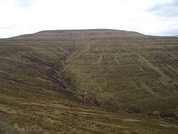
Waun Fach from Mynydd Llysiau
|
|
| Highest point | |
| Elevation | 811 m (2,661 ft) |
| Prominence | 622 m (2,041 ft) |
| Parent peak | Pen y Fan |
| Listing | Marilyn, Hewitt, Nuttall |
| Naming | |
| English translation | small moor |
| Language of name | Welsh |
| Pronunciation | Welsh: [wai̯n ˈvaːχ] |
| Geography | |
| Location | Black Mountains, South Wales |
| OS grid | SO215300 |
| Topo map | OS Landranger 161 |
Waun Fach is the highest mountain in the Black Mountains. These mountains are found in the south-eastern part of Wales. Its top reaches 811 meters (2,661 feet) above sea level. This makes it a very important peak in the area.
Waun Fach is one of the tallest mountains in Britain south of Snowdonia. Only Pen y Fan and Corn Du are higher. It sits at the top of the Grwyne Fechan valley. You can find it west of the Grwyne Fawr reservoir. The mountain has a rounded top that can be hard to spot. Other nearby peaks, like Pen Trumau and Pen y Gadair Fawr, are easier to recognize.
What is Waun Fach Made Of?
The top parts of Waun Fach are made from ancient sandstones. These rocks formed millions of years ago during the Early Devonian period. This time is part of what scientists call the Old Red Sandstone era. Below these, the lower slopes also have sandstones.
Some layers of mudstone are mixed within these sandstones. Mudstone wears away more easily than sandstone. This creates a stepped look on parts of the mountain. The very top of Waun Fach is covered by a thick layer of peat. Peat is made from decaying plants. It built up after the last ice age. However, some of this peat has worn away in recent years.
Exploring Waun Fach
Waun Fach is a great place for walkers to explore. It is part of an area known as "open country." This means people can legally walk there. You don't need a special path to reach the top.
If you enjoy mountain biking or horse riding, there are special paths for you. These paths lead to a lower area south of Pen Trumau. However, these paths do not go all the way to the very top of Waun Fach. The paths from the north and west have been improved. The Brecon Beacons National Park Authority has worked to fix them. This makes it easier and safer for everyone to visit.
 | Madam C. J. Walker |
 | Janet Emerson Bashen |
 | Annie Turnbo Malone |
 | Maggie L. Walker |

