Cinnamon Peak facts for kids
Quick facts for kids Cinnamon Peak |
|
|---|---|

Cinnamon Peak
|
|
| Highest point | |
| Elevation | 2,727 m (8,947 ft) |
| Prominence | 337 m (1,106 ft) |
| Parent peak | Whitehorn Mountain (3399 m) |
| Listing | Mountains of British Columbia |
| Geography | |
| Parent range | Park Ranges of the Canadian Rockies |
| Topo map | NTS 83E/03 |
| Climbing | |
| Easiest route | Scrambling |
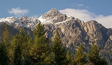
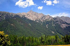
Cinnamon Peak is a mountain in British Columbia, Canada. It stands 2,727-metre (8,947-foot) tall in the Canadian Rockies. You can find it in the northwestern part of Mount Robson Provincial Park.
This peak is easy to spot from the Yellowhead Highway. It is located near the park's visitor centre. The mountain was first called "Little Grizzly" on a map from 1911. Its name was changed to Cinnamon because of its color. The mountain looks like a Cinnamon bear, which is a type of black bear. The name "Cinnamon Peak" became official in 1951. The closest taller mountain is Whitehorn Mountain, about 6.0 km (3.7 mi) to the north.
What is the Climate Like at Cinnamon Peak?
Cinnamon Peak has a subarctic climate. This means it has very cold and snowy winters. Summer months are usually mild. Winter temperatures can drop below −20 °C (or −4 °F). The wind can make it feel even colder, sometimes below −30 °C (or −22 °F).
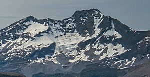
This cold climate helps keep a glacier on the mountain's northeast side. The best time to visit or climb Cinnamon Peak is from June through September. During these months, the weather is usually good. Water from the peak flows into Swiftcurrent Creek and the Robson River. These rivers then join the larger Fraser River.
 | William Lucy |
 | Charles Hayes |
 | Cleveland Robinson |


