City of South Perth facts for kids
Quick facts for kids City of South PerthWestern Australia |
|||||||||||||||
|---|---|---|---|---|---|---|---|---|---|---|---|---|---|---|---|

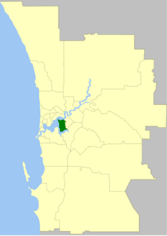
The City of South Perth within the Perth Metropolitan Area
|
|||||||||||||||
| Established | 1892 | ||||||||||||||
| Area | 19.8 km2 (7.6 sq mi) | ||||||||||||||
| Mayor | Greg Milner | ||||||||||||||
| Council seat | South Perth | ||||||||||||||
| Region | South Metropolitan Perth | ||||||||||||||
| State electorate(s) | South Perth | ||||||||||||||
| Federal Division(s) | Swan | ||||||||||||||
 |
|||||||||||||||
| Website | City of South Perth | ||||||||||||||
|
|||||||||||||||
The City of South Perth is a local government area in Perth, Western Australia. It's like a local council that manages services for the people living there. It's located in the southern suburbs of Perth, about 4 kilometers (2.5 miles) south of the city center.
This area covers about 19.9 square kilometers (7.7 square miles). It has 203 kilometers (126 miles) of roads and over 4.3 square kilometers (1.7 square miles) of parks and gardens. In 2021, about 43,405 people lived here. The City of South Perth is mostly surrounded by the Swan and Canning rivers.
Contents
History of South Perth
The area started as the South Perth Road District on 9 June 1892. This was a group that looked after roads and local services. It became a Municipality of South Perth on 21 February 1902. A municipality is a town or city with its own local government.
It went back to being a road district in 1922, but then became a municipality again in 1956. Finally, it was given "city status" on 1 July 1959. This means it officially became known as the City of South Perth.
In 2014, the state government suggested a big change. They wanted to combine the City of South Perth with the Town of Victoria Park. They also wanted to add a part of the City of Canning. People living in South Perth got to vote on this idea in early 2015.
More than half of the voters in South Perth voted. A large majority of them (77.75%) voted against the idea. Because enough people voted, the plan to combine these areas was stopped. So, the City of South Perth and the Town of Victoria Park stayed as separate local governments.
How South Perth is Governed
The City of South Perth is split into four areas called wards. Each ward elects two councillors. These councillors are like representatives for the people in their ward. They help make decisions for the whole city.
Suburbs in South Perth
The City of South Perth includes several suburbs. These suburbs are known for being nice places to live. They are close to the river, good schools, and the city center. Here are the suburbs with their populations and sizes from the 2021 Australian census:
| Suburb | Population | Area | Map |
|---|---|---|---|
| Como | 14,786 | [convert: needs a number] | |
| Karawara | 1,842 | [convert: needs a number] | |
| Kensington | 4,627 | [convert: needs a number] | |
| Manning | 4,219 | [convert: needs a number] | |
| Salter Point | 2,913 | [convert: needs a number] | |
| South Perth | 12,596 | [convert: needs a number] | |
| Waterford | 2,460 | [convert: needs a number] |
The suburbs in South Perth are known for having higher house prices than the state average. Here is a table showing the typical house price in each suburb:
| Suburb | Median house price |
|---|---|
| Como | $970,000 |
| Karawara | $599,000 |
| Kensington | $965,000 |
| Manning | $825,000 |
| Salter Point | $1,117,500 |
| South Perth | $1,252,000 |
| Waterford | $875,000 |
Schools in South Perth
The City of South Perth has many schools for students of all ages.
High Schools
- Aquinas College
- Como Secondary College
- Penrhos College
- Wesley College
- Clontarf Aboriginal College
Primary Schools
- Como Primary School
- Collier Primary School
- Curtin Primary School
- Kensington Primary School
- Manning Primary School
- St Columba's Catholic Primary School
- Saint Pius X Primary School
- South Perth Primary School
Libraries in South Perth
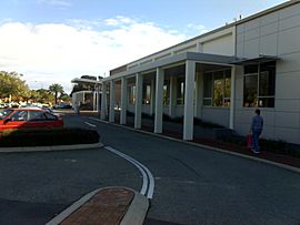
The City of South Perth has two libraries. You can find them in Manning and South Perth.
Together, these libraries have over 70,000 items. This includes books, movies, and other resources. The libraries also have a special collection about the local history of South Perth and its suburbs. This collection helps preserve information about the area's past.
Picture South Perth is an online collection of old photos. It shows images from the 1870s onwards. These pictures are part of the City of South Perth's Local History Collection.
Population Growth
The population of the City of South Perth has grown a lot over the years. Here's how the population has changed:
| Historical population | ||||||||||||||||||||||||||||||||||||||||||||||||||||||||||||||||
|---|---|---|---|---|---|---|---|---|---|---|---|---|---|---|---|---|---|---|---|---|---|---|---|---|---|---|---|---|---|---|---|---|---|---|---|---|---|---|---|---|---|---|---|---|---|---|---|---|---|---|---|---|---|---|---|---|---|---|---|---|---|---|---|---|
|
|
|||||||||||||||||||||||||||||||||||||||||||||||||||||||||||||||
Historic Places
The City of South Perth has many places that are important to its history. As of 2024, there are 189 places listed as heritage sites. Twenty of these are on the State Register of Heritage Places. This means they are very important to the history of Western Australia.
Some of these famous places include the Old Mill, which is a very old building. Also, the Clontarf Aboriginal College and the Cygnet Cinema are important heritage sites.
 | Emma Amos |
 | Edward Mitchell Bannister |
 | Larry D. Alexander |
 | Ernie Barnes |


