City of Canning facts for kids
Quick facts for kids City of CanningWestern Australia |
|||||||||||||||
|---|---|---|---|---|---|---|---|---|---|---|---|---|---|---|---|

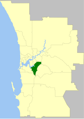
The City of Canning within the Perth Metropolitan Area
|
|||||||||||||||
| Established | 1871 | ||||||||||||||
| Area | 64.8 km2 (25.0 sq mi) | ||||||||||||||
| Mayor | Patrick Hall | ||||||||||||||
| Council seat | Cannington | ||||||||||||||
| Region | South East Metropolitan Perth | ||||||||||||||
| State electorate(s) | Cannington, Victoria Park, Belmont, Riverton, Southern River | ||||||||||||||
| Federal Division(s) | Swan, Tangney, Canning | ||||||||||||||
 |
|||||||||||||||
| Website | City of Canning | ||||||||||||||
|
|||||||||||||||
The City of Canning is a local government area in the southeastern suburbs of Perth, the capital city of Western Australia. It is about 10 kilometres (6.2 mi) southeast of Perth's main city centre. The City of Canning covers an area of 64.8 square kilometres (25.0 sq mi). In 2016, about 90,000 people lived there.
Contents
History of Canning City
The area now known as the City of Canning has a long history. An early attempt to create a local town group in the Canning District happened between 1843 and 1847, but it didn't last. The area then grew under a Central Board of Works. In 1871, the Canning Road District was officially created. This was a local group in charge of roads and other services.
The City of Canning began as the Municipality of Queen's Park on 1 July 1907. At this time, the original Canning Road District was split into two parts: the Queen's Park municipality and the Gosnells Road District (which later became the City of Gosnells). The Queen's Park municipality was renamed the Queen's Park Road District on 5 November 1913.
It changed its name again to become the second Canning Road District on 17 June 1921. On 30 November 1923, it gained a lot of land from the Jandakot Road District, which was no longer active. On 1 July 1961, the Canning Road District became the Shire of Canning. A "shire" is a type of local government area, often covering a larger, more rural region.
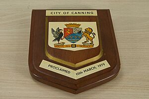
The area continued to grow and develop. On 4 December 1970, it became the Town of Canning. A "town" status means it was more developed than a shire. Finally, on 10 March 1979, it became the City of Canning. This "city" status shows it is a major urban area.
In 1974, the Town of Canning bought Woodloes Homestead. This old house became a local museum to help people learn about the area's history.
In 2012, there were some challenges with how the City of Canning council was being managed. As a result, the State Government decided to temporarily put new leaders, called Commissioners, in charge of the city. This was to help sort out the issues. Two years later, in 2014, the remaining councillors were replaced by a new group of three Commissioners. There were also plans to combine the City of Canning with other nearby areas like the City of Gosnells and City of Melville, but these plans did not go ahead.
City Wards
The City of Canning is divided into five main areas called "wards." Each ward chooses two councillors to represent them. The mayor, who leads the city, is chosen directly by all the people in the city.
- Mason Ward: This ward includes the suburbs of Bentley, East Cannington, Queens Park, St James, and Welshpool.
- Bannister Ward: This ward covers Riverton, Rossmoyne, and Shelley.
- Beeliar Ward: This ward includes Leeming and Willetton.
- Nicholson Ward: This ward covers Canning Vale and Parkwood.
- Beeloo Ward: This ward includes Cannington, Ferndale, Lynwood, and Wilson.
Suburbs in Canning
Here are the suburbs located within the City of Canning. The numbers show how many people lived there and the size of the area, based on the most recent Australian census.
| Suburb | Population | Area | Map |
|---|---|---|---|
| Bentley * | 9,051 (SAL 2021) | [convert: needs a number] | |
| Canning Vale * | 34,504 (SAL 2021) | [convert: needs a number] | |
| Cannington | 6,875 (SAL 2021) | [convert: needs a number] | |
| East Cannington | 6,512 (SAL 2021) | [convert: needs a number] | |
| Ferndale | 4,457 (SAL 2021) | [convert: needs a number] | |
| Leeming * | 10,883 (SAL 2021) | [convert: needs a number] | |
| Lynwood | 3,541 (SAL 2021) | [convert: needs a number] | |
| Parkwood | 5,995 (SAL 2021) | [convert: needs a number] | |
| Queens Park | 7,268 (SAL 2021) | [convert: needs a number] | |
| Riverton | 6,078 (SAL 2021) | [convert: needs a number] | |
| Rossmoyne | 3,638 (SAL 2021) | [convert: needs a number] | |
| St James * | 4,894 (SAL 2021) | [convert: needs a number] | |
| Shelley | 4,795 (SAL 2021) | [convert: needs a number] | |
| Welshpool * | 16 (SAL 2021) | [convert: needs a number] | |
| Willetton | 19,262 (SAL 2021) | [convert: needs a number] | |
| Wilson | 6,608 (SAL 2021) | [convert: needs a number] |
( * indicates suburb partially located within City)
Population Growth
| Historical population | |||||||||||||||||||||||||||||||||||||||||||||||||||||||||||||
|---|---|---|---|---|---|---|---|---|---|---|---|---|---|---|---|---|---|---|---|---|---|---|---|---|---|---|---|---|---|---|---|---|---|---|---|---|---|---|---|---|---|---|---|---|---|---|---|---|---|---|---|---|---|---|---|---|---|---|---|---|---|
|
|
||||||||||||||||||||||||||||||||||||||||||||||||||||||||||||
Special Heritage Places
The City of Canning has many important historical sites. As of 2024, there are 107 places listed as heritage sites. Eight of these are on the State Register of Heritage Places. These include Castledare Boys' Home and Woodloes Homestead, which are very important historical buildings.
Sister Cities
The City of Canning has a special connection with another city far away.
- Casoli, in Abruzzo, Italy (since 2010)
Canning also has a friendship agreement with Fresagrandinaria, which is also in Abruzzo, Italy. These connections help people from different countries learn about each other's cultures.
See also
 In Spanish: Ciudad de Canning para niños
 | Jessica Watkins |
 | Robert Henry Lawrence Jr. |
 | Mae Jemison |
 | Sian Proctor |
 | Guion Bluford |


