Clare, New York facts for kids
Quick facts for kids
Clare, New York
|
|
|---|---|

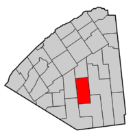
Map highlighting Clare's location within St. Lawrence County.
|
|
| Country | United States |
| State | New York |
| County | St. Lawrence |
| Area | |
| • Total | 97.26 sq mi (251.89 km2) |
| • Land | 96.50 sq mi (249.92 km2) |
| • Water | 0.76 sq mi (1.97 km2) |
| Elevation | 1,148 ft (350 m) |
| Population
(2010)
|
|
| • Total | 105 |
| • Estimate
(2016)
|
105 |
| • Density | 1.09/sq mi (0.42/km2) |
| Time zone | UTC-5 (Eastern (EST)) |
| • Summer (DST) | UTC-4 (EDT) |
| FIPS code | 36-15792 |
| GNIS feature ID | 0978828 |
Clare is a small town located in St. Lawrence County, New York, in the United States. In 2010, about 105 people lived there.
The Town of Clare is found in the south-central part of St. Lawrence County. It is located south of the Village of Canton, which is the main town of the county.
Contents
History of Clare: A Look Back in Time
How Clare Became a Town
The town of Clare was officially created in 1880. It was formed from a part of another town called Pierrepont. Clare was the very last town to be formed in St. Lawrence County.
Early Days and Famous Connections
A long time ago, even before Clare was its own town, a famous French writer named Madam De Stael invested in land here. She bought the land based on advice from her friend, Gouverneur Morris.
In 1894, a history book mentioned that Clare was a very quiet place. There were almost no businesses, and there were no organized churches in the town at that time.
Clare Town Hall: A Historic Building
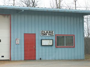
The Clare Town Hall is an important building in the town. It was recognized for its history and added to the National Register of Historic Places in 2004. This means it's a special place worth preserving.
Geography: Exploring Clare's Landscape
Size and Waterways
According to the United States Census Bureau, the town of Clare covers about 97.3 square miles (251.89 square kilometers). Most of this area, about 96.6 square miles (249.92 square kilometers), is land. The rest, about 0.6 square miles (1.97 square kilometers), is water.
Location in the Adirondack Park
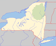
Clare is located inside the beautiful Adirondack Park. This park is a large protected area known for its forests, mountains, and rivers. Two parts of the Grasse River flow through the town, adding to its natural beauty.
Population: Who Lives in Clare?
| Historical population | |||
|---|---|---|---|
| Census | Pop. | %± | |
| 1890 | 281 | — | |
| 1900 | 330 | 17.4% | |
| 1910 | 420 | 27.3% | |
| 1920 | 152 | −63.8% | |
| 1930 | 227 | 49.3% | |
| 1940 | 139 | −38.8% | |
| 1950 | 107 | −23.0% | |
| 1960 | 87 | −18.7% | |
| 1970 | 97 | 11.5% | |
| 1980 | 121 | 24.7% | |
| 1990 | 78 | −35.5% | |
| 2000 | 112 | 43.6% | |
| 2010 | 105 | −6.2% | |
| 2016 (est.) | 105 | 0.0% | |
| U.S. Decennial Census | |||
In the year 2000, there were 112 people living in Clare. These people made up 46 households and 32 families. The town had 106 housing units.
About 24.1% of the people living in Clare were under 18 years old. The median age in the town was 43 years. This means half the people were younger than 43, and half were older.
Communities and Places in Clare
- Brouses Corners – This is a small area located north of Clare village. You can find it on County Road 27, also known as Clare Road.
- Canton Farm – This location is in the eastern part of Clare, near the Grasse River.
- Clare – This is the main hamlet (a small village) of Clare. It's in the northwestern part of the town on County Road 27.
- Clarksboro – You can find this spot south of Clare village, in the eastern part of the town.
- Moores landing strip (1E8) – This is a small airport with a grass runway. It's located south of Clare village.
- Newbridge – This is another small hamlet in the southwestern part of the town.
- Lampson Falls – This is a beautiful spot with several waterfalls. You can reach them by following a trail off County Road 27.
See also
 In Spanish: Clare (Nueva York) para niños
 | Calvin Brent |
 | Walter T. Bailey |
 | Martha Cassell Thompson |
 | Alberta Jeannette Cassell |


