
Clark, South Dakota facts for kids
Quick facts for kids
Clark, South Dakota
|
|
|---|---|

Clark County Courthouse in Clark
|
|

Location within Clark County and South Dakota
|
|
| Country | United States |
| State | South Dakota |
| County | Clark |
| Incorporated | 1886 |
| Area | |
| • Total | 1.35 sq mi (3.51 km2) |
| • Land | 1.35 sq mi (3.51 km2) |
| • Water | 0.00 sq mi (0.00 km2) |
| Elevation | 1,811 ft (552 m) |
| Population
(2020)
|
|
| • Total | 1,148 |
| • Density | 848.48/sq mi (327.51/km2) |
| Time zone | UTC−6 (Central (CST)) |
| • Summer (DST) | UTC−5 (CDT) |
| ZIP code |
57225
|
| Area code(s) | 605 |
| FIPS code | 46-12180 |
| GNIS feature ID | 1267330 |
Clark is a small city located in Clark County, South Dakota, United States. It is also the county seat, which means it's where the main government offices for the county are. In 2020, about 1,148 people lived in Clark.
Contents
Exploring Clark's History
Clark has a rich history that dates back to the late 1800s. It was officially founded in 1886, a few years before South Dakota became a state. The city is named after Clark County, where it is located.
Early Days and Growth

A post office opened in Clark in 1880, helping connect the growing community. The town's layout was planned in 1882. That same year, railroad tracks were built right through the middle of Clark. This railroad, later known as Burlington Northern, and Highway 212 ran side-by-side, dividing the city into two halves. Highway 212 also served as a direct route for travelers heading from Minneapolis, Minnesota, through Clark, and on to famous places like the Black Hills and Yellowstone National Park.
Soon after its founding, the local government started making rules. In 1899, the Clark City Council passed Ordinance No. 26. This rule made it illegal to ride a horse or bicycle faster than eight miles per hour on Commercial Street! This shows how the town was organized even in its early days.
Population Changes Over Time
Clark's population reached its highest point in the 1950s and early 1960s, with almost 1,500 residents. During this time, many people from nearby towns would come to Clark for work, entertainment, and to attend school. The Clark Public School System offered education from kindergarten through 12th grade. Students from surrounding areas like Thorpe, Carpenter, and Garfield were bused into Clark for school.
Most people who lived in Clark during its peak either lived on family farms outside of town or in modest homes within the city. Many worked in the retail stores located on Commercial Street.
Local Businesses and Changes
In the 1960s, Clark had many small businesses. There were two hardware stores, two banks, two grain elevators, two clothing stores, a jewelry store, a movie theater, a bakery, a restaurant, and a dry cleaners. This shows how lively and self-sufficient the community was.
As years passed, Clark's economy changed. Some stores on Commercial Street closed down. The Burlington Northern Railroad stopped offering service to Clark. However, important parts of the town, like the Clark water tower, the busy grain elevators, and County Highway 212, continued to be used.
In 2018, only 12 students graduated from Clark High School. This was a big change from 1968, when 66 students graduated. However, recent numbers show that the kindergarten class in 2017–2018 had 28 students, suggesting new growth for the town.
Clark's Location and Landscape
Clark is located almost exactly in the center of Clark County. The city covers about 1.35 square miles (3.51 square kilometers) of land, with no significant water areas.
The highest point in Clark County is near the Township of Maydell. This unnamed peak reaches an elevation of 1,930 feet (588 meters).
Who Lives in Clark?
| Historical population | |||
|---|---|---|---|
| Census | Pop. | %± | |
| 1880 | 25 | — | |
| 1890 | 592 | 2,268.0% | |
| 1900 | 684 | 15.5% | |
| 1910 | 1,220 | 78.4% | |
| 1920 | 1,392 | 14.1% | |
| 1930 | 1,290 | −7.3% | |
| 1940 | 1,291 | 0.1% | |
| 1950 | 1,471 | 13.9% | |
| 1960 | 1,484 | 0.9% | |
| 1970 | 1,356 | −8.6% | |
| 1980 | 1,351 | −0.4% | |
| 1990 | 1,292 | −4.4% | |
| 2000 | 1,285 | −0.5% | |
| 2010 | 1,139 | −11.4% | |
| 2020 | 1,148 | 0.8% | |
| U.S. Decennial Census 2018 Estimate |
|||
According to the 2010 census, there were 1,139 people living in Clark. The city had 552 households. Most residents were White (98.5%). About 1.4% of the population identified as Hispanic or Latino.
The average age in Clark was 51.5 years old. About 18.8% of residents were under 18, and 32.7% were 65 or older. This shows a community with a mix of ages, including many older adults.
Famous People from Clark
Clark has been home to several notable individuals:
- Samuel H. Elrod: He was the fifth Governor of South Dakota.
- Doug Hegdahl: A former sailor in the United States Navy and a prisoner of war (POW) during the Vietnam War.
- Orator Henry LaCraft: He served as a South Dakota State Senator.
- Urban Odson: An NFL player for the Green Bay Packers.
Images for kids
-
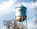
City of Clark Water Tower

See also
 In Spanish: Clark (Dakota del Sur) para niños
