Clay, West Virginia facts for kids
Quick facts for kids
Clay, West Virginia
|
|
|---|---|

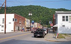
Main Street (WV Route 16) in Clay; Photo 2007
|
|
| Nickname(s):
Haven In The Hills
|
|

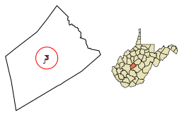
Location of Clay in Clay County, West Virginia.
|
|
| Country | United States |
| State | West Virginia |
| County | Clay |
| Area | |
| • Total | 0.62 sq mi (1.59 km2) |
| • Land | 0.56 sq mi (1.44 km2) |
| • Water | 0.06 sq mi (0.15 km2) |
| Elevation | 709 ft (216 m) |
| Population
(2020)
|
|
| • Total | 399 |
| • Estimate
(2021)
|
387 |
| • Density | 790.32/sq mi (305.26/km2) |
| Time zone | UTC-5 (Eastern (EST)) |
| • Summer (DST) | UTC-4 (EDT) |
| ZIP code |
25043
|
| Area code(s) | 304 |
| FIPS code | 54-15676 |
| GNIS feature ID | 1537360 |
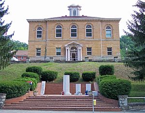
Clay is a small town in West Virginia, United States. It is the main town and county seat of Clay County, West Virginia. A county seat is like the capital city of a county, where the main government offices are located. In 2020, about 399 people lived in Clay. It is the only official town in Clay County.
Contents
History of Clay
Clay started on a farm where Clay County's first court meeting happened in 1858. The town had a few different names before it became "Clay." It was first called "Marshall," then "Henry," and later "Clay Courthouse." Finally, it was named "Clay."
Both the town and the county are named after Henry Clay. He was a famous American politician who served as a U.S. Senator and United States Secretary of State. The town officially became a town in 1895.
For a long time, it was hard to get to Clay by horse-drawn vehicles. The main way to travel to and from Clay was by using the Elk River. In 1905, the Coal and Coke Railway reached Clay, which made travel and trade much easier.
In June 2016, the town faced serious flooding from the Elk River.
Geography of Clay

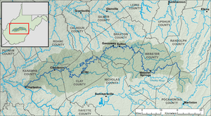
Clay is located in the middle of Clay County. It sits along the Elk River and West Virginia Route 16. The town is about 708 feet (216 meters) above sea level. West Virginia Route 4 also passes through the northern part of Clay.
The state capital, Charleston, is about 40 miles (64 km) southwest of Clay. The town does not have much flat land because the river cuts a deep valley through it. This limits how much the town can grow.
The total area of Clay is about 0.62 square miles (1.59 square kilometers). Most of this area is land, and a small part is water.
Clay's Climate
Clay has a climate with hot and humid summers. The winters are usually mild to cool. This type of weather is known as a humid subtropical climate.
Population Information
| Historical population | |||
|---|---|---|---|
| Census | Pop. | %± | |
| 1900 | 339 | — | |
| 1910 | 392 | 15.6% | |
| 1920 | 342 | −12.8% | |
| 1930 | 444 | 29.8% | |
| 1940 | 511 | 15.1% | |
| 1950 | 500 | −2.2% | |
| 1960 | 486 | −2.8% | |
| 1970 | 479 | −1.4% | |
| 1980 | 940 | 96.2% | |
| 1990 | 592 | −37.0% | |
| 2000 | 593 | 0.2% | |
| 2010 | 491 | −17.2% | |
| 2020 | 399 | −18.7% | |
| 2021 (est.) | 387 | −21.2% | |
| U.S. Decennial Census | |||
The population of Clay has changed over the years. In 2010, there were 491 people living in the town. These people lived in 218 households. About 134 of these households were families.
Most of the people living in Clay are White (97.8%). A small number are Native American or from other backgrounds. About 0.4% of the population were Hispanic or Latino.
The average age in Clay in 2010 was about 38.8 years old.
- About 21.8% of residents were under 18 years old.
- About 16.9% were 65 years old or older.
- The town had a slightly higher number of males (52.7%) than females (47.3%).
Economy in Clay
Some newer businesses in the Clay area are found along a place locals call "Two Run." In May 2015, the only grocery store in Clay County, a Piggly Wiggly, closed down.
Notable People from Clay
- Oscar Lambert: He was an American athlete who played football, basketball, baseball, table tennis, and chess.
- Dave Vineyard: He was a baseball player who pitched for the Baltimore Orioles in part of the 1964 season.
See also
 In Spanish: Clay (Virginia Occidental) para niños
 | George Robert Carruthers |
 | Patricia Bath |
 | Jan Ernst Matzeliger |
 | Alexander Miles |


