Clearwater Lake (British Columbia) facts for kids
Quick facts for kids Clearwater Lake |
|
|---|---|

Clearwater Lake
|
|
| Location | British Columbia |
| Coordinates | 52°14′N 120°12′W / 52.233°N 120.200°W |
| Primary inflows | Clearwater River |
| Primary outflows | Clearwater River |
| Basin countries | Canada |
| Max. length | 24 km (14.9 mi) |
| Max. width | 2.6 km (1.6 mi) |
| Surface area | 33.255 km2 (13 sq mi) |
| Max. depth | 197 m (646 ft) |
| Water volume | 3.38 km3 (1 cu mi) |
| Shore length1 | 57.97 km (36 mi) |
| Surface elevation | 680 m (2,231 ft) |
| Islands | None |
| Settlements | None |
| 1 Shore length is not a well-defined measure. | |
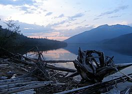
Clearwater Lake is a really cool lake located in Wells Gray Provincial Park in British Columbia, Canada. It's one of six big lakes in this amazing park! The Clearwater River flows into the lake from the north, bringing water from Hobson Lake and Azure Lake. This same river also flows out of Clearwater Lake. While a few small streams join the lake, the Clearwater River is the main water source.
Contents
How Clearwater Lake Was Formed

Clearwater Lake was created by powerful glaciers during several ice ages. Imagine giant sheets of ice carving out the land! The last big ice age, called the Wisconsin Ice Age, ended here about 10,000 years ago. After the ice melted, the deep basin filled up with water, forming the lake we see today.
Scientists believe the deepest part of the lake is near a spot called Diver's Bluff. About 8,500 years ago, a volcano named Dragon Cone erupted. The lava flowed for 15 km (9 mi) and blocked the Clearwater River, creating a natural dam about 3 m (10 ft) high. This dam caused the lake's water level to rise. This was just one of many volcanic events in the Wells Gray-Clearwater volcanic field over the last 500,000 years!
Osprey Falls: A Powerful Waterfall
Osprey Falls is a large waterfall where the Clearwater River flows out of Clearwater Lake. This waterfall is as tall as the lava dam that helped form the lake. It's also very wide, stretching over 500 m (1,640 ft)! The current in the southern 3 km (1.9 mi) of Clearwater Lake is very strong near Osprey Falls. It's important for boaters to be careful because the current can be dangerous.
Visiting Clearwater Lake: Access and Trails
The Clearwater Valley Road, also known as Wells Gray Park Road, leads right to Clearwater Lake. This is where you'll find some of Wells Gray Park's biggest campgrounds: Clearwater Lake and Falls Creek. Together, they have 80 campsites!
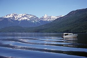
If you want to explore the lake, you can take a boat tour or use a water taxi service, which operate near the campgrounds. There's also a public boat launch about 3 km (1.9 mi) further up the lake.
Lakeside Trails for Hikers
There's a nice trail that follows the lakeshore from the water taxi dock to the public boat launch. It continues for another 1.5 km (0.9 mi) before climbing up to a viewpoint above the Easter Bluffs.
At the north end of Clearwater Lake, you can find a portage trail. This trail lets canoeists and kayakers easily move their boats to nearby Azure Lake. The Hobson Lake trail also starts here and is 13 km (8.1 mi) long. It's a challenging trail, and hikers need to cross Lickskillet Creek above Sundt Falls because the bridge washed out in 1998.
There are also seven small campgrounds along the east and west shores of Clearwater Lake. You can only reach these campsites by boat.
How Clearwater Lake Got Its Name
In 1862, a group of explorers called the Overlanders traveled down the North Thompson River. When they reached the mouth of the Clearwater River, they noticed how clear its water was compared to the muddy North Thompson River. So, they named it "Clear Water." Later, in 1866, white prospectors likely saw the lake and extended the river's name to it.
 | Bayard Rustin |
 | Jeannette Carter |
 | Jeremiah A. Brown |


