Clifton, Colorado facts for kids
Quick facts for kids
Clifton, Colorado
|
|
|---|---|

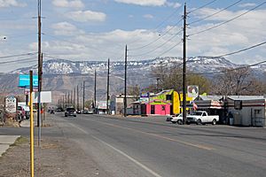
F Road (U.S. Route 6) in Clifton looking toward Grand Mesa
|
|

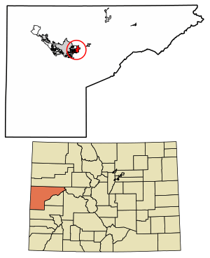
Location in Mesa County, Colorado
|
|
| Country | |
| State | |
| County | Mesa County |
| Government | |
| • Type | unincorporated town |
| Area | |
| • Total | 6.061 sq mi (15.70 km2) |
| • Land | 5.988 sq mi (15.51 km2) |
| • Water | 0.073 sq mi (0.19 km2) |
| Elevation
/
|
4,724 ft (1,440 m) |
| Population
(2020)
|
|
| • Total | 20,413 |
| • Density | 3,409.0/sq mi (1,316.2/km2) |
| Time zone | UTC-7 (MST) |
| • Summer (DST) | UTC-6 (MDT) |
| ZIP Codes |
81520 (Clifton)
81504 (Grand Junction) |
| Area code(s) | 970 |
| GNIS feature | 2407634 |
Clifton is a community in Mesa County, Colorado, United States. It is a special type of area called a census-designated place (CDP). This means it's like a town but not officially a city with its own local government. Clifton is part of the larger Grand Junction, CO Metropolitan Statistical Area. In 2020, about 20,413 people lived in Clifton. It has its own post office with the ZIP Code 81520.
Contents
History of Clifton
The community of Clifton got its name from the tall cliffs found near the area. The Clifton Post Office has been open and serving the community since the year 1900.
Clifton's Geography
Clifton is located in the central part of Mesa County. To its west, you'll find the city of Grand Junction. The Colorado River flows along the southern edge of Clifton.
Roads and Travel
Major roads pass through Clifton. U.S. Route 6 goes right through the middle of the community. This road leads west about 6 miles to the center of Grand Junction. It also goes east the same distance to Palisade. Interstate 70 runs along the northern side of Clifton. You can get onto Interstate 70 from Exit 37. Another road, Colorado State Highway 141, heads south from U.S. Route 6.
Area and Water
The Clifton area covers about 6.1 square miles (about 15.8 square kilometers). A small part of this area, about 0.07 square miles (0.18 square kilometers), is water.
Population and Demographics
| Clifton CDP, Colorado | ||
|---|---|---|
| Year | Pop. | ±% |
| 1970 | 5,223 | — |
| 1980 | 6,597 | +26.3% |
| 1990 | 12,671 | +92.1% |
| 2000 | 12,238 | −3.4% |
| 2010 | 19,889 | +62.5% |
| 2020 | 20,413 | +2.6% |
| Source: United States Census Bureau | ||
Clifton has seen its population grow quite a bit over the years. The United States Census Bureau first started counting Clifton as its own separate area in the 1980 census. This helps track how many people live there over time. In 2020, the population reached over 20,000 people.
See also
 In Spanish: Clifton (Colorado) para niños
 | Jackie Robinson |
 | Jack Johnson |
 | Althea Gibson |
 | Arthur Ashe |
 | Muhammad Ali |


