Clifton City, Missouri facts for kids
Quick facts for kids
Clifton City
|
|
|---|---|
| Country | United States |
| State | Missouri |
| County | Cooper County |
| Township | Otterville Township |
| Elevation | 771 ft (235 m) |
| ZIP code |
65348
|
| GNIS feature ID | 0739984 |
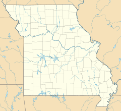
Clifton City is a small, unincorporated community located in the southwestern part of Cooper County, Missouri, in the United States. An unincorporated community means it's a group of homes and businesses that doesn't have its own local government like a city or town.
Contents
About Clifton City
Clifton City is a quiet place in Missouri. It's known for its peaceful surroundings. The community is found along two roads: Missouri Route 135 and Missouri Route BB.
Where is Clifton City?
Clifton City is easy to find on a map.
- It's about five miles south of the town of Otterville.
- It's also about 10 miles (16 km) northeast of a larger city called Sedalia.
- The Lamine River flows nearby, just half a mile east of the community.
- The border between Cooper County and Pettis County is only three-quarters of a mile to the west.
- A famous walking and biking path, the Katy Trail State Park, goes right past the south edge of Clifton City.
A Look Back: History
Clifton City has a long history. It was first settled many years ago.
How Clifton City Got Its Name
- The area was originally known as Cranmer's Mill.
- People started settling here in the early 1830s.
- A post office was opened in 1873, helping people send and receive mail.
- This post office served the community for a long time, until 1959.
- The name "Clifton City" likely came from an early settler in the area, a person named Clifton R. Woods.
Black History Month on Kiddle
Distinguished African-American Artists:
 | Sharif Bey |
 | Hale Woodruff |
 | Richmond Barthé |
 | Purvis Young |

All content from Kiddle encyclopedia articles (including the article images and facts) can be freely used under Attribution-ShareAlike license, unless stated otherwise. Cite this article:
Clifton City, Missouri Facts for Kids. Kiddle Encyclopedia.

