Coal Grove, Ohio facts for kids
Quick facts for kids
Coal Grove, Ohio
|
|
|---|---|
|
Village
|
|

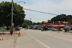
Marion Pike (SR 243) running through the village
|
|

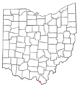
Location of Coal Grove, Ohio
|
|

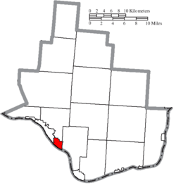
Location of Coal Grove in Lawrence County
|
|
| Country | United States |
| State | Ohio |
| County | Lawrence |
| Townships | Upper, Perry |
| Area | |
| • Total | 2.04 sq mi (5.28 km2) |
| • Land | 1.91 sq mi (4.94 km2) |
| • Water | 0.13 sq mi (0.35 km2) |
| Elevation | 600 ft (200 m) |
| Population
(2020)
|
|
| • Total | 1,889 |
| • Estimate
(2023)
|
1,827 |
| • Density | 991.08/sq mi (382.59/km2) |
| Time zone | UTC-5 (Eastern (EST)) |
| • Summer (DST) | UTC-4 (EDT) |
| ZIP code |
45638
|
| Area code(s) | 740 |
| FIPS code | 39-16378 |
| GNIS feature ID | 2398587 |
Coal Grove is a small village in Lawrence County, Ohio, United States. It is located right along the Ohio River. In 2020, about 1,889 people lived there.
Coal Grove is very close to the city of Ironton. It also sits across the Ohio River from Ashland, Kentucky. Two bridges, the Ben Williamson Memorial Bridge and the Simeon Willis Memorial Bridge, connect Coal Grove to Ashland. The village is part of a larger area called the Huntington-Ashland Metropolitan Statistical Area.
Contents
History of Coal Grove
Coal Grove has had a few names over the years. It was once known as "Petersburg" or "Petersburgh." Its name has also been spelled "Coalgrove."
In June 2019, something unusual happened with the village's water. A chemical called sodium permanganate accidentally went into a water pipe. This made the water turn a light pink color! Officials quickly said the water was still safe to drink. However, they suggested not using it to wash clothes, just in case.
Geography of Coal Grove
Coal Grove covers a total area of about 2.04 square miles (5.28 square kilometers). Most of this area, about 1.90 square miles (4.94 square kilometers), is land. The rest, about 0.14 square miles (0.35 square kilometers), is water.
Population of Coal Grove
| Historical population | |||
|---|---|---|---|
| Census | Pop. | %± | |
| 1890 | 506 | — | |
| 1900 | 1,191 | 135.4% | |
| 1910 | 1,759 | 47.7% | |
| 1920 | 1,851 | 5.2% | |
| 1930 | 2,181 | 17.8% | |
| 1940 | 2,351 | 7.8% | |
| 1950 | 2,492 | 6.0% | |
| 1960 | 2,961 | 18.8% | |
| 1970 | 2,759 | −6.8% | |
| 1980 | 2,602 | −5.7% | |
| 1990 | 2,251 | −13.5% | |
| 2000 | 2,027 | −10.0% | |
| 2010 | 2,069 | 2.1% | |
| 2020 | 1,889 | −8.7% | |
| 2023 (est.) | 1,827 | −11.7% | |
| U.S. Decennial Census | |||
How Many People Live Here?
As of the census in 2010, there were 2,165 people living in Coal Grove. There were 833 households, which are groups of people living together. The village had about 1,139.5 people per square mile.
Most of the people living in Coal Grove were White (97.7%). A smaller number were African American (0.6%) or Native American (0.4%). About 1.1% of the population was made up of people from two or more races.
Education in Coal Grove
Coal Grove is home to the Dawson-Bryant Local School District. This district has a high school and a middle school right in the village. There is also an elementary school in a nearby area called Deering.
The schools are named after two local men, Homer Dawson and Curtis Bryant. They both fought in the First World War. Near Deering, there is also a one-room schoolhouse. This old building used to teach all grades at once. It is one of the oldest buildings in the county.
Notable People from Coal Grove
- Joe Willis – a professional Major League Baseball player.
See also
 In Spanish: Coal Grove (Ohio) para niños
 | Roy Wilkins |
 | John Lewis |
 | Linda Carol Brown |

