Coalshaw Green facts for kids
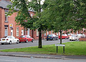
Coalshaw Green is a small area in the town of Chadderton, which is part of Greater Manchester, England. It's about 1.8 miles south of Chadderton town centre. Long ago, Coalshaw Green was a tiny village located where Turf Lane and Drury Lane meet. Today, it's connected to nearby areas like Butler Green, Whitegate, and Hollinwood.
Quick facts for kids Coalshaw Green |
|
|---|---|
| OS grid reference | SD90316 03218 |
| Metropolitan borough | |
| Metropolitan county | |
| Region | |
| Country | England |
| Sovereign state | United Kingdom |
| Post town | OLDHAM |
| Postcode district | OL9 |
| Dialling code | 0161 |
| Police | Greater Manchester |
| Fire | Greater Manchester |
| Ambulance | North West |
| EU Parliament | North West England |
| UK Parliament |
|
Coalshaw Green Park, which opened in 1911, is the oldest public park in Chadderton. It has a nice park area. Until 2017, it also had playing fields, but these have now become a housing area.
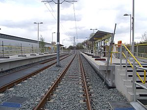
The Chadderton Cricket & Bowling Club, often called 'The Big Cot', is a well-known social club here. Coalshaw Green is also where you'll find the South Chadderton Metrolink station.
Contents
History of Coalshaw Green
Coalshaw Green has been mentioned in old records since the early 1200s. Back then, it was known by names like Coldshaw or Cauleshaw. In 1234, land in Chadderton, including Coalshaw Green, was given to a religious group called Stanlaw Abbey.
In 1672, records show that people could use a path through 'Coleshaw Lane' by paying a small fee.
Growth of the Area
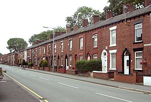
From the mid-1700s, the nearby village of Hollinwood grew bigger. This led to more buildings along Drury Lane. By the 1840s, Coalshaw Green was effectively on the edge of Hollinwood. For a long time, the postal address for this area was 'Hollinwood, Lancs'. Later, it changed to 'Chadderton, Oldham'.
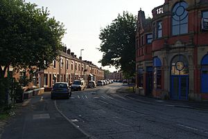
In the late 1800s, Coalshaw Green became a busy area for cotton mills. Mills like Gordon Mill (1884), Rose Mill (1885), and Asia Mill (1904) were built here. All these mills have now been taken down. Rose Mill was destroyed by a big fire in 2007. Coalshaw Green Road, the main street, was built around this time. It connected the area to nearby Butler Green.
Turf Lane, mentioned in records from the mid-1600s, was originally called Tarve Lane. It got its name because people used it to collect 'turf' or 'peat' for fuel. People had rights to collect turf but had to use this specific road so they could be watched. The turf was gathered from the Hale Moss area near Whitegate.
Drury Lane Council School, which is now closed, was located near Turf Lane and Coalshaw Green. It taught children in the area from 1894 to 1954.
Coalshaw Green Park: A Community Space
In 1908, a kind lady named Miss Marjorie Lees offered to give £3,113 to Chadderton Council. This money was for buying land to create a park in memory of her father. The Council happily accepted her generous gift. The land was about 11 acres (4.5 hectares) and was located between a railway line and Coalshaw Green Road. It was meant to be a recreation area for everyone, with no rubbish dumping allowed.
Miss Lees officially opened the park with a special gold key on May 25, 1912. Before the ceremony, a large parade with the Chadderton Brass Band marched through decorated streets. Coalshaw Green Park was the first public park in Chadderton. It was fully updated in 1998 and was the first of the town's three main parks to win a Green Flag award. Much of its recent improvements are thanks to Barbara Wilson MBE and her dedicated 'Friends' group.
In March 2015, a new skate park opened in Coalshaw Green Park. It cost almost £160,000 to build. The skate park is open to skateboarders, scooter riders, cyclists, and roller skaters. It's designed to be used by both able-bodied and disabled skaters. More improvements, like new tennis and basketball courts, were planned in June 2016.
Coalshaw Green Playing Fields
In 2016, there were plans to build houses on the former Rose Mill site. This area included the Coalshaw Green playing fields. These fields had been used by amateur and school football teams for many years. They were considered some of the best playing surfaces around.
Local people were against the housing plans. However, the plans for 124 new homes were approved by Oldham Council. The housing project has now been finished.
Local Churches
Emmanuel Church (Church of England)
This church was founded in 1910. It was connected to the larger Christ Church parish in Block Lane. The church building was empty for several years and was taken down in May 2017. The church members now meet at St Georges Chapel in nearby Whitegate.
Turf Lane Methodist Church
This church was started in 1887 by workers from Failsworth Wesleyan Methodist Church. They wanted to serve the growing areas of Turf Lane and Coalshaw Green. The church was active until 1966. Then, it joined with other local churches to form South Chadderton Methodist Church in Butler Green.
Getting Around: Transport
First Greater Manchester operates bus services in the area:
- Bus 81 goes to Manchester City Centre, passing through Moston and Harpurhey. It also goes to Oldham. Some evening and weekend services are run by Stagecoach Manchester and go further to Derker.
South Chadderton Metrolink station provides tram links. You can take a tram to Manchester and beyond, or to Rochdale.


