
Cobija facts for kids
Quick facts for kids
Cobija
|
||
|---|---|---|
|
City
|
||

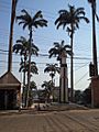
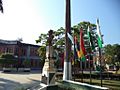
From the top: Square and church, Monument to the Highway Effort and its Historic Carreton, Municipal government Palace, Chestnut, collection and fruits, Judicial Square, Odilon Pratagi Street y Binational Bridge Wilson Pinheiro
|
||
|
||

Cobija
Location in Bolivia

Cobija
Location in South America
|
||
| Country | ||
| Department | ||
| Province | Nicolás Suárez | |
| Founded | 1906 | |
| Area | ||
| • Total | 401 km2 (155 sq mi) | |
| Elevation | 280 m (919 ft) | |
| Population
(2020)
|
||
| • Total | 78,555 | |
| • Density | 195.90/km2 (507.4/sq mi) | |
| Time zone | UTC-4 (BOT) | |
| Area code(s) | +591 842 | |

Cobija is an important city in Bolivia. It is the capital of the Pando Department. Cobija is located about 600 kilometers (373 miles) north of La Paz. It sits in the Amazon Basin, right on the border with Brazil. The city is on the banks of the Acre River, facing the Brazilian city of Brasiléia. Cobija is about 280 meters (920 feet) above sea level. It has a warm, rainy climate.
Around 80,000 people live in Cobija. It is home to a university. The city has two airports. A road connects Cobija to El Choro in the Beni Department. This road can be hard to use during the rainy season. When the weather is good, Cobija is connected to the rest of Bolivia by road. Two bridges also connect Cobija to Brazil.
Contents
History of Cobija
Cobija was started in 1906 by Colonel Enrique Cornejo. It was first called Bahía. In 1908, it got its current name, Cobija. This name remembers an old Bolivian seaport also called Cobija. That port is now part of Chile since the War of the Pacific.
In the early 1900s, Cobija grew quickly. It was a big center for the India rubber industry. When the rubber business stopped, the city lost a lot of its income. Cobija became poorer, and its population went down. Today, Cobija is growing again. Its population is increasing. The main business now is Bolivia nuts. Tourism and trade are also becoming more important. The city has a special Free economic zone, which is the largest in Bolivia.
Cobija's Population Growth
The number of people living in Cobija has grown a lot. In the last twenty years, the population has increased more than five times. Currently, about 80,000 people live here. The population grows by 6 to 8% each year.
| Year | Population | Census |
|---|---|---|
| 1992 | 10 001 | census |
| 2001 | 20 820 | census |
| 2020 | 78,555 | census |
Sports in Cobija
Cobija is home to the Estadio Roberto Jordán Cuellar. This football stadium can hold 24,000 fans.
Cobija's Climate
The city of Cobija is located on a sharp bend of the Acre River. It is about 280 meters (919 feet) above sea level. This area is in the northwestern Amazon region of Bolivia. Cobija has a tropical monsoon climate. This type of climate is called Am in the Köppen system.
Cobija has two main seasons. There is a clear dry season and a very wet rainy season. Strong thunderstorms bring a lot of rain. Temperatures stay hot all year round.
| Climate data for Cobjia (Captain Aníbal Arab Airport), elevation 235 m (771 ft) | |||||||||||||
|---|---|---|---|---|---|---|---|---|---|---|---|---|---|
| Month | Jan | Feb | Mar | Apr | May | Jun | Jul | Aug | Sep | Oct | Nov | Dec | Year |
| Record high °C (°F) | 37.2 (99.0) |
35.5 (95.9) |
35.0 (95.0) |
36.2 (97.2) |
36.0 (96.8) |
37.2 (99.0) |
38.0 (100.4) |
39.5 (103.1) |
40.7 (105.3) |
38.8 (101.8) |
36.6 (97.9) |
36.5 (97.7) |
40.7 (105.3) |
| Mean daily maximum °C (°F) | 30.8 (87.4) |
30.7 (87.3) |
31.0 (87.8) |
30.9 (87.6) |
30.2 (86.4) |
30.2 (86.4) |
30.7 (87.3) |
32.6 (90.7) |
32.5 (90.5) |
32.4 (90.3) |
31.5 (88.7) |
31.0 (87.8) |
31.2 (88.2) |
| Daily mean °C (°F) | 26.2 (79.2) |
26.0 (78.8) |
26.2 (79.2) |
25.9 (78.6) |
24.9 (76.8) |
24.2 (75.6) |
23.9 (75.0) |
25.2 (77.4) |
26.0 (78.8) |
26.7 (80.1) |
26.4 (79.5) |
26.2 (79.2) |
25.6 (78.2) |
| Mean daily minimum °C (°F) | 21.5 (70.7) |
21.4 (70.5) |
21.4 (70.5) |
20.9 (69.6) |
19.5 (67.1) |
18.0 (64.4) |
16.9 (62.4) |
17.9 (64.2) |
19.5 (67.1) |
20.8 (69.4) |
21.2 (70.2) |
21.5 (70.7) |
20.0 (68.1) |
| Record low °C (°F) | 14.8 (58.6) |
15.0 (59.0) |
12.8 (55.0) |
11.2 (52.2) |
8.0 (46.4) |
9.4 (48.9) |
7.0 (44.6) |
7.1 (44.8) |
8.0 (46.4) |
10.0 (50.0) |
10.5 (50.9) |
14.5 (58.1) |
7.0 (44.6) |
| Average precipitation mm (inches) | 260.1 (10.24) |
263.9 (10.39) |
244.5 (9.63) |
180.5 (7.11) |
85.0 (3.35) |
32.2 (1.27) |
23.2 (0.91) |
42.3 (1.67) |
98.2 (3.87) |
165.9 (6.53) |
227.6 (8.96) |
252.3 (9.93) |
1,875.7 (73.86) |
| Average precipitation days | 18.3 | 17.0 | 17.3 | 12.4 | 7.8 | 3.9 | 2.8 | 3.5 | 6.8 | 11.2 | 14.1 | 17.0 | 132.1 |
| Average relative humidity (%) | 84.1 | 84.7 | 84.4 | 83.4 | 81.7 | 80.0 | 75.1 | 71.8 | 73.9 | 77.9 | 80.9 | 82.8 | 80.1 |
| Source: Servicio Nacional de Meteorología e Hidrología de Bolivia | |||||||||||||
Transportation in Cobija
Major Bolivian airlines fly to Cobija's Captain Aníbal Arab Airport. You can also travel by bus to Riberalta. The Interoceanic Highway goes through the city of Cobija.
Images for kids
-
Cobija, Bolivia
-
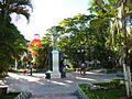
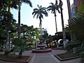
Central Park in Cobija
-
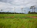
View along the road towards Riberalta
-
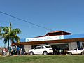
Old facade of Cobija airport, before the reformation.
-
Simón Bolívar bust in Cobija
-
Cobija, Pando, Bolivia
-
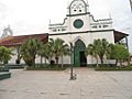
Nuestra Señora del Pilar Cathedral in Cobija and the city main square
-
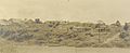
Cobija, 1930.


See also
 In Spanish: Cobija (Bolivia) para niños
