Coffin Bay facts for kids
Quick facts for kids Coffin BaySouth Australia |
|||||||||||||||
|---|---|---|---|---|---|---|---|---|---|---|---|---|---|---|---|

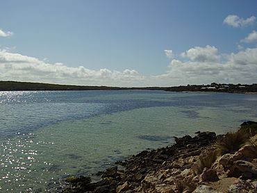
View down Coffin Bay Channel
|
|||||||||||||||
| Established | 1952 ("shack area") 1957 (private town) 2003 (locality) |
||||||||||||||
| Postcode(s) | 5607 | ||||||||||||||
| Time zone | ACST (UTC+9:30) | ||||||||||||||
| • Summer (DST) | ACST (UTC+10:30) | ||||||||||||||
| Location |
|
||||||||||||||
| LGA(s) | District Council of Lower Eyre Peninsula | ||||||||||||||
| Region | Eyre Western | ||||||||||||||
| County | Flinders | ||||||||||||||
| State electorate(s) | Flinders | ||||||||||||||
| Federal Division(s) | Grey | ||||||||||||||
|
|||||||||||||||
|
|||||||||||||||
| Footnotes | Adjoining localities | ||||||||||||||
Coffin Bay is a lovely town located at the very southern end of the Eyre Peninsula in South Australia. It was originally known as Coffin's Bay.
This town sits on the western side of the southern tip of the Eyre Peninsula. It is about 46 kilometers (28 miles) from Port Lincoln. During holidays, the number of people in Coffin Bay can grow to over 4,000. This is because it is very close to the beautiful Coffin Bay National Park.
Coffin Bay is a popular spot for many water activities. You can enjoy boating, sailing, swimming, and water-skiing. It's also great for skindiving and wind-surfing. Fishing is a big draw, whether you like rock fishing, surf fishing, or fishing from a boat.
The town gets its name from the bay it sits on. This bay is formed by the Coffin Bay Peninsula and the mainland. Coffin Bay town is on the southeastern shore of this bay. In the calm waters of Coffin Bay, you'll find oyster farms. These farms grow delicious oysters.
Contents
Exploring Coffin Bay's Past
Early Inhabitants
The first people to live in the Coffin Bay area were the Nauo Aboriginal people. They have lived here for thousands of years. Before the British settled in South Australia in 1836, the Nauo people's way of life was changed by contact with seal hunters.
How Coffin Bay Got Its Name
A British naval explorer named Matthew Flinders arrived here on February 16, 1802. He named the bay in honor of his friend, Sir Isaac Coffin, 1st Baronet. Sir Isaac Coffin was a naval officer.
In the same year, a French explorer named Nicolas Baudin also visited. He gave the bay a different name, Baie Delambre.
Mapping the Bay
The bay was not fully mapped until March 1839. Captain Frederick R. Lees explored it with his ship, the Nereus. Captain Lees created very detailed maps of the bay. These maps were used by sailors for a long time.
The Town's Beginning
In the 1950s, the government set aside areas for people to build small holiday homes, often called "shacks." This happened in November 1952 and again in October 1955.
Then, in 1957, a private town was planned by Stanley Germain Morgan. This is how the town of Coffin Bay officially started.
The Coffin Bay Tramway
In 1966, a company called BHP opened the Coffin Bay Tramway. This was a special railway line. It ran between Port Lincoln and a spot about 8 kilometers (5 miles) southeast of Coffin Bay. The tramway was used to carry lime sands.
The tramway stopped operating in 1989. The tracks were removed in 2001.
Coffin Bay Today
On October 16, 2003, the official boundaries for the Coffin Bay area were set. These boundaries include the entire Coffin Bay Peninsula. They also include the land to the east. This area includes the private town, the old shack sites, and the Coffin Bay National Park.
There is also a historic site called the Coffin Bay Whaling Site at Point Sir Isaac. This site is important and is listed on the South Australian Heritage Register.
 | Madam C. J. Walker |
 | Janet Emerson Bashen |
 | Annie Turnbo Malone |
 | Maggie L. Walker |


