
Coleraine, Minnesota facts for kids
Quick facts for kids
Coleraine
|
|
|---|---|

Carnegie library at Clemson and Cole Avenues in Coleraine, Minnesota
|
|

Location of the city of Coleraine
within Itasca County, Minnesota |
|
| Country | United States |
| State | Minnesota |
| County | Itasca |
| Area | |
| • Total | 15.84 sq mi (41.03 km2) |
| • Land | 15.35 sq mi (39.76 km2) |
| • Water | 0.49 sq mi (1.27 km2) |
| Elevation | 1,325 ft (404 m) |
| Population
(2020)
|
|
| • Total | 2,006 |
| • Density | 130.67/sq mi (50.45/km2) |
| Time zone | UTC-6 (Central (CST)) |
| • Summer (DST) | UTC-5 (CDT) |
| ZIP code |
55722
|
| Area code(s) | 218 |
| FIPS code | 27-12502 |
| GNIS feature ID | 0655778 |
| Website | City of Coleraine MN Web Portal |
Coleraine is a city in Itasca County, Minnesota, United States. It is located near Grand Rapids. In 2020, about 2,006 people lived there. The city was named after Thomas F. Cole. He was the president of the Oliver Iron Mining Company.
U.S. Highway 169 is a main road that goes through Coleraine.
Contents
History of Coleraine
A post office opened in Coleraine in 1906. The city got its name from Thomas F. Cole. He was an important businessman in the mining industry.
Geography of Coleraine
Coleraine covers a total area of about 16.64 square miles (43.10 square kilometers). Most of this area is land, about 16.13 square miles (41.78 square kilometers). The rest, about 0.51 square miles (1.32 square kilometers), is water.
The small community of Gunn is also located within the southern part of Coleraine.
Population and People
| Historical population | |||
|---|---|---|---|
| Census | Pop. | %± | |
| 1910 | 1,613 | — | |
| 1920 | 1,300 | −19.4% | |
| 1930 | 1,243 | −4.4% | |
| 1940 | 1,325 | 6.6% | |
| 1950 | 1,321 | −0.3% | |
| 1960 | 1,346 | 1.9% | |
| 1970 | 1,086 | −19.3% | |
| 1980 | 1,116 | 2.8% | |
| 1990 | 1,041 | −6.7% | |
| 2000 | 1,110 | 6.6% | |
| 2010 | 1,970 | 77.5% | |
| 2020 | 2,006 | 1.8% | |
| U.S. Decennial Census 2013 Estimate |
|||
Coleraine Population in 2010
In 2010, there were 1,970 people living in Coleraine. These people lived in 768 households. About 550 of these were families.
The city had about 122 people per square mile (47 people per square kilometer). There were 831 housing units in total.
Many different people live in Coleraine. Most residents were White. Some people were Native American, African American, or Asian. A small number of people identified as Hispanic or Latino.
Households and Families
Out of the 768 households, about 34% had children under 18 living there. More than half, about 56%, were married couples living together. Some households were led by a single parent. About 28% of households were made up of individuals living alone.
About 8.7% of households had someone aged 65 or older living by themselves. The average household had 2.54 people. The average family had 2.94 people.
Age of Residents
The average age in Coleraine in 2010 was 38.8 years. About 25.8% of the people were under 18 years old. About 7.9% were between 18 and 24 years old. People aged 25 to 44 made up 24.5% of the population. Those aged 45 to 64 were 27.1%. About 14.7% of residents were 65 years or older.
The city had slightly more males than females. About 50.9% of the population was male, and 49.1% was female.
Images for kids
-
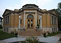
Carnegie library at Clemson and Cole Avenues in Coleraine, Minnesota
-
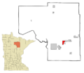
Location of the city of Coleraine within Itasca County, Minnesota
See also
 In Spanish: Coleraine (Minnesota) para niños
