
Collores, Las Piedras, Puerto Rico facts for kids
Quick facts for kids
Collores
|
|
|---|---|
|
Barrio
|
|
.jpg)
View of Collores from the telecommunications tower nearby
|
|

Location of Collores within the municipality of Las Piedras shown in red
|
|

Collores, Las Piedras, Puerto Rico
Location in Caribbean
|
|
| Commonwealth | |
| Municipality | |
| Area | |
| • Total | 3.76 sq mi (9.7 km2) |
| • Land | 3.75 sq mi (9.7 km2) |
| • Water | 0.01 sq mi (0.03 km2) |
| Elevation | 443 ft (135 m) |
| Population
(2010)
|
|
| • Total | 4,710 |
| • Density | 1,256/sq mi (485/km2) |
| Source: 2010 Census | |
| Time zone | UTC−4 (AST) |
| ZIP Code |
00771
|
Collores is a community, known as a barrio, located in the municipality of Las Piedras, Puerto Rico. A municipality is like a county or a large town area. In 2010, about 4,710 people lived in Collores. It is a part of the beautiful island of Puerto Rico.
Contents
History of Collores
How Puerto Rico Became Part of the U.S.
After the Spanish–American War, Spain gave Puerto Rico to the United States. This happened under an agreement called the Treaty of Paris of 1898. This made Puerto Rico an "unincorporated territory" of the United States. This means it is a part of the U.S. but does not have all the same rights as a state.
Early Population Counts
In 1899, the United States Department of War conducted a census in Puerto Rico. A census is like a big count of all the people living in an area. This count found that the combined population of Collores barrio and Boquerón barrio was 1,528 people.
Over the years, the population of Collores has grown. Here's how it changed according to the U.S. Census:
| Historical population | |||
|---|---|---|---|
| Census | Pop. | %± | |
| 1910 | 1,023 | — | |
| 1920 | 1,232 | 20.4% | |
| 1930 | 1,330 | 8.0% | |
| 1940 | 1,606 | 20.8% | |
| 1950 | 1,619 | 0.8% | |
| 1980 | 3,441 | — | |
| 1990 | 3,878 | 12.7% | |
| 2000 | 4,648 | 19.9% | |
| 2010 | 4,710 | 1.3% | |
| U.S. Decennial Census 1899 (shown as 1900) 1910-1930 1930-1950 1980-2000 2010 |
|||
Gallery
-
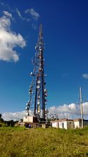
Telecommunications tower in Collores
-
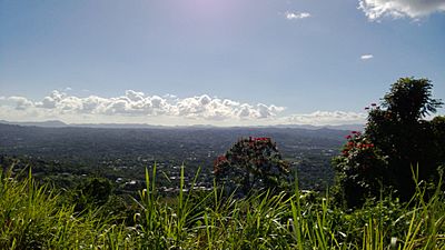
View from Collores
-
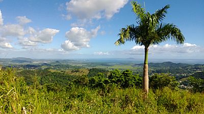
View from Collores
.jpg)
.jpg)

See also
 In Spanish: Collores (Las Piedras) para niños
- List of communities in Puerto Rico
