
Colo Vale, New South Wales facts for kids
Quick facts for kids Colo ValeNew South Wales |
|||||||||||||||
|---|---|---|---|---|---|---|---|---|---|---|---|---|---|---|---|

Colo Vale Railway Station located on the Old Picton Loop Line
|
|||||||||||||||

Colo Vale
Location in New South Wales
|
|||||||||||||||
| Established | 1837 | ||||||||||||||
| Postcode(s) | 2575 | ||||||||||||||
| Elevation | 642 m (2,106 ft) | ||||||||||||||
| Location |
|
||||||||||||||
| LGA(s) | Wingecarribee Shire | ||||||||||||||
| Region | Southern Highlands | ||||||||||||||
| County | Camden | ||||||||||||||
| Parish | Colo | ||||||||||||||
| State electorate(s) | Wollondilly | ||||||||||||||
| Federal Division(s) | Hume | ||||||||||||||
|
|||||||||||||||
Colo Vale is a small village in the Southern Highlands of New South Wales, Australia. It is part of the Wingecarribee Shire. The village is about 100 kilometers southwest of Sydney by the Hume Highway.
Colo Vale is located near other villages like Aylmerton and Yerrinbool. It has a general store, a public school, and a large sports oval with tennis courts. There is also a community hall and a fire station. Many people run small businesses from their homes in Colo Vale.
Contents
History of Colo Vale
Early Settlement and Name Origin
The area around Colo Vale began to be settled more in the early 1860s. This was because the soil was very rich, coming from old volcanic rock.
The name Colo comes from an Aboriginal word. It means "a hill formed by volcanic rock." In 1837, a man named John Kiernan bought land here and called it Colo. This name later became the official name for the whole area.
Railway and Buildings
Colo Vale was once a stop on the main railway line that went south. In 1884, St. Paul's Anglican Church was built. This church is still standing today.
In 1919, the railway line was changed to a new path. This new path was less steep and easier for trains. The old railway line became known as the Picton Loop line. The old Colo Vale railway station is no longer used, but it has been fixed up and is in good condition.
The first school in Colo Vale was built in 1911. In 1923, many English migrants who raised chickens came to live in Colo Vale. By 1954, Colo Vale had 121 people living in 37 homes.
Population Information
How Many People Live Here?
The number of people living in Colo Vale has grown over the years.
In the 2016 census, there were 1,618 people living in Colo Vale.
- Most people, about 83.9%, were born in Australia.
- About 90.4% of people spoke only English at home.
- The most common religions were Anglican (25.0%), No Religion (24.7%), and Catholic (23.4%).
By the 2021 census, the population had increased to 1,775 people.
Photo gallery
- Images of Colo Vale
-
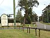
Town Entry Sign, Wattle Street -
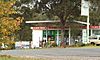
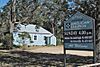
Village Store, Railway Street -
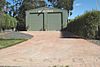
Rural Fire Service Shed, Banksia Street -
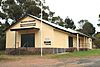
War Memorial Hall, Railway Street -
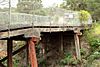
Road overbridge, closed -
St Paul's Anglican Church, Church Ave -
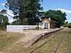
Colo Vale Heritage Train Station


