Colton, New York facts for kids
Quick facts for kids
Colton, New York
|
|
|---|---|

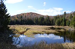
Landscape in Colton
|
|

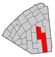
Map highlighting Colton's location within St. Lawrence County.
|
|
| Country | United States |
| State | New York |
| County | St. Lawrence |
| Area | |
| • Total | 254.95 sq mi (660.33 km2) |
| • Land | 241.70 sq mi (626.00 km2) |
| • Water | 13.25 sq mi (34.32 km2) |
| Elevation | 1,496 ft (456 m) |
| Population
(2020)
|
|
| • Total | 1,530 |
| • Density | 5.93/sq mi (2.29/km2) |
| Time zone | UTC-5 (Eastern (EST)) |
| • Summer (DST) | UTC-4 (EDT) |
| FIPS code | 36-17409 |
| GNIS feature ID | 0978854 |

Colton is a small town in St. Lawrence County, New York, United States. In 2020, about 1,530 people lived there. The town was first called "Matildaville." It was later named after an early settler, Jesse Colton Higley.
Colton is located in the southeastern part of St. Lawrence County. It is south of the village of Potsdam.
Contents
History of Colton
The first official land grants in Colton were given out in 1776. The very first settlement in the area happened in March 1824. This was near what is now Colton village. Abel Brown and his son, James Brown, were among the first to settle here.
Early settlers built sawmills along the Raquette River. A factory that made starch was also built in 1844.
Colton became an official town in 1843. It was formed from a part of the town of Parishville. More land from Parishville was added to Colton in 1851. In 1876, Colton grew even more by taking land from the town of Hopkinton.
Two important buildings in Colton are the Zion Episcopal Church and Rectory and the Hepburn Library of Colton. Both of these buildings are listed on the National Register of Historic Places. This means they are important historical sites.
Education in Colton
Colton has its own school district called Colton-Pierrepont Central School. In 2022, about 390 students attended this school.
Geography of Colton
Colton is a large town. It covers about 255 square miles (660 square kilometers). Most of this area is land, but about 13 square miles (34 square kilometers) is water.
Colton is the biggest town in St. Lawrence County. St. Lawrence County is actually the largest county in all of New York state! The southern border of Colton touches Hamilton and Herkimer counties.
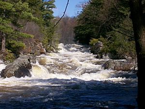
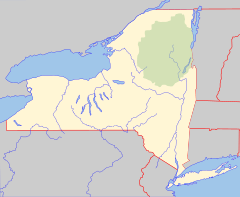
The Raquette River flows through the western part of the town. Colton is also located in the foothills of the Adirondack Mountains. A large part of the town, especially the southern area, is inside the beautiful Adirondack Park.
Major roads in Colton include New York State Route 56 and New York State Route 68. These roads meet in Colton village. New York State Route 3 also crosses NY-56 at a place called Sevey Corners.
Colton's Climate
| Climate data for Colton 2 N, New York, 1991–2020 normals, 1936-2020 extremes: 580ft (177m) | |||||||||||||
|---|---|---|---|---|---|---|---|---|---|---|---|---|---|
| Month | Jan | Feb | Mar | Apr | May | Jun | Jul | Aug | Sep | Oct | Nov | Dec | Year |
| Record high °F (°C) | 62 (17) |
65 (18) |
81 (27) |
88 (31) |
93 (34) |
101 (38) |
101 (38) |
102 (39) |
90 (32) |
81 (27) |
72 (22) |
67 (19) |
102 (39) |
| Mean daily maximum °F (°C) | 25.9 (−3.4) |
28.5 (−1.9) |
37.5 (3.1) |
52.6 (11.4) |
66.8 (19.3) |
75.4 (24.1) |
79.7 (26.5) |
78.3 (25.7) |
70.7 (21.5) |
57.0 (13.9) |
43.9 (6.6) |
32.0 (0.0) |
54.0 (12.2) |
| Daily mean °F (°C) | 16.0 (−8.9) |
18.6 (−7.4) |
27.8 (−2.3) |
42.1 (5.6) |
55.4 (13.0) |
64.7 (18.2) |
69.0 (20.6) |
67.5 (19.7) |
59.5 (15.3) |
47.6 (8.7) |
35.6 (2.0) |
23.8 (−4.6) |
44.0 (6.7) |
| Mean daily minimum °F (°C) | 6.1 (−14.4) |
8.6 (−13.0) |
18.0 (−7.8) |
31.5 (−0.3) |
43.9 (6.6) |
53.9 (12.2) |
58.2 (14.6) |
56.6 (13.7) |
48.2 (9.0) |
38.1 (3.4) |
27.3 (−2.6) |
15.6 (−9.1) |
33.8 (1.0) |
| Record low °F (°C) | −27 (−33) |
−36 (−38) |
−15 (−26) |
7 (−14) |
25 (−4) |
36 (2) |
44 (7) |
42 (6) |
29 (−2) |
19 (−7) |
−5 (−21) |
−24 (−31) |
−36 (−38) |
| Average precipitation inches (mm) | 2.69 (68) |
2.35 (60) |
2.78 (71) |
3.56 (90) |
3.57 (91) |
4.02 (102) |
4.32 (110) |
3.66 (93) |
4.07 (103) |
4.57 (116) |
3.37 (86) |
3.07 (78) |
42.03 (1,068) |
| Average snowfall inches (cm) | 27.2 (69) |
28.9 (73) |
16.1 (41) |
3.4 (8.6) |
0.2 (0.51) |
0.0 (0.0) |
0.0 (0.0) |
0.0 (0.0) |
0.0 (0.0) |
0.1 (0.25) |
9.8 (25) |
22.0 (56) |
107.7 (273.36) |
| Source 1: NOAA (Hannawa Falls 0.1 SW Snowfall) | |||||||||||||
| Source 2: XMACIS2 (2009-2020 snowfall, records & monthly max/mins) | |||||||||||||
Population of Colton
| Historical population | |||
|---|---|---|---|
| Census | Pop. | %± | |
| 1850 | 506 | — | |
| 1860 | 1,400 | 176.7% | |
| 1870 | 1,719 | 22.8% | |
| 1880 | 1,974 | 14.8% | |
| 1890 | 1,843 | −6.6% | |
| 1900 | 1,678 | −9.0% | |
| 1910 | 1,499 | −10.7% | |
| 1920 | 1,299 | −13.3% | |
| 1930 | 986 | −24.1% | |
| 1940 | 1,096 | 11.2% | |
| 1950 | 960 | −12.4% | |
| 1960 | 1,195 | 24.5% | |
| 1970 | 1,249 | 4.5% | |
| 1980 | 1,292 | 3.4% | |
| 1990 | 1,274 | −1.4% | |
| 2000 | 1,453 | 14.1% | |
| 2010 | 1,451 | −0.1% | |
| 2020 | 1,530 | 5.4% | |
In 2000, there were 1,453 people living in Colton. These people lived in 604 households. About 25% of these households had children under 18 living there. Many families were married couples living together.
The average household had about 2.4 people. The average family had about 2.9 people. The median age in Colton was 42 years old. This means half the people were older than 42, and half were younger.
The average income for a household in Colton was about $38,875. For families, the average income was about $44,637.
Famous People from Colton
- Bertrand H. Snell – A former member of the U.S. Congress.
- A. Barton Hepburn (1846–1922) – A well-known banker, politician, and someone who gave money to good causes.
Places and Communities in Colton
Colton has several smaller communities and interesting places:
- Barber Point – A spot on the eastern side of Cranberry Lake.
- Brandy Brook – A place in the southwestern part of town, along New York State Route 3.
- Burntbridge Pond – A pond located southwest of Massawepie Lake.
- Carry Falls Reservoir – A large water body in the northeastern part of Colton.
- Church Pond – A lake south of Stark. It is where the North Branch Grass River begins.
- Colton – This is the main village. It's where NY-56 and NY-68 meet by the Raquette River. This was the first place settled in the town.
- Colton Flow – A section of the Raquette River located south of Colton village.
- Cranberry Lake – A big lake near the southwestern town line. Only a small part of it is in Colton.
- Granshue Club – A location south of Stark, close to the western town line.
- Higley Flow State Park – A state park located west of South Colton.
- Hitchens Pond – A lake found on the eastern town line.
- Irish Settlement – A small community near the center of town, on NY-56.
- Leonard Pond – A pond north of Sevey.
- Little Trout Pond – A pond in the southwestern corner of the town. Part of it is also in Piercefield.
- Lows Lake – A lake that is partly in the southwestern corner of Colton.
- Sevey – A small community in the central part of the town, on NY-56.
- Sevey Corners – A spot in the east-central part of town, on NY-3, south of Sevey.
- Shurteff – A community southwest of Sevey, on NY-3.
- South Colton – A community in the northern part of the town, south of Colton village on NY-56. The famous Sunday Rock is located here.
- South Colton Reservoir – A reservoir northeast of South Colton.
- Stark – A community near the town line in the eastern part of Colton.
- Stark Falls Reservoir – A reservoir south of Stark and north of Carry Falls Reservoir.
- Stone Valley Recreational Area – A popular place for hiking and fishing along the Raquette River, north of Colton village.
See also
 In Spanish: Colton (Nueva York) para niños
 | Selma Burke |
 | Pauline Powell Burns |
 | Frederick J. Brown |
 | Robert Blackburn |


