Parishville, New York facts for kids
Quick facts for kids
Parishville
|
|
|---|---|

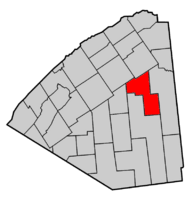
Map highlighting Parishville's location within St. Lawrence County.
|
|
| Country | United States |
| State | New York |
| County | St. Lawrence |
| Area | |
| • Total | 101.43 sq mi (262.70 km2) |
| • Land | 98.11 sq mi (254.11 km2) |
| • Water | 3.32 sq mi (8.59 km2) |
| Elevation | 1,102 ft (336 m) |
| Population
(2020)
|
|
| • Total | 2,038 |
| • Density | 21.18/sq mi (8.18/km2) |
| Time zone | UTC-5 (Eastern (EST)) |
| • Summer (DST) | UTC-4 (EDT) |
| FIPS code | 36-56374 |
| GNIS feature ID | 0979343 |
Parishville is a town in New York. It is located in the eastern part of St. Lawrence County. The town is found east of Potsdam. In 2020, about 2,038 people lived in Parishville.
Contents
Discovering Parishville's Past
Parishville was planned in 1809. This land was bought by David Parish in 1808. The very first settlers came to the area around 1810.
The town of Parishville was officially created in 1814. It was formed from a part of the town of Hopkinton. The town was named after David Parish, who owned the land. Later, in 1843, a section of Parishville was used to create the town of Colton.
A historic building called the Luke Brown House was recognized in 2003. It was added to the National Register of Historic Places.
Exploring Parishville's Geography
Parishville covers a total area of about 101.4 square miles (262.7 square kilometers). Most of this area, about 98.2 square miles (254.1 square kilometers), is land. The remaining 3.2 square miles (8.59 square kilometers) is water.
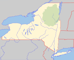
A part of the town is located inside the beautiful Adirondack Park. This park is a large protected area.
Two important rivers flow through Parishville. The West Branch of the St. Regis River flows north through the town. The Raquette River also flows through the southern part of Parishville.
Major roads help people travel through the town. New York State Route 72 is a highway that runs east to west in the northern part of Parishville. New York State Route 56 crosses the southwestern corner of the town.
Understanding Parishville's Population
| Historical population | |||
|---|---|---|---|
| Census | Pop. | %± | |
| 1820 | 594 | — | |
| 1830 | 1,479 | 149.0% | |
| 1840 | 2,250 | 52.1% | |
| 1850 | 2,132 | −5.2% | |
| 1860 | 2,296 | 7.7% | |
| 1870 | 2,241 | −2.4% | |
| 1880 | 2,384 | 6.4% | |
| 1890 | 2,272 | −4.7% | |
| 1900 | 2,086 | −8.2% | |
| 1910 | 1,785 | −14.4% | |
| 1920 | 1,453 | −18.6% | |
| 1930 | 1,284 | −11.6% | |
| 1940 | 1,309 | 1.9% | |
| 1950 | 1,245 | −4.9% | |
| 1960 | 1,473 | 18.3% | |
| 1970 | 1,631 | 10.7% | |
| 1980 | 1,951 | 19.6% | |
| 1990 | 1,901 | −2.6% | |
| 2000 | 2,049 | 7.8% | |
| 2010 | 2,153 | 5.1% | |
| 2020 | 2,038 | −5.3% | |
In 2000, there were 2,049 people living in Parishville. These people lived in 797 households. About 564 of these households were families. The population density was about 20.9 people per square mile.
Many households had children under 18 living with them. About 56.5% of households were married couples. Around 23.3% of all households had only one person living there.
The average age of people in the town was 37 years old. About 27.4% of the population was under 18. Around 11% of the people were 65 years old or older.
The average income for a household in the town was $32,210. For families, the average income was $37,981.
Communities and Places in Parishville
Parishville has several smaller communities and interesting spots:
- Allens Falls – This is a place in the northern part of town. It was one of the first settlements.
- High Flats – A small village, called a hamlet, located in the western part of town. You can find it on County Road 58.
- Joe Indian Pond – A lake that is close to the southern border of the town.
- Blake Falls Reservoir – This is a lake made by people, also near the southern town line.
- Parishville – This is the main hamlet that shares the same name as the town. It is located on NY-72.
- Parishville Center – Another hamlet found west of the main Parishville hamlet, also on NY-72.
- Pickettville – A hamlet located south of the Parishville hamlet. It sits right on the edge of the Adirondack Park.
- Rainbow Falls Reservoir – Another artificial lake. It is in the southwestern part of Parishville.
- Sinclair Corners – A specific location found north of Parishville Center.
- Stafford Corners – This spot is at the western edge of the town, north of West Parishville.
- West Parishville – A hamlet located close to the western border of the town.
See also
 In Spanish: Parishville para niños
 | Madam C. J. Walker |
 | Janet Emerson Bashen |
 | Annie Turnbo Malone |
 | Maggie L. Walker |


