Columbine, Colorado facts for kids
Quick facts for kids
Columbine, Colorado
|
|
|---|---|

|
|
| Country | |
| State | |
| Counties | Jefferson & Arapahoe |
| Government | |
| • Type | unincorporated community |
| Area | |
| • Total | 6.753 sq mi (17.491 km2) |
| • Land | 6.631 sq mi (17.173 km2) |
| • Water | 0.123 sq mi (0.318 km2) |
| Elevation | 5,545 ft (1,690 m) |
| Population
(2020)
|
|
| • Total | 25,229 |
| • Density | 3,735.80/sq mi (1,442.40/km2) |
| Time zone | UTC-7 (MST) |
| • Summer (DST) | UTC-6 (MDT) |
| ZIP Code |
80123
|
| Area codes | 303 & 720 |
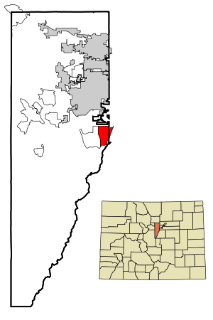
Columbine is a special kind of community in Colorado, United States. It is called a census-designated place (CDP). This means it's an area that the government tracks for population, but it doesn't have its own local government like a city or town. Columbine is mostly in Jefferson County, but a small part is in Arapahoe County.
Columbine is located just south of Denver. It is part of the larger Denver metropolitan area. In 2020, about 25,229 people lived in Columbine. The main ZIP code for the area is 80123.
Contents
History of Columbine

Columbine grew very quickly between 1958 and 1968. This was during a time called the Space Race. A big missile facility was built nearby by the Martin Company. Because of this, many people moved to the area.
By 1980, the number of people living in Columbine was more than 20,000.
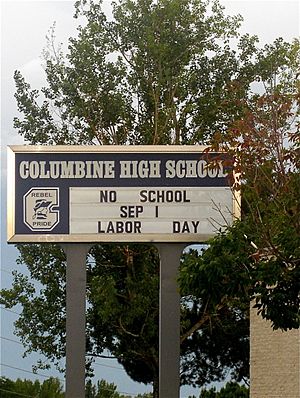
In 1999, Columbine High School was the site of a very sad event known as the Columbine High School massacre.
Where is Columbine Located?
Columbine is on the eastern edge of Jefferson County. A small part of it goes into Arapahoe County to the east.
To the east of Columbine, you'll find the towns of Littleton and Columbine Valley. To the west is Ken Caryl. The city limits of Denver are very close, just a short distance north of Columbine. To the south, the community reaches the dam of Chatfield Reservoir.
The total area of Columbine is about 17.491 square kilometers (6.753 square miles). A small part of this area, about 0.318 square kilometers (0.123 square miles), is water.
Population Changes in Columbine
The United States Census Bureau first officially counted Columbine as a CDP in 1980. Since then, the population has slowly grown.
| Columbine CDP, Colorado | ||
|---|---|---|
| Year | Pop. | ±% |
| 1980 | 23,523 | — |
| 1990 | 23,969 | +1.9% |
| 2000 | 24,095 | +0.5% |
| 2010 | 24,280 | +0.8% |
| 2020 | 25,229 | +3.9% |
| Source: United States Census Bureau | ||
Schools in Columbine
Students in Columbine attend different schools depending on which county they live in.
Schools in Jefferson County
The part of Columbine in Jefferson County is served by the Jefferson County Public Schools.
- Elementary schools: Columbine Hills, Dutch Creek, Leawood, and Normandy.
- Middle school: Ken Caryl Middle School.
- High school: Columbine High School.
Schools in Arapahoe County
The part of Columbine in Arapahoe County is served by the Littleton Public Schools.
- Elementary school: Wilder Elementary School (located within Columbine CDP).
- Middle school: Goddard Middle School.
- High school: Heritage High School.
Public Library
The Jefferson County Public Library has a branch called the Columbine Library. It first opened in 1989. The library was updated and made bigger in 2017.
See also
 In Spanish: Columbine (Colorado) para niños
 | Frances Mary Albrier |
 | Whitney Young |
 | Muhammad Ali |


