Comodoro Rivadavia facts for kids
Quick facts for kids
Comodoro Rivadavia
|
||
|---|---|---|
|
City and Port
|
||
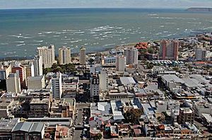
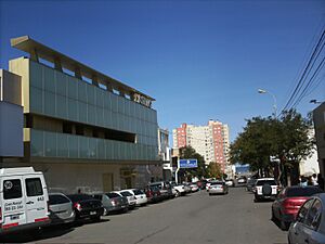
Downtown Comodoro Rivadavia
|
||
|
||
Nickname(s):
|
||
| Motto(s):
A city with energy.
|
||
| Country | ||
| Province | ||
| Department | Escalante Department | |
| Founded | 1901 | |
| Area | ||
| • Total | 548.2 km2 (211.7 sq mi) | |
| Elevation | 61 m (200 ft) | |
| Population
(2010)
|
||
| • Total | 182,631 | |
| • Density | 333.147/km2 (862.85/sq mi) | |
| Time zone | UTC−3 (ART) | |
| Post code |
9000
|
|
| Climate | BSk | |
| Website | Official Website: https://www.comodoro.gov.ar/index.php | |
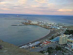
Comodoro Rivadavia, often called Comodoro, is a big city in the Patagonian province of Chubut in southern Argentina. It sits on the San Jorge Gulf, which is part of the Atlantic Ocean, right at the base of Chenque Hill.
Comodoro Rivadavia is the most important city in the San Jorge Basin. It is also the largest city in Chubut province. In fact, it's the biggest city south of the 45th parallel south!
The city was once the capital of the Comodoro Rivadavia Territory, which existed from 1943 to 1955. It became the capital of the Escalante Department. In 2010, about 182,631 people lived there. Comodoro Rivadavia is a major center for business and transport in its area. It's also a key place for exporting oil from Argentina. A long pipeline, 1,770 kilometers long, carries natural gas from Comodoro Rivadavia all the way to Buenos Aires.
The city was officially started on February 23, 1901. It was meant to be a port for the town of Sarmiento, which was further inland. The first person to settle there was Francisco Pietrobelli. Some early settlers were Boers from South Africa and Welsh people. The city was named after Martín Rivadavia, a shipping minister who wanted to help southern Argentina grow. It became very successful in 1907 when workers drilling for water found oil instead!
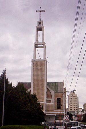
Comodoro Rivadavia is home to the main campus of the National University of Patagonia San Juan Bosco. The city's main church, the Comodoro Rivadavia Cathedral, is special because it's the only one in the world named after San Juan Bosco, who started the Salesian Order. It opened in 1979.
Rada Tilly is a popular beach town and suburb located 12 kilometers south of Comodoro. The National Museum of Petroleum is in the General Mosconi neighbourhood, about 3 kilometers north of downtown Comodoro Rivadavia. It was opened in 1987 by the state-owned oil company YPF.
General Enrique Mosconi International Airport serves Comodoro Rivadavia. It has daily flights to Buenos Aires and other cities in Patagonia. It's a main hub for the airline LADE.
Contents
History of Comodoro Rivadavia
How the City Started
People needed a quick way to move goods to and from the town of Colonia Sarmiento. This led to the idea of building a port in the San Jorge Gulf area. This is how Comodoro Rivadavia, now known as Argentina's oil capital, came to be.
The first governor of the Chubut region was Colonel Luis Jorge Fontana. In 1885, he explored the area with a group of Welsh immigrants.
Early People and Explorers
Scientists like Junius Bird and Väinö Auer found proof that the Tehuelche people lived near Rada Tilly about 9,000 years ago. This was also supported by Father Brea, who found old tools and human remains there.
The Tehuelche people, who came from northern Patagonia, often camped in the area where Rada Tilly is today during the warm summers. The English sailor Robert FitzRoy was the first to mark this place on a map.
Finding a Port and Naming the City
On March 10, 1889, Francisco Pietrobelli, along with a Tehuelche man named Sainajo and Marcelo Pereira, arrived at Rada Tilly. They were using FitzRoy's maps to find a good spot for a deep-water port. This port would allow large ships to stop and supply the growing Colonia Sarmiento.
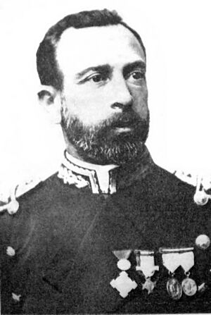
The ship La Argentina, led by Commodore Martín Rivadavia, explored the area near Mount Chenque. They found a good place to anchor, which is now called Kilometro 5. Pietrobelli finished building the first storage shed there on June 26. Commodore Rivadavia was the first Argentine sailor to anchor his ship in Rada Tilly in March 1891. He was checking the area to keep an eye on the Chilean Army's movements in southern Argentina.
The settlement was named Comodoro Rivadavia on February 23, 1901. This was done to honor the important sailor, Martín Rivadavia. He was also the grandson of Bernardino Rivadavia, Argentina's first president.
The Discovery of Oil
In 1903, about 600 Afrikaner families came to Argentina after losing the Second Boer War. They were given farmland near Comodoro Rivadavia. But there wasn't enough water, so they had to bring it in by ox wagon. This lack of water made it hard for the settlement to grow.
Because the Afrikaners insisted, drilling began in 1907 to find water. Instead, they found oil! Even though much of the oil was found on land given to the Afrikaner settlers, they couldn't directly benefit. This is because Argentine law says that all minerals belong to the state. So, most of the Afrikaner settlers moved to Sarmiento and nearby areas to start farms.
The discovery of oil in 1907 made Comodoro Rivadavia's economy boom. By 1919, most of the 1,719 oil workers lived in small metal houses. These houses often had no heating or electric light, even when temperatures were below freezing and winds were strong.
The creation of Yacimientos Petrolíferos Fiscales (YPF) in 1922, a state-owned oil company, helped the town grow even more. In the late 1950s, President Arturo Frondizi encouraged many foreign companies to set up in the area. The city grew around the oil industry. Even today, it is still known as the "National Oil Capital."
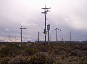
The beach town of Rada Tilly was founded on July 24, 1948. Today, it's a popular spot for tourism in Argentina. Oil production has started to decrease, but the area is now focusing on wind power. Large windmills on Cerro Chenque and other hills make up South America's biggest wind farm. These windmills provide 20% of Comodoro's energy needs.
Climate in Comodoro Rivadavia
Comodoro Rivadavia has a cold semi-desert climate. This means it's dry, but not a full desert. It's one of the southernmost places in the world to have this type of climate.
The city gets just over 250 millimeters of rain each year. Summers are warm to hot and dry, with an average temperature of about 19.7°C (67.5°F) in January. Winters are mild, with an average temperature of about 6.8°C (44.2°F) in July. It rains more in winter than in summer.
| Climate data for Comodoro Rivadavia (General Enrique Mosconi International Airport) 1991–2020, extremes 1931–present | |||||||||||||
|---|---|---|---|---|---|---|---|---|---|---|---|---|---|
| Month | Jan | Feb | Mar | Apr | May | Jun | Jul | Aug | Sep | Oct | Nov | Dec | Year |
| Record high °C (°F) | 40.2 (104.4) |
40.2 (104.4) |
39.2 (102.6) |
31.6 (88.9) |
26.3 (79.3) |
22.6 (72.7) |
22.8 (73.0) |
24.7 (76.5) |
29.7 (85.5) |
32.0 (89.6) |
35.5 (95.9) |
38.6 (101.5) |
40.2 (104.4) |
| Mean daily maximum °C (°F) | 26.3 (79.3) |
25.1 (77.2) |
22.7 (72.9) |
18.8 (65.8) |
14.6 (58.3) |
11.3 (52.3) |
11.0 (51.8) |
13.1 (55.6) |
15.6 (60.1) |
18.9 (66.0) |
22.2 (72.0) |
24.7 (76.5) |
18.7 (65.7) |
| Daily mean °C (°F) | 19.8 (67.6) |
18.8 (65.8) |
16.5 (61.7) |
13.3 (55.9) |
10.0 (50.0) |
7.3 (45.1) |
6.7 (44.1) |
8.2 (46.8) |
10.2 (50.4) |
13.1 (55.6) |
15.9 (60.6) |
18.3 (64.9) |
13.2 (55.8) |
| Mean daily minimum °C (°F) | 13.5 (56.3) |
12.8 (55.0) |
11.0 (51.8) |
8.5 (47.3) |
5.7 (42.3) |
3.3 (37.9) |
2.7 (36.9) |
3.9 (39.0) |
5.2 (41.4) |
7.4 (45.3) |
9.9 (49.8) |
12.2 (54.0) |
8.0 (46.4) |
| Record low °C (°F) | 3.9 (39.0) |
2.6 (36.7) |
0.3 (32.5) |
−4.1 (24.6) |
−4.9 (23.2) |
−8.5 (16.7) |
−7.6 (18.3) |
−5.4 (22.3) |
−5.7 (21.7) |
−1.8 (28.8) |
0.2 (32.4) |
2.0 (35.6) |
−8.5 (16.7) |
| Average precipitation mm (inches) | 10.7 (0.42) |
17.3 (0.68) |
27.7 (1.09) |
31.8 (1.25) |
33.5 (1.32) |
37.2 (1.46) |
21.4 (0.84) |
19.3 (0.76) |
19.8 (0.78) |
12.6 (0.50) |
14.3 (0.56) |
12.5 (0.49) |
258.1 (10.16) |
| Average precipitation days (≥ 0.1 mm) | 2.7 | 3.9 | 4.6 | 4.2 | 6.1 | 6.3 | 5.9 | 6.1 | 6.5 | 4.7 | 4.2 | 3.8 | 58.8 |
| Average snowy days | 0.0 | 0.0 | 0.0 | 0.1 | 0.3 | 2.0 | 2.3 | 0.8 | 0.9 | 0.2 | 0.0 | 0.0 | 6.6 |
| Average relative humidity (%) | 39.0 | 44.8 | 48.4 | 51.0 | 57.8 | 59.0 | 57.9 | 54.3 | 51.8 | 46.3 | 41.9 | 39.8 | 49.3 |
| Mean monthly sunshine hours | 303.8 | 259.9 | 229.4 | 189.0 | 148.8 | 129.0 | 142.6 | 167.4 | 195.0 | 244.9 | 276.0 | 282.1 | 2,567.9 |
| Mean daily sunshine hours | 9.8 | 9.2 | 7.4 | 6.3 | 4.8 | 4.3 | 4.6 | 5.4 | 6.5 | 7.9 | 9.2 | 9.1 | 7.0 |
| Percent possible sunshine | 51 | 55 | 47 | 45 | 43 | 43 | 41 | 42 | 42 | 47 | 53 | 49 | 47 |
| Source 1: Servicio Meteorológico Nacional, NOAA (percent sun 1961–1990) | |||||||||||||
| Source 2: Meteo Climat (record highs and lows) Secretaria de Mineria (November record high, and April, May, July, and August record lows only), | |||||||||||||
Population and City Layout
In 2010, Comodoro Rivadavia had 182,631 people. This was a big jump from 135,632 people in 2001. The city grew by about a third between 2001 and 2010.
Comodoro Rivadavia is the 20th largest city in Argentina. It is also the biggest city in South Patagonia, which stretches from Chubut to Tierra del Fuego.
How Comodoro Rivadavia is Divided
Comodoro Rivadavia is the largest city south of the Colorado River. The city grew from many oil camps that eventually became different neighborhoods.
The city has three main parts: the North Area, the South Area, and the Downtown Area.
- The South Area is the most populated part of the city. It includes neighborhoods like Jorge Newbery, San Martin, Las Flores, and San Cayetano.
- The Downtown Area has the Centro, Loma, and Civico neighborhoods.
- The North Area is divided by kilometers, like 3rd Kilometre, 4th Kilometre, 5th Kilometre, 6th Kilometre, and 8th Kilometre. The National University of Patagonia San Juan Bosco is located in the 4th Kilometre.
Economy of Comodoro Rivadavia
Industries and Businesses
Comodoro Rivadavia has the most important businesses and industries in its region. The city makes many different products. These include chemical products, concrete, and industrial houses.
It also has shipyards, metal factories, and places that make refrigerated goods. Other industries include textiles, bricks, and cement.
Oil Industry
Oil production in Chubut began in 1907. This happened when a drilling team looking for water found oil instead. The Argentine oil industry started right here in Comodoro Rivadavia.
An old law from 1886, the National Mining Code, said that oil fields belonged to the state. But private companies could also use them with special permission.
In 1922, YPF (Yacimientos Petrolíferos Fiscales) was created. This was the world's first state-owned oil company. YPF helped the community by building houses, creating jobs, and providing healthcare. Engineer Enrique Mosconi was in charge of the company. By 1933, many oil wells had been drilled in Comodoro Rivadavia, and most of them were producing oil.
In 1935, the First Oil Law was passed. It stated that the national and provincial governments would receive 12% of the money from all oil drilling. This rule is still in place today.
In 1958, President Arturo Frondizi signed a law that gave the government full ownership of all oil fields.
Important oil fields like El Huemul and Piedra Clavada were found in the 1960s. Many new wells were drilled during this time.
Between 1977 and 1986, a huge amount of oil was drilled from the San Jorge Gulf. In 1979, the San Jorge Gulf produced over 10 million cubic meters of oil.
By 2001, over 5,300 wells had been drilled, with 3,000 of them still producing oil. The San Jorge Gulf is a leader in oil extraction. It produces 46,000 cubic meters of oil per day. This is 46% of all the crude oil produced in Argentina!
Geography and Port Facilities
Comodoro Rivadavia is in southern Argentina, in the province of Chubut. It is located on the coast of the San Jorge Gulf.
A port was needed in the San Jorge Gulf area. This would create shorter routes for moving products to and from Sarmiento, a town 180 kilometers away.
The Port of Comodoro Rivadavia
Since 1908, a small wooden port called Maciel received ships and passengers. It could only handle small vessels. The construction of a larger port began in 1923. After a pause, it was finished in 1928.
Port Facilities and Shipyard
The shipyard has two large indoor areas, each 70 meters long and 4 meters wide. This allows ships to be repaired and built without being affected by the weather. The shipyard also has three cranes. They build wind turbine towers and oil buoys here.
The port has several important facilities:
- The main Port is near downtown. It can receive ships up to 181 meters long. It has a pier that is 216 meters long. This pier is used for moving goods, deep-sea fishing, and ship repairs.
- Caleta Cordova's pier is in the north of the city. It is used by local fishermen.
- Repsol-YPF's pier is used for unloading fuel. Over 29,000 liters of fuel are unloaded here each month.
- Caleta Olivares's facilities are used for loading crude oil onto ships.
- Caleta Cordova also has facilities for loading crude oil. These are located 5 kilometers from the coast. They can handle very large ships.
Concrete and Wind Energy
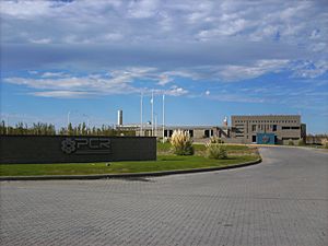
Comodoro Rivadavia also has a factory that makes concrete. It produces different types of concrete for various uses, including for the oil industry. In 2002, the factory produced 228,000 tons of concrete.
The wind farm in Comodoro Rivadavia is very important. It has 26 generators and can produce 18,820 kilowatts of power. It is the largest wind farm in Latin America. There are plans to connect it to the national energy grid. This would allow the city to sell energy to other regions.
Sports in Comodoro Rivadavia
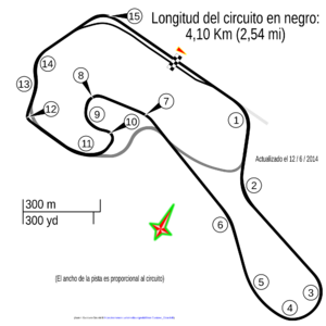
The most popular sports in Comodoro Rivadavia are basketball, football (soccer), and car racing. Other sports like land yachting, judo, rugby, and athletics are also enjoyed.
Comodoro Rivadavia is home to the basketball team Gimnasia y Esgrima (Comodoro Rivadavia). Other local basketball clubs are Nautico and Federacion Deportiva.
The most popular football clubs are CAI, Huracán, and Club Atlético Jorge Newbery. Huracán plays in the Argentine Tournament "B".
Comodoro Rivadavia also has its own football league with many teams. The main teams are Jorge Newbery, Huracán, and Petroquímica. Other clubs include Tiro Federal, Universitario, and Portugues.
Land yachting has become very popular in the city. The beaches of Rada Tilly and the windy climate are perfect for this sport. The World Championship of Landyachting was even held in Rada Tilly in 2008.
|
See also
 In Spanish: Comodoro Rivadavia para niños
 | Laphonza Butler |
 | Daisy Bates |
 | Elizabeth Piper Ensley |


