Conegar Hill facts for kids
Quick facts for kids Conegar Hill |
|
|---|---|

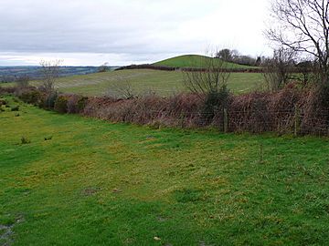
View from Conegar Hill of its northern sub-summit, Blagdon Hill.
|
|
| Highest point | |
| Elevation | 214 m (702 ft) |
| Prominence | 47 m (154 ft) |
| Parent peak | Lewesdon Hill |
| Listing | Tump |
| Geography | |
| Location | Dorset, England |
| Parent range | Yeovil Scarplands |
| OS grid | ST439032 |
| Topo map | OS Landranger 193 |
Conegar Hill is a noticeable hill in Dorset, a county in southern England. It stands about 214 meters (702 feet) high. You can find it just north of the village of Broadwindsor. This hill is part of the Yeovil Scarplands area. Conegar Hill is known as a "Tump" because it rises at least 30 meters (98 feet) above the land around it.
Contents
Where is Conegar Hill Located?
The very top of Conegar Hill is an open, unwooded area. On its eastern and western sides, you'll find small streams. These streams are tributaries that flow into the River Axe. To the south, a lower area connects Conegar Hill to Waddon Hill.
Nearby Features of Conegar Hill
North of Conegar Hill is Blagdon Hill. This is a smaller peak on the same ridge. A road, the B3164, crosses the southeastern side of Conegar Hill. This road connects Broadwindsor to the A3066 at Whetley Cross. A smaller lane also branches off to the north. It crosses the western side of the hill.
What's in a Name? The Meaning of "Conegar"
The name "Conegar" comes from an old English term. It is from the early Medieval English words "cony-garth." This literally means "rabbit yard."
Why is it Called "Conegar"?
There are two main ideas about why the hill got this name. One idea is that the hill might be what's left of an ancient "pillow mound." These were man-made mounds used to raise rabbits. Another idea is that the hill simply looks a lot like a pillow mound.

