Waddon Hill facts for kids
Quick facts for kids Waddon Hill |
|
|---|---|
| Highest point | |
| Elevation | 207 m (679 ft) |
| Prominence | 35 m (115 ft) |
| Parent peak | Lewesdon Hill |
| Geography | |
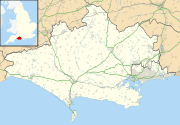
| Location | Marshwood Vale, Dorset |
| OS grid | ST448015 |
| Topo map | OS Explorer 193 |
Waddon Hill is a special hill in Dorset, England. It's not just any hill; it's also the site of an ancient Roman fort! The name Waddon comes from an old English word meaning "wheat hill."
A walking path called the Wessex Ridgeway goes near the top of the hill. The B3162 road also passes close to the western side. Another hill, Lewesdon Hill, is about 1 kilometer (0.6 miles) to the west.
It's important to know that you cannot freely walk to the very top of Waddon Hill. There is no public path to the summit.
Contents
Waddon Hill: A Roman Fort Site
This section tells you more about the Roman fort found on Waddon Hill.
What Was the Roman Fort Like?
The fort was built on a narrow ridge that runs from east to west. This ridge reaches a height of 210 meters (about 689 feet). It had very steep natural slopes on its south and west sides. On the north and east sides, the Romans built strong walls called ramparts.
Who Built the Fort and Why?
The Second Legion of the Roman army built this fort. They were led by a famous Roman general named Vespasian. This happened when they were conquering the Durotriges, a local tribe living in Dorset.
It's possible the fort started as a temporary camp. This might have been during a fight against a nearby place called Pilsdon Pen. Roman ballista bolts, which are like large arrows fired from a giant crossbow, have been found there.
Discovering the Past at Waddon Hill
People first realized this was an important site in the 1800s. Workers quarrying stone found old military items from the 1st century AD.
Later, an archaeologist named Graham Webster led digs starting in 1959. These digs helped uncover the full plan of the Roman camp. Only small parts were missing because of the earlier quarrying.
The main fort was likely built and used between 50 and 60 AD. This was after the Romans stopped using another fort called Hod Hill, which was further east. A Roman road led to Waddon Hill. It branched off the main road between Dorchester and Axminster. This road passed through Eggardon Hill and south of Beaminster before reaching Waddon Hill from the east.
 | Bayard Rustin |
 | Jeannette Carter |
 | Jeremiah A. Brown |


