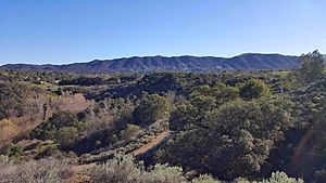
Conejo Canyons Open Space facts for kids
Quick facts for kids Conejo Canyons Open Space |
|
|---|---|

View of Hill Canyon, La Branca, Newbury Park and the Santa Monica Mountains from the Mount Clef Ridge.
|
|
| Type | Open-space park |
| Location | Newbury Park, CA |
| Area | 1,628 acres (659 ha) |
| Operated by | Conejo Open Space Conservation Agency (COSCA) |
| Status | Open |
The Conejo Canyons Open Space is a huge natural area in Newbury Park, Ventura County, California. It covers about 1,628 acres (659 ha) of land. This open space has deep canyons, tall ridgelines, and flat plateaus. It's found in the northwestern part of the Conejo Valley.
This area is full of amazing natural features. You can find deep canyons with streams that flow all year. There are also high ridges and even volcanic mountains. Many different types of plants and animals live here. Some plants include chaparral, oak trees, and coastal sage. You might even spot cool animals like mountain lions, coyotes, mule deer, and bobcats!
Fun Things to Do at Conejo Canyons
The Conejo Canyons Open Space is a great place for outdoor adventures. It includes areas like Western Canyon, Western Plateau, and Hill Canyon. This open space is right next to Wildwood Regional Park in Thousand Oaks. It also borders the Conejo Grade near Camarillo to the west.
On clear days, the trails here offer amazing views. You can see all the way to the Pacific Ocean and the City of Ventura. You might even spot the distant Topatopa Mountains. The Conejo Canyons connect to Santa Rosa Valley in the north. This connection is made by the Conejo Canyons Bridge.
The canyons follow the Conejo Creek. Many trails cross over water and have bridges. These bridges connect different parts of the trail system. The only developed spot is the Hill Canyon Wetlands. This is the largest man-made wetland in Ventura County. It covers about fifteen acres. These wetlands are part of the Arroyo Conejo Nature Preserve. The water from these wetlands flows into the Arroyo Conejo. Eventually, it reaches the Pacific Ocean at the Mugu Lagoon.
The Conejo Canyons Bridge opened in February 2012. It created a path between the Arroyo Conejo Open Space and Santa Rosa Valley. From there, you can even reach the Mount Clef Ridge and Lizard Rock in Wildwood Regional Park. The Conejo Open Space Conservation Agency (COSCA) manages this park. It's a popular spot for mountain biking, hiking, and horse-back riding.
Exploring the Trails
Conejo Canyons has more than fifteen miles of hiking trails. There are many trails to choose from! Some popular ones include the Western Plateau Trail and the Hill Canyon Trail. Other trails are the Hawk Canyon Trail, Peninsula Trail, and Hawk Canyon Rim Trail. You can also find the Outlaw Loop, Elliot Mountain Trail, and South-East Face Trail. The Overlook Trail goes into Santa Rosa Valley. From there, it climbs up the Mount Clef Ridge to Lizard Rock in Wildwood Regional Park.
You can get to the Conejo Canyons Open Space from several starting points. One way is from the Lizard Rock Trail in Wildwood Regional Park. Another is from the Santa Rosa County Park in Santa Rosa Valley. You can also start from the Rancho Conejo Playfields in Newbury Park.
 | Tommie Smith |
 | Simone Manuel |
 | Shani Davis |
 | Simone Biles |
 | Alice Coachman |

