
Santa Monica Mountains facts for kids
Quick facts for kids Santa Monica Mountains |
|
| Range | |
 Malibu Canyon in the Santa Monica Mountains
|
|
| Country | United States |
|---|---|
| State | California |
| Counties | Los Angeles, Ventura |
| Part of | Transverse Ranges |
| Borders on | Santa Susana Mountains, Simi Hills, Verdugo Mountains |
| Coordinates | 34°7′13.023″N 118°55′54.348″W / 34.12028417°N 118.93176333°W |
| Highest point | Sandstone Peak |
| - elevation | 3,111 ft (948 m) |
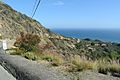
The Santa Monica Mountains are a range of hills and mountains in southern California, United States. They stretch for about 40 miles (64 km) from the Hollywood Hills in Los Angeles to Point Mugu in Ventura County. These mountains create a natural border between the San Fernando Valley to the north and west-central Los Angeles to the south.
Contents
- Exploring the Santa Monica Mountains' Geography
- Weather in the Santa Monica Mountains
- Ancient History of the Mountains
- Parks and Development in the Mountains
- Important Peaks in the Santa Monica Mountains
- The Los Angeles River and Griffith Park
- Amazing Wildlife of the Santa Monica Mountains
- See also
- Images for kids
- See also
Exploring the Santa Monica Mountains' Geography
The Santa Monica Mountains run next to the Santa Susana Mountains, which are on the north side of the San Fernando Valley. At their eastern end, the mountains are bordered by the Los Angeles River. This river then flows south past Elysian Park, marking the eastern edge of the mountains. Mt. Washington, located across the river, has similar plants and weather to the Santa Monica Mountains.
How the Mountains Were Formed
Scientists believe that the northern Channel Islands are actually a part of the Santa Monica Mountains that extends into the Pacific Ocean. The mountains were formed by the Raymond Fault. This fault caused rocks to push up and sink down over a long time. This process brought old volcano rock closer to the surface. Malibu Creek cuts right through the middle of the mountain range.
Weather in the Santa Monica Mountains
The Santa Monica Mountains have dry, warm to humid summers. Their winters are wet and mild to cool. The dry summer weather makes the area prone to wildfires. It rarely snows in the Santa Monica Mountains because they are not as high as the nearby San Gabriel Mountains.
On January 17, 2007, a very cold storm brought snow to the Santa Monica Mountains. Malibu received three inches (eight centimeters) of snow. This was the first measurable snow there in 50 years! Snow was also seen on Boney Peak in the winter of 2005 and in March 2006.
Ancient History of the Mountains
The mountains hold more than 1,000 places where people lived a very long time ago. Many of these sites were home to the Tongva and Chumash people. These groups lived off the land and left behind important clues about their ancient cultures.
Parks and Development in the Mountains
The Cahuenga Pass is the easiest way to travel through the mountains. Today, U.S. Route 101 runs through it, connecting the Los Angeles Basin to the San Fernando Valley. In the 1800s, two battles were fought here, and the Treaty of Cahuenga was signed nearby. Later, many Hollywood movie studios were built on both sides of the pass.
The Sepulveda Pass is another main route, connecting the Westside of Los Angeles to Sherman Oaks via the San Diego Freeway (I-405). Further west, you'll find other important roads like Topanga Canyon Boulevard (SR 27), Malibu Canyon Road, and Kanan Dume Road.
Mulholland Drive runs along much of the Santa Monica Mountains, from Cahuenga Pass to Woodland Hills. The Mulholland Highway continues from Woodland Hills to Sequit Point. The eastern part of the mountains, within Los Angeles, has more buildings and homes. The city of Malibu stretches along the coast, between the ocean and the main mountain ridge.
Protected Areas and Parks
Much of the mountains are part of the Santa Monica Mountains National Recreation Area. The Santa Monica Mountains Conservancy helps protect these lands. There are over twenty state and city parks in the Santa Monica Mountains, including:
- Topanga State Park
- Leo Carrillo State Park
- Malibu Creek State Park
- Point Mugu State Park
- Will Rogers State Historic Park
- Point Dume State Beach
- Griffith Park
- Marvin Braude Mulholland Gateway Park
- Charmlee Wilderness Park
- Runyon Canyon Park
- The Paramount Ranch
Communities Near the Mountains
Many communities are located along the slopes of the Santa Monica Mountains.
Places along the north side include (from east to west):
- The Los Angeles communities of:
- Calabasas
- Agoura Hills
- Westlake Village
- Thousand Oaks
- Newbury Park
- Simi Valley
Places along the south side include (from east to west):
- The Los Angeles communities of:
- Beverly Hills
- The community of Topanga
- Malibu
Important Peaks in the Santa Monica Mountains
| Peak | Height | Notes | |
|---|---|---|---|
| US | SI | ||
| Sandstone Peak | 3111 ft | 948 m | also known as Mount Allen, rising nearly a kilometer high |
| Tri-Peaks | 3010 ft | 917 m | |
| Exchange Peak | 2950 ft | 899 m | |
| Boney Peak | 2825 ft | 861 m | |
| Castro Peak | 2824 ft | 861 m | highest peak in the eastern end of the range |
| Saddle Peak | 2805 ft | 855 m | |
| Calabasas Peak | 2165 ft | 660 m | |
| Temescal Peak | 2126 ft | 648 m | |
| San Vicente Mountain | 1965 ft | 599 m | former site of a Nike missile base, now a Cold War park |
| Clarks Peak | 1965 ft | 599 m | |
| Mesa Peak | 1844 ft | 562 m | |
| Cahuenga Peak | 1820 ft | 555 m | |
| Brents Mountain | 1713 ft | 522 m | |
| Mount Lee | 1640 ft | 500 m | the Hollywood Sign is on the southern slope, at exactly half a kilometer high |
| Mount Hollywood | 1625 ft | 495 m | |
| Mount Chapel | 1622 ft | 494 m | |
| Mount Bell | 1587 ft | 484 m | |
| La Jolla Peak | 1567 ft | 478 m | |
| Laguna Peak | 1457 ft | 444 m | |
| Mugu Peak | 1266 ft | 386 m | the westernmost peak in the range, rising directly from the beach |
The Los Angeles River and Griffith Park
The Los Angeles River starts in the Santa Monica Mountains. It also forms the northern border of the mountains from the eastern San Fernando Valley to Elysian Park. At Elysian Park, the river turns south, marking the easternmost part of the mountain range.
Griffith Park and Elysian Park are at the very eastern end of the Santa Monica Mountains. Griffith Park is separated from the rest of the mountains by the Cahuenga Pass. The 101 Freeway goes through this pass, connecting the San Fernando Valley to Hollywood. Elysian Park is the farthest east part of the mountains and has the Los Angeles River to its east.
Amazing Wildlife of the Santa Monica Mountains

The Santa Monica Mountains are part of the California chaparral and woodlands area. They are home to hundreds of different plant species. Some of these plants are very rare, while others are popular in gardens. The mountains also have a huge variety of animals. These range from mountain lions to the endangered steelhead fish.
The number of mountain lions in the Santa Monica Mountains (including the Simi Hills and Santa Susana Pass) is very low. Only seven adult mountain lions are known to live there. Their population has dropped because of several reasons:
- They are often hit by cars.
- They eat prey that has been poisoned by human-made chemicals.
- Older, stronger mountain lions sometimes attack and kill younger or weaker ones, possibly because there isn't enough space for all of them.
Snakes are common in the mountains but are not often seen. The only venomous snake is the Southern Pacific rattlesnake. Other snakes you might find include the Mountain Kingsnake, California Kingsnake, Gopher snake, and Garter snake.
See also
Images for kids
-
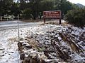
Snow in the Santa Monica Mountains in 2007.
-
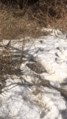
Deep graupel in Malibu Canyon in 2021.
-
Boney Mountain is sacred to the Chumash people.
-
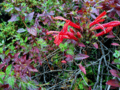
Heart leaf penstemon, Keckiella cordifolia, along the Backbone Trail in the Santa Monica Mountains
-
First mile of CA 23 and southern coastal scrub
-
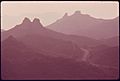
Haze in the Santa Monica Mountains near the west edge of Los Angeles County, 1975. Photo by Charles O'Rear
-
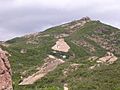
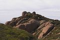
Sandstone Peak


See also
 In Spanish: Sierra de Santa Mónica para niños
