
Pacific Palisades, Los Angeles facts for kids
Quick facts for kids
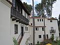
Pacific Palisades
|
||
|---|---|---|
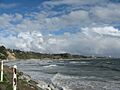
 .jpg)      Pacific Palisades and Will Rogers State Beach, California
|
||
|
||
| Nickname(s):
The Palisades, Pali, Palisades
|
||
| Motto(s):
"Where the mountains meet the sea."
|
||

Pacific Palisades
Location in the Los Angeles metropolitan area
|
||
| Country | United States | |
| State | California | |
| County | Los Angeles | |
| City | Los Angeles | |
| First settlement by Chumash people | 8,000 BC | |
| Mexican settlement | 1838 | |
| Established | 1921 | |
| Government | ||
| • Type | Neighborhood of Los Angeles | |
| Area | ||
| • Total | 24.31 sq mi (62.97 km2) | |
| • Land | 22.84 sq mi (59.15 km2) | |
| • Water | 1.47 sq mi (3.8 km2) | |
| Elevation | 328 ft (98.5 m) | |
| Highest elevation | 2,126 ft (648 m) | |
| Lowest elevation | 0 ft (0 m) | |
| Population
(2023)
|
||
| • Total | 23,648 | |
| • Density | 1,185/sq mi (457.5/km2) | |
| Demonym(s) | Palisadian, Palisadians | |
| Time zone | UTC-8 (Pacific) | |
| • Summer (DST) | UTC-7 (PDT) | |
| ZIP Code |
90272
|
|
| Area code(s) | 310 and 424 | |
| Website | Community Council Chamber of Commerce |
|

Pacific Palisades is a neighborhood in the Westside area of Los Angeles, California. It is about 20 miles (32 km) west of downtown Los Angeles. In January 2025, a large part of Pacific Palisades was badly damaged by the Palisades Fire. This fire was part of bigger wildfires across Southern California.
Pacific Palisades was started in 1921 by a Methodist group. Later, famous people looked for homes here because it offered privacy. The area is known for being a quiet, close-knit community. It has a Mediterranean climate, rolling hills, and lots of parks and hiking trails. It also has a 3-mile (4.8 km) coastline. Many homes here are famous for their architecture. In 2023, about 23,648 people lived in Pacific Palisades.
Pacific Palisades is mostly a place where people live. It does not get many tourists. Most visitors come for the beaches, the Getty Villa, or the Self-Realization Fellowship Lake Shrine.
Locals and surfers call it the Palisades or Pali. The coast stretches from Santa Monica in the south to Malibu in the north. Beaches along this coast include Will Rogers State Beach, Sunset Point Beach, and Ginger Rogers Beach. Many parks in the Santa Monica Mountains National Recreation Area are located above the community. These include Will Rogers State Historic Park.
The Palisades is bordered by Brentwood to the east and Topanga to the west. Santa Monica is to the southeast. The Santa Monica Bay is to the southwest, and the Santa Monica Mountains are to the north.
Contents
- History of Pacific Palisades
- Geography and Climate
- Neighborhoods of Pacific Palisades
- The Village: Downtown Hub
- The Alphabet Streets: North Village Homes
- El Medio Mesa: Westside Living
- Marquez Knolls: Homes with Ocean Views
- The Via Bluffs and The Huntington: Oceanfront Living
- El Medio Bluffs: More Ocean Views
- Castellammare: Italian-Inspired Coastal Area
- Rustic Canyon: Nature and History
- The Riviera: Golf and Luxury
- Palisades Highlands: Mountain Living
- Santa Monica Canyon: Historic Area
- Community Demographics
- Parks and Outdoor Fun
- City Parks for Everyone
- Hiking Trails to Explore
- Backbone Trail: A Long Adventure
- Bushwacker's Delight: For Experienced Hikers
- Eagle Springs Fire Road Loop Trail: Paved Path with Views
- High Point Trail: Overlooking the Palisades
- Inspiration Point Trail: Historic and Scenic
- Los Leones Trail: Popular and Challenging
- Skull Rock Loop: Unique Rock Formations
- Trailer Canyon Fire Road: Wide and Scenic
- Will Rogers Trail: A Challenging Hike
- State Parks and Beaches
- Community Services and Government
- Politics in Pacific Palisades
- Education for Young People
- Local Culture and Events
- Sports and Recreation
- Local Media
- Important Landmarks
- Bradbury House: Historic Home
- Business Block: A Community Hub
- Dolores del Río House: Actress's Home
- Eames House: Design Pioneers' Home
- The Getty Villa: Ancient Art and Culture
- Kappe Residence: Modern Architecture
- Mort's Palisades Deli: A Local Favorite
- Old Santa Monica Forestry Station: First of its Kind
- Self-Realization Fellowship Lake Shrine: A Spiritual Place
- Thomas Mann House: A Writer's Refuge
- Villa Aurora: Home for Exiled Artists
- Wildlife in Pacific Palisades
- Images for kids
- See also
History of Pacific Palisades
Early Native American Life
Archaeological findings show that Native American Indians lived in the Santa Monica Mountains for over 10,000 years. Before Europeans arrived, the Tongva people lived in the western Santa Monica Mountains. The closest Tongva village to Pacific Palisades was called Topa'nga. This village was on the edge of Tongva land, next to the Chumash people's territory. Because of this, the culture here had some Chumash influences.
Mexican Era Settlements
During the time Mexico ruled California, the land of Pacific Palisades was part of Rancho Boca de Santa Monica. The governor of California gave this land to Francisco Marquez and Ysidro Reyes in 1839. The Ysidro Reyes Adobe was the first adobe home built in Santa Monica Canyon. It was built in 1838 on land now known as Pampas Ricas Blvd. Sketches of this home are in the UCLA Library. A plaque on Pampas Ricas Blvd remembers the adobe house. Ysidro Reyes died in 1863. His wife, Maria Antonia Villa, sold his part of the land to Robert Symington Baker in 1875.
Hollywood's Early Days: Inceville and Hartville
In 1911, film director Thomas Ince built his famous film studio, Inceville. It was on a 460-acre (1.9 km2) ranch called Bison Ranch. This land was at Sunset Blvd. and Pacific Coast Highway in the Santa Monica Mountains. Today, the Self-Realization Fellowship Lake Shrine is located here. This was the first big development in the Palisades since the Mexican rancho era.

Inceville was the first studio in the area with everything in one place. It had silent stages, offices, labs, a large dining hall, dressing rooms, and sets. It was a model for future Hollywood studios.
The studio had streets lined with buildings that looked like different countries. Large outdoor western sets were also built. Many cowboys, Native Americans, and workers lived at Inceville. Main actors traveled from Los Angeles by red trolley cars. They would then take buckboards to the set.
Ince lived in a house overlooking the studio. Inceville became a model for future Hollywood film studios. It had a studio head, producers, directors, and writers all working together.
On January 16, 1916, a fire started at Inceville. More fires followed, destroying the buildings. Ince sold the studio to William S. Hart, who renamed it Hartville. In 1919, Hart sold it to Robertson-Cole Pictures Corporation. They filmed there until 1922. The last parts of Inceville burned on July 4, 1922.
The Methodist Church Era (1921–1931)

In 1921, Reverend Charles H. Scott and the Southern California Methodist Episcopal Church bought the land. In 1922, Scott founded Pacific Palisades. He imagined it as a religious and intellectual community. People bought land and lived in tents while their homes were built. By 1925, the Palisades had 100 homes. In one area, streets were named in alphabetical order after Methodist missionaries. These are known as the "Alphabet Streets." The tents were replaced by cabins, then bungalows, and now multimillion-dollar homes. The cool climate was a big reason people wanted to live there.
The name "Pacific Palisades" comes from the word "palisade," meaning a tall wooden fence or wall. This refers to the cliff-like bluffs along the Pacific Ocean side of the neighborhood. These bluffs looked like the Palisades in New Jersey.
Pacific Palisades grew steadily in the 1920s. When Sunset Boulevard was paved in 1925, it made travel easier to nearby Westwood and Beverly Hills.
In 1928, the Los Angeles Police Department rented office space in the Business Block building. By 1929, a motorcycle officer patrolled the area. The Palisades got its own fire station in 1929.
By 1929, the town had about 365 homes and 1,000 residents. Most lived in the "Alphabet Streets" area. New homes were also being built in other neighborhoods. On August 18, 1929, the foundation for the Methodist Episcopal Church was laid. It was the only church in the community at that time. The town's first permanent school, "Palisades Elementary", was dedicated on June 12, 1931.
By the end of the 1920s, most open areas of Pacific Palisades were being developed. This showed the area's rapid growth and coastal appeal. Golfers enjoyed the Riviera Country Club, which opened in 1927. The Bel-Air Bay Club opened in March 1930.
Modern Pacific Palisades (1930–Present)

In the 1930s and 1940s, the Palisades attracted German and Austrian artists and thinkers. They were escaping Hitler’s Holocaust. These included famous writers like Thomas Mann and Lion Feuchtwanger. Many had first gone to France but then came to the United States. They were surprised by how similar the climate and landscape were to the Mediterranean. Villa Aurora on Paseo Miramar, the home of Feuchtwanger, became a meeting place for these exiles. It was nicknamed "Weimar by the Sea."
For many years, selling alcohol was mostly banned in the area. Only one Chinese restaurant, House of Lee, had a liquor license. The Methodist Church created a conference center in Temescal Canyon. In 1943, the Presbyterian Synod bought it. It became a private retreat until 1994, when it became Temescal Gateway Park.
Pacific Palisades had a Jewish population since the 1930s. But it was mostly Methodist until the 1970s. Then, more Jewish families moved to the area. Mort's Deli, a local landmark, opened in 1972 and closed in 2007.
In 2021, a wildfire burned about 1,200 acres (4.9 km2) in Pacific Palisades. A suspect was arrested for arson.

On January 7, 2025, the Palisades Fire started north of Bienveneda Ave. Strong Santa Ana Winds and very dry brush caused the fire to spread quickly. The fire moved through the Palisades and nearby communities. It was fully put out on January 31, 2025. The fire destroyed 6,831 buildings and damaged 973 others. It injured 3 civilians and 1 firefighter, and tragically killed 12 civilians. This fire is the tenth-deadliest and third-most destructive California wildfire ever recorded. It was the most destructive fire in Los Angeles city history.
Geography and Climate
Where is Pacific Palisades Located?
Pacific Palisades is about 7 miles (11 km) west of the UCLA campus. The Santa Monica Mountain range runs through the northern and eastern parts of Pacific Palisades. You can access these mountains through many trailheads.
Pacific Palisades covers a total area of 24.31 square miles (62.97 km2). This includes 22.84 square miles (59.15 km2) of land and 1.47 square miles (3.8 km2) of water. The Palisades coastline is about 3 miles (4.8 km) long.
What is the Climate Like?
| Weather chart for Pacific Palisades | |||||||||||||||||||||||||||||||||||||||||||||||
|---|---|---|---|---|---|---|---|---|---|---|---|---|---|---|---|---|---|---|---|---|---|---|---|---|---|---|---|---|---|---|---|---|---|---|---|---|---|---|---|---|---|---|---|---|---|---|---|
| J | F | M | A | M | J | J | A | S | O | N | D | ||||||||||||||||||||||||||||||||||||
|
1.6
66
52
|
1.5
65
50
|
1
67
52
|
0.4
69
54
|
0.4
71
56
|
0.1
74
59
|
0.2
79
63
|
0.1
81
65
|
0.2
81
65
|
0.2
77
62
|
0.4
71
57
|
1.1
64
51
|
||||||||||||||||||||||||||||||||||||
| temperatures in °F precipitation totals in inches |
|||||||||||||||||||||||||||||||||||||||||||||||
|
Metric conversion
|
|||||||||||||||||||||||||||||||||||||||||||||||
Pacific Palisades has a Mediterranean climate. This means it has mild, wet winters and warm, dry summers. Daytime temperatures are generally mild all year. In winter, they average around 68°F (20°C). The area gets a lot of sunshine, with only about 35 days of rain each year.
Temperatures in the Palisades go above 90°F (32°C) about a dozen days a year. This usually happens from April to November. The average ocean temperature is 63°F (17°C). It ranges from 58°F (14°C) in January to 68°F (20°C) in August. The area gets over 3,000 hours of sunshine per year.
Like other parts of Southern California, Pacific Palisades experiences "June Gloom" in late spring/early summer. This means cloudy or foggy mornings that clear up by early afternoon.
Pacific Palisades gets about 14.93 inches (379 mm) of rain each year. Most of this rain falls between November and March. It usually comes as moderate showers, but sometimes as heavy rain during winter storms. Hillier areas get more rain. Summers are typically dry. Sometimes, moist air from the south or east can bring brief thunderstorms in late summer, especially in the mountains.
Freezing temperatures and snowfall are very rare. The last time it was 32°F (0°C) was on January 4, 1949. Snow has fallen a few times in recorded history, most recently in January 2021. During autumn and winter, Santa Ana winds can bring warmer, drier conditions. These winds also increase the risk of wildfires.
| Climate data for Pacific Palisades, California | |||||||||||||
|---|---|---|---|---|---|---|---|---|---|---|---|---|---|
| Month | Jan | Feb | Mar | Apr | May | Jun | Jul | Aug | Sep | Oct | Nov | Dec | Year |
| Record high °F (°C) | 88 (31) |
92 (33) |
95 (35) |
102 (39) |
97 (36) |
104 (40) |
97 (36) |
98 (37) |
110 (43) |
106 (41) |
101 (38) |
94 (34) |
110 (43) |
| Mean daily maximum °F (°C) | 66 (19) |
67 (19) |
67 (19) |
70 (21) |
71 (22) |
75 (24) |
79 (26) |
80 (27) |
79 (26) |
76 (24) |
70 (21) |
67 (19) |
72 (22) |
| Mean daily minimum °F (°C) | 48 (9) |
49 (9) |
50 (10) |
52 (11) |
55 (13) |
58 (14) |
61 (16) |
62 (17) |
61 (16) |
57 (14) |
52 (11) |
49 (9) |
55 (13) |
| Record low °F (°C) | 27 (−3) |
34 (1) |
37 (3) |
43 (6) |
45 (7) |
48 (9) |
52 (11) |
51 (11) |
47 (8) |
43 (6) |
38 (3) |
32 (0) |
27 (−3) |
| Average precipitation inches (mm) | 3.41 (87) |
3.69 (94) |
2.86 (73) |
0.65 (17) |
0.27 (6.9) |
0.04 (1.0) |
0.02 (0.51) |
0.13 (3.3) |
0.21 (5.3) |
0.41 (10) |
1.14 (29) |
1.98 (50) |
14.83 (377) |
| Month | Jan | Feb | Mar | Apr | May | Jun | Jul | Aug | Sep | Oct | Nov | Dec |
|---|---|---|---|---|---|---|---|---|---|---|---|---|
| Hottest | 63.9 °F (17.7 °C) | 64.2 °F (17.9 °C) | 67.5 °F (19.7 °C) | 68.2 °F (20.1 °C) | 71.5 °F (21.9 °C) | 75.9 °F (24.4 °C) | 79.8 °F (26.6 °C) | 79.0 °F (26.1 °C) | 80.3 °F (26.8 °C) | 75.4 °F (24.1 °C) | 66.9 °F (19.4 °C) | 62.2 °F (16.8 °C) |
| Coldest | 46.7 °F (8.2 °C) | 51.1 °F (10.6 °C) | 52.0 °F (11.1 °C) | 55.2 °F (12.9 °C) | 57.2 °F (14.0 °C) | 62.9 °F (17.2 °C) | 66.2 °F (19.0 °C) | 66.3 °F (19.1 °C) | 63.1 °F (17.3 °C) | 57.8 °F (14.3 °C) | 55.2 °F (12.9 °C) | 49.4 °F (9.7 °C) |
| Wettest | 14.43 in (367 mm) | 15.23 in (387 mm) | 10.44 in (265 mm) | 7.31 in (186 mm) | 3.83 in (97 mm) | 0.98 in (25 mm) | 0.43 in (11 mm) | 2.54 in (65 mm) | 5.13 in (130 mm) | 5.13 in (130 mm) | 9.96 in (253 mm) | 11.46 in (291 mm) |
| Driest | 0 in (0 mm) | 0 in (0 mm) | 0 in (0 mm) | 0 in (0 mm) | 0 in (0 mm) | 0 in (0 mm) | 0 in (0 mm) | 0 in (0 mm) | 0 in (0 mm) | 0 in (0 mm) | 0 in (0 mm) | 0 in (0 mm) |
Neighborhoods of Pacific Palisades
The Village: Downtown Hub
The Village is the main business area of Pacific Palisades. It is centered around Sunset Boulevard and Via de la Paz. This area is known for its many Italian restaurants. The main shopping center, Palisades Village, opened in 2018. It replaced several older buildings. The Village has a weekly farmers' market, restaurants, a coffee shop, and other stores and offices.
The Alphabet Streets: North Village Homes
The Alphabet Streets, also called "The North Village," are north of Sunset Boulevard. This was the first neighborhood built in Pacific Palisades, starting in 1921. It was developed by members of the Methodist movement. Homes here have smaller lots, from 5,200 to 7,500 square feet. This area is close to The Village. The streets are named in alphabetical order after Methodist bishops, giving the neighborhood its name. It is a popular spot for trick-or-treaters on Halloween.
El Medio Mesa: Westside Living
The El Medio Mesa is located south of Sunset Boulevard. It starts about a quarter mile west of The Village, past Palisades Charter High School. This area stretches all the way to where Sunset Boulevard meets the Pacific Coast Highway.
Marquez Knolls: Homes with Ocean Views
Marquez Knolls is a large area of homes north of Sunset Boulevard. It starts about a quarter mile west of The Village, up the mountain. This neighborhood is known for its amazing ocean views. There is a small shopping center on Marquez Avenue and Sunset Boulevard.
The Via Bluffs and The Huntington: Oceanfront Living
The Via Bluffs and The Huntington are neighborhoods south of Sunset Boulevard, overlooking the ocean. The Via Mesa is between Temescal Canyon and Potrero Canyon. The Huntington Palisades is between Potrero Canyon and Chautauqua Boulevard. Both areas are close to The Village. They sit on high bluffs with views of the Pacific Ocean.
El Medio Bluffs: More Ocean Views
Like The Via Bluffs and The Huntington Palisades, The El Medio Bluffs are on a high ridge. Most homes here have ocean views and fresh ocean air.
Castellammare: Italian-Inspired Coastal Area
Castellammare is located along Pacific Coast Highway. It is on small bluffs closer to sea-level, north of where Sunset Boulevard meets PCH. This neighborhood is home to the Getty Villa. Its narrow, winding streets have Italian names and enjoy ocean breezes.
Rustic Canyon: Nature and History
Rustic Canyon is east of Chautauqua Boulevard. It dips into Santa Monica Canyon and includes the Will Rogers State Historic Park. This area has homes built on a former polo field. It also has "cabins" that were once second homes and weekend getaways. This area is also known as Uplifter's Ranch.
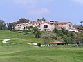
The Riviera: Golf and Luxury


The Riviera is a neighborhood about 2 miles (3.2 km) east of The Palisades Village. Its streets are named after places in the French and Italian Riviera. It is divided by Sunset Boulevard. The Riviera Country Club is here, hosting the Genesis Open golf tournament every February. The club has hosted major golf championships, including the U.S. Open in 1948 and the PGA Championship in 1983 and 1995. It is known as "Hogan's Alley" because Ben Hogan won three times there. The country club will also host golf events for the 2028 Summer Olympics.
Palisades Highlands: Mountain Living
The Palisades Highlands is a neighborhood in the northern part of Pacific Palisades. It is located in the upper Santa Ynez Canyon. The Highlands has access to several Topanga State Park hiking trails. This area includes several gated communities and neighborhoods:
- Country Estates: A gated community with 80 homes on the western side of the Highlands.
- Palisades Hills: The oldest and highest part of the Highlands, about 1,600 feet (490 m) above sea level.
- The Summit: The newest neighborhood, finished in the early 2000s. It includes The Summit Club, a recreation center.
- Lower Highlands: Includes homes, condos, a shopping center, and businesses. Development here began in the early 1970s.
Santa Monica Canyon: Historic Area

Santa Monica Canyon is part of Pacific Palisades. It is named after the historic Rancho Boca de Santa Monica. Canyon Charter School serves this area. The neighborhood is bordered by Chautauqua Boulevard to the north and Adelaide Drive to the south.
Community Demographics
In 2009, the Los Angeles Times reported that Pacific Palisades had 25,507 residents in its 22.84 square miles (59.15 km2). This means it has a low population density compared to other parts of Los Angeles. Data from 2023 showed that the population was mostly White (81%). Other groups included Asian (6%), Black (1%), and multiracial (8%). About 4% of residents were Hispanic or Latino. Pacific Palisades also has a large Jewish population, estimated to be between 5,000 and 10,000 residents.
Parks and Outdoor Fun
City Parks for Everyone
The Los Angeles Department of Recreation and Parks manages several fun places in Pacific Palisades.
- Palisades Park, at 851 Alma Real Drive, is the largest park in the area. It has 117 acres (47 ha) of land. The Palisades Recreation Center, also at this address, has barbecue pits and four baseball fields. It also has indoor and outdoor basketball courts, a children's play area, and a football field. There is an indoor gym, picnic tables, and tennis and volleyball courts. The center also has a kitchen, a stage, and a TV area.
- Rustic Canyon Park is on Rustic Canyon Road. The Rustic Canyon Pool is at 601 Latimer Road. The Rustic Canyon Recreation Center, at the same address, has a multipurpose room for events. It also has barbecue pits, a baseball field, basketball courts, a children's play area, and picnic tables.
- Temescal Canyon Park is a smaller park along Temescal Canyon Drive. It has barbecue pits, a children's play area, picnic tables, hiking trails, and a native garden.
- Santa Ynez Canyon Park is at Palisades Drive and Avenida de Santa Ynez.
- Rivas Canyon Park is at the east end of Oracle Place.
Hiking Trails to Explore
Hiking is popular in the Palisades. Here are some of the trails:
Backbone Trail: A Long Adventure
The Backbone Trail is a long trail, 68 miles (109 km) long, that crosses the Santa Monica Mountains. It goes through both Malibu and Pacific Palisades. The trail is open for hikers. Some parts allow dogs, mountain bikers, and horseback riders. It is a well-kept path, and you do not need a permit to hike it.
Bushwacker's Delight: For Experienced Hikers
Bushwacker's Delight is a 0.8-mile (1.3 km) trail with a 528-foot (161 m) elevation gain. It is inside Will Rogers State Historic Park. This trail is for more experienced hikers because it is not cleared and has overgrown plants.
Eagle Springs Fire Road Loop Trail: Paved Path with Views
Eagle Springs Fire Road Loop Trail is a 5.5-mile (8.9 km) loop with a 1,095-foot (334 m) elevation gain. It is near the Palisades Highlands neighborhood. The trail is paved and well-maintained. It is also used as a fire road. It is popular from September to May. This trail is open to horseback riders. Parking is available for $10 a day. The trail leads to Eagle Rock, a rock formation with great views.
High Point Trail: Overlooking the Palisades
High Point Trail is a 2.8-mile (4.5 km) paved trail with 1,007 feet (307 m) of elevation gain. It is in the Santa Monica Mountains, overlooking the Palisades. Hikers sometimes go onto private property to complete the hike. This trail is known for its wildlife. It leads to "Goat Peak," one of the highest points in the Palisades with great views.
Inspiration Point Trail: Historic and Scenic
Inspiration Point Trail is a 2.1-mile (3.4 km) hiking trail with 324 feet (99 m) of elevation gain. It is in Will Rogers State Historic Park, near the Riviera neighborhood. Will Rogers created this trail in the early 1900s. It is one of the few trails in the Palisades where dogs are allowed. It is an easy hike with unique views of the Los Angeles Basin and Santa Monica Bay. On a clear day, you can see Catalina Island and other distant areas. Inspiration Point Trail connects to the Backbone Trail.
Los Leones Trail: Popular and Challenging
Los Leones Trail, also known as Los Liones, is a moderately challenging trail in the Castellammare neighborhood. It is 7.3 miles (11.7 km) long, with over 1,300 feet (400 m) of elevation gain. The area is named after the mountain lions that live there.
Los Leones is one of the most popular trails in the Westside. It goes through a green canyon in the southern part of Topanga State Park, close to the Pacific Ocean. The trail offers great views of Santa Monica Bay. After 1.3 miles (2.1 km), the trail reaches a clearing with a bench. From there, you can see the Palisades, Santa Monica, and the bay. The trail connects to East Topanga Fire Road, which leads to the Paseo Miramar Trail. Further along is "Parker Mesa Overlook," known for some of the best coastal views in Los Angeles.
Skull Rock Loop: Unique Rock Formations

Skull Rock Loop is a 4-mile (6.4 km) loop trail with 1,141 feet (348 m) of elevation gain. It is near the Temescal Canyon neighborhood. This trail is popular with rock climbers and birders because of its rocky terrain and many bird species. Skull Rock Loop branches off from the Temescal Canyon Trail. It has a waterfall and its famous "Skull Rock," which looks like a skull. You can find free street parking or pay for parking in a nearby lot.
Trailer Canyon Fire Road: Wide and Scenic
Trailer Canyon Fire Road is a 4.3-mile (6.9 km) trail with 925 feet (282 m) of elevation gain. It is near The Summit development in the Palisades Highlands. This wide, paved trail is also used as a fire road. Mountain bikers and birdwatchers also use it. After 1.5 miles (2.4 km), it connects to the Temescal Ridge Trail, which leads to Temescal Gateway Park. Trailer Canyon Fire Road offers views of the ocean and Temescal Canyon.
Will Rogers Trail: A Challenging Hike
Will Rogers Trail is a 4.1-mile (6.6 km) trail with 449 feet (137 m) of elevation gain. It is located within Will Rogers State Historic Park, near the Riviera neighborhood. This trail is known for being very challenging, even for experienced hikers. It is not always well-maintained. Hikers might need to climb over stones and through bushes to avoid falling into the nearby creek. In winter, the creek can overflow, making the trail even harder to follow.
State Parks and Beaches
The California Department of Parks and Recreation also has places in Pacific Palisades.
Will Rogers State Beach: Fun by the Ocean
Will Rogers State Beach stretches about 1.75 miles (2.8 km) along the shore. You can swim and skin dive here. The beach has volleyball courts, a playground, and gym equipment. There is also a bike path and walkway. Many movies and TV shows have been filmed at this beach. It is located off the Pacific Coast Highway, near Temescal Canyon Road.
Will Rogers State Historic Park: A Famous Home

Will Rogers bought almost 200 acres (81 ha) of land above Sunset Blvd. in 1922 to build a weekend home. In 1926, he built a polo field. In 1928, he and his family moved there. In 1944, nine years after Rogers died, the ranch became a state park. The home is kept just as it was, with its original furniture. It is open to the public most days, but you need to pay to enter. The trail at the top of the property offers views of the ocean and city.
Temescal Gateway Park: Nature's Escape

Temescal Gateway Park, at 15601 Sunset Blvd., has 141 acres (57 ha) of oak and sycamore canyons. It offers ridgetop views and access to miles of trails. These trails connect to Topanga State Park, Will Rogers State Historic Park, and the large "Big Wild" area.
Topanga State Park: Trails and Views
Topanga State Park is located in the cliffs and canyons of the Santa Monica Mountains. It has 36 miles (58 km) of trails through open grasslands and oak trees. You can also see views of the Pacific Ocean. The park is bordered by Pacific Palisades and Brentwood to the south. Many trailheads into the park are located throughout Pacific Palisades.
Community Services and Government
The most important local group is the Pacific Palisades Community Council. This council meets twice a month to talk about issues affecting residents. They prefer to stay independent rather than become an official part of the city. This allows them to appeal city decisions and speak to state and federal authorities about local issues.
Local Government Services
Pacific Palisades is in Los Angeles City Council District 11. Traci Park represents this district.
The Los Angeles Fire Department has two fire stations in Pacific Palisades. Station 69 serves Pacific Palisades and the coast. Station 23 serves the Palisades Highlands, Castellammare, and the coast.
The Los Angeles Police Department operates the West Los Angeles Community Police Station. This station serves the neighborhood.
County, State, and Federal Representation
Pacific Palisades is in Los Angeles County's 3rd Supervisorial District. Sheila Kuehl represents this district.
The Los Angeles County Department of Health Services serves Pacific Palisades. They operate the Simms/Mann Health and Wellness Center in Santa Monica.
Pacific Palisades is part of California's 50th State Assembly district, represented by Richard Bloom. It is also part of California's 23rd State Senate district, represented by Ben Allen. The community is part of the California State Board of Equalization District 4, represented by Mike Schaefer.
In the U.S. House of Representatives, Pacific Palisades is in California's 32nd congressional district. It is currently represented by Brad Sherman. The United States Postal Service has a post office at 15243 La Cruz Drive.
Law Enforcement and Safety
The West Los Angeles Division of the Los Angeles Police Department serves Pacific Palisades. A private security company, Palisades Patrol, also helps with security. Many residents also use private security companies like ADT or ACS security.
Politics in Pacific Palisades
Pacific Palisades is a strong area for the Democratic Party. Democrats usually win most votes in elections here.
In the 2024 presidential election, Kamala Harris received 71.17% of the votes from the main voting areas in the Palisades. Donald Trump and RFK Jr. received 27.75% and 1.08% of the votes, respectively.
Education for Young People
Public Schools in the Area
Residents attend schools in the Los Angeles Unified School District. The area is in Board District 4, represented by Nick Melvoin.
Some students go to Pacific Palisades Elementary School, some to Canyon Elementary School, and others to Marquez Elementary School. All students attend Paul Revere Charter Middle School and Palisades Charter High School.
- Canyon Elementary School opened in 1910.
- Pacific Palisades Elementary opened in 1922.

- Marquez Elementary School opened in 1955.

- Paul Revere Middle School opened in 1955. It became a charter school in 1994.
- Palisades Charter High School, known as "Pali High," opened in 1961. It became a charter school in 1994.
Private Schools Available
Private schools in the area include:
- Palisades Jewish Early Childhood Center (preschool-kindergarten)
- Calvary Christian (Kindergarten–8th grade)
- Village School (pre-Kindergarten–6th grade)
- Corpus Christi (Kindergarten–8th grade)
- St. Matthew's Parish School (Preschool–8th grade)
- Seven Arrows (Kindergarten–6th grade)
- Westside Waldorf (Kindergarten–8th grade)
- Lycée Français de Los Angeles Pacific Palisades Campus
Public Libraries for Learning

The Los Angeles Public Library operates the Palisades Branch at 861 Alma Real Drive.
Local Culture and Events
Menorah Lighting Ceremony
Since 1988, a public menorah lighting ceremony has been held each year on the first night of Hanukkah. It takes place at the Palisades Village, the downtown area. The event is organized by Chabad of Pacific Palisades and other Jewish community leaders. It is hosted by Rabbi Zushe Cunin and the honorary mayor. The event includes live Hanukkah music, traditional Hanukkah foods like latkes and sufganiyot, arts and crafts, and face painting.
On December 2, 2018, the 30th Annual Pacific Palisades Menorah Lighting was held at the Palisades Village shopping center. Over 1,000 people attended, including actors and Co-honorary Mayors Janice and Billy Crystal.
Palisades Rocks The Fourth!

Palisades Rocks The Fourth is a tradition that started in 1967. Every Fourth of July, the community's Chamber of Commerce sponsors day-long events. These include 5K and 10K runs, a home decorating contest, and a parade down Sunset Boulevard. There is also a concert with fireworks at Palisades High School football field.
Due to the COVID-19 pandemic, Palisades Rocks The Fourth! was held mostly online starting in 2020. A virtual concert was held with fireworks and a flyover by World War II fighter pilots.
Synagogues in the Community
Pacific Palisades has a large Jewish population and several synagogues:
- Chabad of Pacific Palisades: A local Chabad center at 17315 Sunset Blvd. It offers religious services and Jewish education. Chabad of the Palisades hosts many Jewish events, including the annual Menorah lighting.
- Kehillat Israel: A Reconstructionist synagogue. This is the oldest synagogue in the Palisades.
Sports and Recreation
Bel Air Bay Club: Private Beach Club
The Bel-Air Bay Club is a private club with an event venue and a beach club.
Riviera Country Club: Famous Golf Course
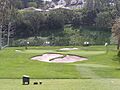
.jpg)
The Riviera Country Club is a private club with a championship golf course and tennis courts. It is in the Riviera neighborhood, just south of Sunset Boulevard.
The Riviera was designed by golf course architects George C. Thomas, Jr. and William P. Bell. It has hosted the Genesis Invitational, an annual PGA Tour event, many times. The 2021 event was the 58th held at Riviera.
The club has hosted three major golf championships: the U.S. Open in 1948, and the PGA Championship in 1983 and 1995. It also hosted the U.S. Senior Open in 1998 and the U.S. Amateur in 2017. The club is set to host golf during the 2028 Summer Olympics.
Will Rogers Polo Club: Horse Sports

The Will Rogers Polo Club is a polo club located at 1501 Will Rogers State Park Road. It is inside Will Rogers State Historic Park. It is the only remaining polo club in Southern California.
Local Media
- The Los Angeles Times is the citywide newspaper.
- The Palisadian-Post, started in 1928, is the oldest newspaper serving Pacific Palisades.
- The Palisades News, first published in 2014, is a local newspaper published twice a month.
- Circling The News is a local news website started in 2017.
- Perspective Palisades is a local magazine started in 2020. It features real estate news, history, and community news.
Important Landmarks
Bradbury House: Historic Home

The Bradbury House is a historic home in the Huntington Palisades neighborhood. It was designed in the Spanish Revival style by architect John Byers. It was finished in 1923 for Lewis L Bradbury Jr. His father, Lewis L Bradbury, built the famous Bradbury Building in Downtown Los Angeles. This house has been on the National Register of Historic Places since 2010.
Business Block: A Community Hub
The Business Block building was a historic building in the Palisades downtown area, called the Village. It was a central part of the downtown area. Designed by architect Clifton Nourse, it was dedicated in 1924. The building was 30,000 square feet (2,800 m2) and sat on 36,000 square feet (3,300 m2) of land. It was located between Antioch, Swarthmore, and Sunset in the Village neighborhood. This building was destroyed in the 2025 fire.
Dolores del Río House: Actress's Home
The Dolores Del Río House is at 757 Kingman Avenue. It was designed in 1929 for Mexican-American actress Dolores del Río and her husband, production designer Cedric Gibbons.
Eames House: Design Pioneers' Home

Eames House is the 1949 home and studio of famous design pioneers Charles and Ray Eames.
The Getty Villa: Ancient Art and Culture

The Getty Villa is a museum and learning center. It focuses on the arts and cultures of Ancient Greece, Rome, and Etruria.
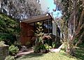
Kappe Residence: Modern Architecture
The Kappe Residence is a house in the Rustic Canyon area of Pacific Palisades. It was designed by architect Raymond Kappe to be his own home. The house has a modern design built into a hillside with many trees. The Kappe Residence was named a Los Angeles Historic-Cultural Monument in 1996. In 2008, the Los Angeles Times named it one of the top ten houses in Los Angeles.
Mort's Palisades Deli: A Local Favorite
Mort's Palisades Deli, often called Mort's Deli, was a Jewish delicatessen. It was located at 1035 Swarthmore Ave, on the corner of Sunset Boulevard in the Village. Mort's was a well-known local spot. It opened in 1972 and closed in 2008. The deli was famous for its Reuben sandwiches and had many celebrity customers.
Old Santa Monica Forestry Station: First of its Kind
The Old Santa Monica Forestry Station was the first experimental forestry station in the nation. It was built in 1887. The station tested different trees for planting in California. It also grew trees for scientific and conservation purposes. The station was named a California Historic Landmark in 1970. It is located in the Rustic Canyon neighborhood. A marker near the entrance of the Rustic Canyon Recreation Center explains its history.
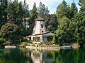
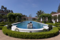
Self-Realization Fellowship Lake Shrine: A Spiritual Place

Self-Realization Fellowship Lake Shrine is a 10-acre (4.0 ha) spiritual center on Sunset Boulevard. It was founded in 1950 by Paramahansa Yogananda. His book Autobiography of a Yogi introduced many Westerners to yoga and Eastern spirituality.
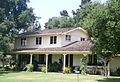
Thomas Mann House: A Writer's Refuge

Designed by JR Davidson, this was the home of writer Thomas Mann. He lived here from 1942 to 1952 during his exile.
Villa Aurora: Home for Exiled Artists

Villa Aurora is a place for artists to live and work. It is a Los Angeles Historic-Cultural Monument. It was once the home of exiled German-Jewish writer Lion Feuchtwanger and his wife Marta.
Wildlife in Pacific Palisades
Pacific Palisades is home to many kinds of wildlife. Some are native to the area, and others were brought from elsewhere.
Wild Parrots: Colorful Residents

Pacific Palisades is known for its large population of California wild parrots. They are one of the main places in Southern California where you can find them. The parrots mostly live in the sycamore-lined canyons. Wild parrots have been in the Palisades since the 1960s. They are thought to be descendants of pet parrots released after the 1961 Bel Air fire and the closing of Busch Gardens in Van Nuys.
Many types of parrots live in the Palisades. The most common is the Nanday parakeet. Other species include the mitred parakeet, yellow-chevroned parakeet, white-winged parakeet, rose-ringed parakeet, red-masked parakeet, blue-crowned parakeet, red-crowned parrot, lilac-crowned parrot, white-fronted parrot, blue-fronted parrot, yellow-headed parrot, and the red-lored parrot.
Images for kids
-
Los Angeles skyline
-
-
-
-
-
-
-
-
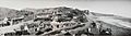
"Inceville", Santa Ynez Canyon, California, c. 1919
-
Santa Monica Canyon, 1921
-
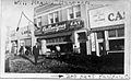
Photo of the devastation from the 1938 flood in what is now The Village
-
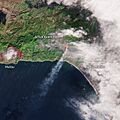
Satellite image of the 2025 Palisades Fire minutes after ignition
-
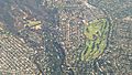
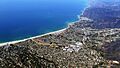
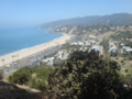
Aerial view of Pacific Palisades, the Riviera neighborhood can be seen to the right
-
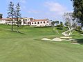
Finishing hole at Riviera Country Club
-
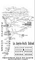
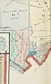
Santa Monica Cañon visible on a LAPRR Balloon Route map circa 1903
-
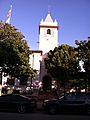
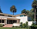
Palisades Charter High School
-
Pacific Palisades Charter Elementary School front tower
-
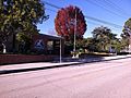
Marquez Elementary School
-
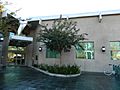
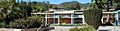
Los Angeles Public Library Palisades Branch
-
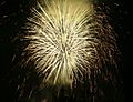
Fireworks during the 2006 Palisades Rocks The Fourth! event
-
Par 3 on the course
-
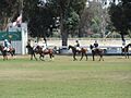
Match at the Will Rogers Polo Club in 2013
-
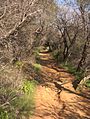
Temescal Canyon Ridge Trail
-
Will Rogers House, one of the park's main attractions
-

Panoramic view from Temescal Peak
-
Bradbury House
-
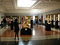
Art on display at the Getty
-
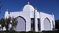
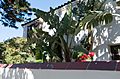
Temple located at the Self-Realization Fellowship Lake Shrine
-
Thomas Mann House
-
Villa Aurora
-
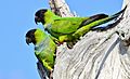
Nanday parakeets resting in a tree in Pacific Palisades
See also
 In Spanish: Pacific Palisades para niños
- List of districts and neighborhoods in Los Angeles
- Old Santa Monica Forestry Station in Pacific Palisades.
