Conesville, New York facts for kids
Quick facts for kids
Conesville, New York
|
|
|---|---|

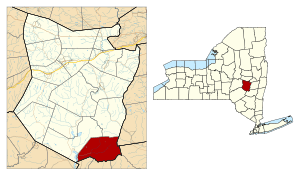
Location in Schoharie County and the state of New York.
|
|
| Country | United States |
| State | New York |
| County | Schoharie |
| Area | |
| • Total | 39.87 sq mi (103.26 km2) |
| • Land | 39.47 sq mi (102.22 km2) |
| • Water | 0.40 sq mi (1.05 km2) |
| Elevation | 1,457 ft (444 m) |
| Population
(2020)
|
|
| • Total | 687 |
| • Density | 17.231/sq mi (6.653/km2) |
| Time zone | UTC-5 (Eastern (EST)) |
| • Summer (DST) | UTC-4 (EDT) |
| FIPS code | 36-17651 |
| GNIS feature ID | 0978859 |
Conesville is a small town in Schoharie County, New York, United States. In 2020, about 687 people lived there. The town is named after Jonathan Cone, who was one of the first people to live in the area.
The Town of Conesville is located in the southeastern part of Schoharie County. It is about 40 miles (64 km) southwest of Albany, the capital city of New York.
Contents
History of Conesville
Conesville was first settled around 1764. This happened after a special document called a "patent" was given in 1754. A patent is like an official paper that gives someone the right to own land.
The town of Conesville was officially created in 1836. It was formed from parts of two other towns: the Town of Durham (which is now in Greene County) and the Town of Broome.
Geography of Conesville
Conesville covers a total area of about 39.9 square miles (103.3 square kilometers). Most of this area, about 39.5 square miles (102.3 square kilometers), is land. The rest, about 0.4 square miles (1.0 square kilometer), is water.
The southern edge of Conesville is the border with Greene County. Part of the eastern edge also borders Greene County. The northern part of the eastern border touches Albany County.
The Manor Kill is an important stream in Conesville. It flows westward and gets water from another stream called the Bear Kill. The Manor Kill eventually flows into the Schoharie Reservoir near West Conesville.
New York State Route 990V is a main road that runs through the town. It goes from the community of Conesville all the way to the western edge of the town, near the Schoharie Reservoir.
Population of Conesville
| Historical population | |||
|---|---|---|---|
| Census | Pop. | %± | |
| 1840 | 1,621 | — | |
| 1850 | 1,582 | −2.4% | |
| 1860 | 1,478 | −6.6% | |
| 1870 | 1,314 | −11.1% | |
| 1880 | 1,127 | −14.2% | |
| 1890 | 929 | −17.6% | |
| 1900 | 793 | −14.6% | |
| 1910 | 708 | −10.7% | |
| 1920 | 652 | −7.9% | |
| 1930 | 569 | −12.7% | |
| 1940 | 673 | 18.3% | |
| 1950 | 626 | −7.0% | |
| 1960 | 593 | −5.3% | |
| 1970 | 489 | −17.5% | |
| 1980 | 681 | 39.3% | |
| 1990 | 684 | 0.4% | |
| 2000 | 726 | 6.1% | |
| 2010 | 734 | 1.1% | |
| 2020 | 687 | −6.4% | |
| U.S. Decennial Census 2020 | |||
According to the census from the year 2000, there were 726 people living in Conesville. These people lived in 304 households, and 214 of these were families. The population density was about 18.4 people per square mile.
The average household had about 2.39 people. The average family had about 2.85 people.
In 2000, about 22.3% of the people in Conesville were under 18 years old. About 18.9% were 65 years old or older. The average age of people in the town was 44 years.
Communities and Landmarks in Conesville
- Conesville – This is the main hamlet (a small village) of Conesville. It is located on the Manor Kill stream. You can find it where County Roads 3 and 18 meet NY-990V.
- Manor Kill – This is a stream that flows through the town. It eventually reaches the Schoharie Reservoir.
- Manorkill – This is another hamlet located in the eastern part of the town. It is on County Road 3 and also along the Manor Kill stream.
- Schoharie Reservoir – This is a large reservoir (a place where water is stored). It is located at the western edge of the town. It was built in 1926.
- West Conesville – This is a hamlet in the western part of the town. It is located on State Route 990V, close to the Schoharie Reservoir.
See also
 In Spanish: Conesville (Nueva York) para niños
 | Selma Burke |
 | Pauline Powell Burns |
 | Frederick J. Brown |
 | Robert Blackburn |

