Cookes Range facts for kids
Quick facts for kids Cookes Range |
|
|---|---|
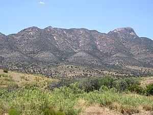
Eastern side of Cookes Range
|
|
| Highest point | |
| Peak | Cookes Peak (Cookes Range) |
| Elevation | 8,408 ft (2,563 m) |
| Dimensions | |
| Length | 17 mi (27 km) N-S |
| Width | 8 mi (13 km) |
| Geography | |
| Country | United States |
| State | New Mexico |
| Region | ((northwest)-Chihuahuan Desert) |
| County | Luna |
| Settlement | Deming Nutt, Lake Valley |
| Borders on | Whitehorse Mountain-NW Mimbres Mountains-N Good Sight Mountains-ESE Deming, NM & Florida Mtns-S |
| Topo map | USGS Massacre Peak |
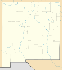
The Cookes Range is a small mountain range in New Mexico, USA. It is about 17 miles (27 km) long. This range is mostly in Luna County, but a small part goes into Grant County. It's like a southern extension of the larger Black Range. The area around Cookes Range is part of the Chihuahuan Desert.
Contents
What is Cookes Range?
Cookes Range is about 17 miles long and 8 miles wide at its widest point. It is a type of mountain range called a basin and range uplift. This means it formed from the Earth's crust stretching and breaking.
The highest point in the range is Cookes Peak. It stands tall at 8,408 feet (2,563 meters) high. This peak was formed by a type of rock called granodiorite pushing up from underground.
Another important peak in the southern part of the range is Massacre Peak. It is 5,667 feet (1,727 meters) high. There are also smaller hills around the main range.
History of Cookes Range
The Cookes Range and its main peak are named after Captain Philip St. George Cooke. He was a leader in the Mormon Battalion.
Cookes Spring, a natural water source, was an important stop. It was used by travelers on the Butterfield Trail. This trail was a famous route for mail and passengers in the 1800s.
Fort Cummings
Fort Cummings was a military fort built near Cookes Spring. It was active from 1863 to 1873, and again from 1880 to 1886. The fort's main purpose was to protect people from raids by the Mimbreño Apache tribe.
Mining in the Range
In 1876, people found silver in the Cookes Range. This led to the creation of the Cooks Peak Mining District in 1880. Miners dug for silver, lead, and zinc in this area. Mining continued there until 1967.
Nature and Wildlife
The higher parts of the Cookes Range are covered in pinon-juniper trees and shrubs. These plants are common in dry, elevated areas. As you go down the mountains, the plant life changes. The lower hills and flat areas are part of the Chihuahuan Desert.
A special protected area called the Cookes Range Wilderness Study Area is located here. This area is set aside to protect its natural environment and wildlife.
 | Anna J. Cooper |
 | Mary McLeod Bethune |
 | Lillie Mae Bradford |


