Coolville, Ohio facts for kids
Quick facts for kids
Coolville, Ohio
|
|
|---|---|
|
Village
|
|
 |
|

Location of Coolville, Ohio
|
|

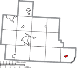
Location of Coolville in Athens County
|
|
| Country | United States |
| State | Ohio |
| County | Athens |
| Area | |
| • Total | 1.00 sq mi (2.58 km2) |
| • Land | 0.98 sq mi (2.54 km2) |
| • Water | 0.02 sq mi (0.05 km2) |
| Elevation | 712 ft (217 m) |
| Population
(2020)
|
|
| • Total | 454 |
| • Estimate
(2023)
|
445 |
| • Density | 463.27/sq mi (178.80/km2) |
| Time zone | UTC-5 (Eastern (EST)) |
| • Summer (DST) | UTC-4 (EDT) |
| ZIP code |
45723
|
| Area code(s) | 740 |
| FIPS code | 39-18588 |
| GNIS feature ID | 2398623 |
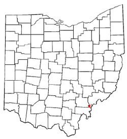
Coolville is a small village in Ohio, United States. It is located in the southeastern part of the state, in Athens County. In 2020, about 452 people lived there.
Contents
History of Coolville
Coolville was first planned out in 1818 by a person named Simeon W. Cooley. The village is named after him! It officially became a village in 1835.
By the 1830s, Coolville had grown quite a bit. It had two stores, a gristmill (which grinds grain into flour), and a sawmill (which cuts wood).
Coolville is known for its interesting name. It's close to other places with "hot" or "cold" names. These include Torch and Frost in Athens County, and Snowville in Meigs County.
A building called "Roots" General and Feed store was built in 1846. It is still standing today, but it has been changed into a home with a business front. The village's bank was originally built in the late 1800s on Main Street. Today, that building is known as the "Village Hall."
Coolville's Geography
Coolville is located on the west bank of the Hocking River. This river flows into the Ohio River a few miles downstream.
Major roads like US 50, SR 32, and SR 7 pass by the north side of the village. These roads make it easy to get to Coolville. Another road, OH-144, is also nearby on the Hocking River's bank.
The United States Census Bureau says that Coolville covers a total area of about 0.85 square miles (2.2 square kilometers). Most of this area is land, with a small part being water.
Population and People
| Historical population | |||
|---|---|---|---|
| Census | Pop. | %± | |
| 1870 | 334 | — | |
| 1880 | 323 | −3.3% | |
| 1890 | 330 | 2.2% | |
| 1900 | 315 | −4.5% | |
| 1910 | 370 | 17.5% | |
| 1920 | 457 | 23.5% | |
| 1930 | 475 | 3.9% | |
| 1940 | 463 | −2.5% | |
| 1950 | 469 | 1.3% | |
| 1960 | 443 | −5.5% | |
| 1970 | 672 | 51.7% | |
| 1980 | 649 | −3.4% | |
| 1990 | 663 | 2.2% | |
| 2000 | 528 | −20.4% | |
| 2010 | 496 | −6.1% | |
| 2020 | 454 | −8.5% | |
| 2023 (est.) | 445 | −10.3% | |
| U.S. Decennial Census | |||
What the 2010 Census Showed
In 2010, the census counted 496 people living in Coolville. There were 188 homes, and 139 of these were families.
Most of the people in the village were White (98.0%). A small number were African American (0.4%), or from two or more races (1.6%). About 0.2% of the population was Hispanic or Latino.
About 34.6% of the homes had children under 18 years old living there. The average age of people in Coolville was 39 years. About 25% of the residents were under 18 years old.
Education in Coolville
Students in Coolville attend schools in the Federal Hocking Local School District. Many go to Federal Hocking High School in Stewart.
Coolville also has its own public library. It is a branch of the Athens County Public Libraries.
See also
 In Spanish: Coolville (Ohio) para niños
 | Delilah Pierce |
 | Gordon Parks |
 | Augusta Savage |
 | Charles Ethan Porter |

