
Coonalpyn, South Australia facts for kids
Quick facts for kids CoonalpynSouth Australia |
|||||||||||||||
|---|---|---|---|---|---|---|---|---|---|---|---|---|---|---|---|

Aerial view of Coonalpyn
|
|||||||||||||||

Coonalpyn
Location in South Australia
|
|||||||||||||||
| Established | 25 November 1909 (town) 24 August 2000 (locality) |
||||||||||||||
| Postcode(s) | 5265 | ||||||||||||||
| Elevation | 22 m (72 ft)(railway station) | ||||||||||||||
| Time zone | ACST (UTC+9:30) | ||||||||||||||
| • Summer (DST) | ACST (UTC+10:30) | ||||||||||||||
| Location |
|
||||||||||||||
| LGA(s) | The Coorong District Council | ||||||||||||||
| Region | Murray and Mallee | ||||||||||||||
| County | Buccleuch | ||||||||||||||
| State electorate(s) | MacKillop | ||||||||||||||
| Federal Division(s) | Barker | ||||||||||||||
|
|||||||||||||||
|
|||||||||||||||
| Footnotes | Locations Adjoining localities |
||||||||||||||
Coonalpyn (pronounced koo-NAL-pin) is a small town and area in South Australia. It's about 143 kilometers (89 miles) south-east of Adelaide, the state capital. You'll find it about 61 kilometers (38 miles) south-east of Tailem Bend. Coonalpyn is part of the The Coorong District Council. It also belongs to the MacKillop state area and the Barker federal area.
Contents
What's in a Name?

The name Coonalpyn comes from an Aboriginal word. It means "barren woman." This name was first chosen by John Barton Hack for his property. Later, the railway station and the town itself took the same name.
A Look Back: Coonalpyn's History
How Coonalpyn Began
The town of Coonalpyn officially started on November 25, 1909. For a long time, the area was seen as part of the Ninety Mile Desert. This changed around 1949 when the AMP Society started to develop the land. This development helped the area become more useful for farming and living.
Local Government Changes
Coonalpyn became important for local government. On May 30, 1957, the District Council of Coonalpyn Downs was created here. This council helped manage the local area.
Later, in 1997, some changes happened. The District Council of Coonalpyn Downs joined with two other councils. These were the Peake District Council and the Meningie District Council. Together, they formed the larger The Coorong District Council.
Modern Services Arrive
Life in Coonalpyn became easier with new services. Electricity came to the town in 1962, thanks to the ETSA. A few years later, in 1968, the Tailem Bend–Keith pipeline was built. This brought much-needed water to the area. The official boundaries for the Coonalpyn area were set on August 24, 2000.
Community and Churches
A group of Lutheran settlers moved to Coonalpyn in the early 1920s. They formed their first church group, Bethlehem Lutheran Congregation, in 1930. A second group, Immanuel Lutheran Congregation, started in 1940.
In 1952, both groups decided to build a new church. The Coonalpyn Lutheran Church was finished and opened in 1953. In 1966, two larger Lutheran church groups merged. Because of this, the local Coonalpyn congregations also joined together. They formed the Redeemer Lutheran congregation. This new church group also included people from nearby Tintinara and Meningie.
Sports and Fun in Coonalpyn
Football and Netball
Sports are a big part of life in Coonalpyn. In 1992, two Australian Rules football teams joined forces. These were the Border-Downs Magpies and the Tintinara Blues. They formed a new team called the Border-Downs Tintinara Crows Football Club.
The Crows first played in the River Murray Football League. In 2001, they moved to the Mallee Football League. The club also has a netball team, the Crows Netball Club.
Tennis and Lawn Bowls
Coonalpyn also has a tennis club. It's part of the Border-Downs Tennis Association. This association includes teams from many nearby towns. Some of these towns are Malinong, Culburra, Yumali, Coomandook, Tintinara, and Ki Ki.
There's also an active lawn bowls club in Coonalpyn. They often hold "community bowls" nights in the summer. This helps everyone in the community enjoy the game of lawn bowls.
Images for kids
-
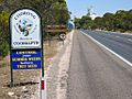
Entrance to Coonalpyn
-
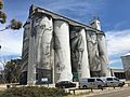
Art on the grain silos at Coonalpyn
-
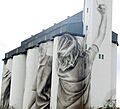
End view of silos
-
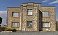
Town hall / Institute building
-
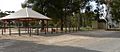
Parking bay at highway rest area
-
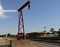
Old Coonalpyn railway station
-
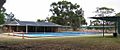
Community swimming pool
-
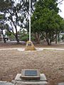
War memorial
-
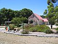
Redeemer Lutheran Church
-
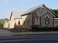
Uniting Church
-
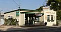
Coonalpyn Bakery
-
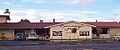
Coonalpyn Hotel


