
Coosada, Alabama facts for kids
Quick facts for kids
Coosada, Alabama
|
||
|---|---|---|

Coosada town hall and post office
|
||
|
||

Location of Coosada in Elmore County, Alabama.
|
||
| Country | United States | |
| State | Alabama | |
| County | Elmore | |
| Area | ||
| • Total | 7.13 sq mi (18.48 km2) | |
| • Land | 6.89 sq mi (17.86 km2) | |
| • Water | 0.24 sq mi (0.62 km2) | |
| Elevation | 180 ft (55 m) | |
| Population
(2020)
|
||
| • Total | 1,217 | |
| • Density | 176.53/sq mi (68.16/km2) | |
| Time zone | UTC-6 (Central (CST)) | |
| • Summer (DST) | UTC-5 (CDT) | |
| ZIP code |
36020
|
|
| Area code(s) | 334 | |
| FIPS code | 01-17176 | |
| GNIS feature ID | 0137171 | |

Coosada is a small town located in Elmore County, Alabama, United States. In 2020, about 1,217 people lived there. It is part of the larger Montgomery area.
Contents
History of Coosada
Early History and Native Americans
The area where Coosada is now was once home to a Creek village called Koasati. This was in the 1700s and early 1800s. Many Chickamauga Cherokee people, who followed a leader named Dragging Canoe, came to this village during and after the American War of Independence.
Coosada is also famous as the birthplace of William Weatherford. He was an important Creek leader who led the "Red Stick uprising" in 1813–1814. After this time, many Native American people were moved away from their lands to the west. This event is known as the Indian removal.
Settlers and Town Growth
Soon after, settlers from the United States began to move into the area. One of these settlers was William Wyatt Bibb, who later became the first governor of Alabama. He bought the land where the Koasati village used to be and divided it into smaller pieces to sell.
By 1818, Coosada had a post office and a sawmill. When a train station was built in 1872, the settlement was called "Coosada Station." Around 1890, its name was shortened to simply "Coosada."
Geography
Coosada is located along the Alabama River. The U.S. Census Bureau says the town covers about 7.3 square miles (18.9 square kilometers). Most of this area is land, with a small part (about 0.2 square miles or 0.5 square kilometers) being water.
Population and People
| Historical population | |||
|---|---|---|---|
| Census | Pop. | %± | |
| 1880 | 45 | — | |
| 1970 | 240 | — | |
| 1980 | 980 | 308.3% | |
| 1990 | 912 | −6.9% | |
| 2000 | 1,382 | 51.5% | |
| 2010 | 1,224 | −11.4% | |
| 2020 | 1,217 | −0.6% | |
| U.S. Decennial Census 2013 Estimate |
|||
Note: The 1880 U.S. Census figure is for the unincorporated community of Coosada Station. Coosada was not incorporated until 1967.
As of the 2020 United States census, Coosada had 1,217 people living there. The town is made up of different groups of people. About 55.7% of the people were White (not Hispanic), and about 36.6% were Black or African American (not Hispanic). There were also smaller numbers of Native American, Asian, and people of mixed races. About 4.2% of the population was Hispanic or Latino.
Education
Students in Coosada attend schools that are part of the Elmore County Public School System.
Famous People from Coosada
- William Wyatt Bibb: He was the very first governor of Alabama. He is buried near Coosada.
- George G. McWhorter: He was a judge on the Florida Supreme Court from 1885 to 1887.
- William Weatherford: A significant Creek chief who was born near Coosada.
Images for kids
-
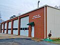
Coosada volunteer fire department

See Also
 In Spanish: Coosada para niños
