Corcoran, California facts for kids
Quick facts for kids
Corcoran, California
|
||
|---|---|---|

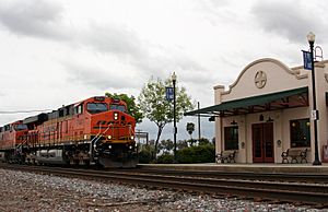
Amtrak station in Corcoran (2010)
|
||
|
||

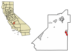
Location within California and Kings County
|
||
| Country | United States | |
| State | California | |
| County | Kings | |
| Incorporated | 1914 | |
| Area | ||
| • Total | 7.46 sq mi (19.32 km2) | |
| • Land | 7.46 sq mi (19.32 km2) | |
| • Water | 0.00 sq mi (0.00 km2) 0% | |
| Elevation | 207 ft (63 m) | |
| Population
(2020)
|
||
| • Total | 22,339 | |
| • Density | 2,995.31/sq mi (1,156.55/km2) | |
| Time zone | UTC-8 (Pacific (PST)) | |
| • Summer (DST) | UTC-7 (PDT) | |
| ZIP code |
93212
|
|
| Area code(s) | 559 | |
| FIPS code | 06-16224 | |
| GNIS feature ID | 1652690 | |
Corcoran is a city located in Kings County, California, in the United States. In 2020, about 22,339 people lived there. The city is about 17 miles (27 km) south-southeast of Hanford. It sits at an elevation of 207 feet (63 meters) above sea level.
Corcoran is well-known because it is home to two large state prisons: the California State Prison, Corcoran and the California Substance Abuse Treatment Facility and State Prison, Corcoran. These facilities are major employers in the area.
Contents
History
Corcoran was started by Hobart Johnstone Whitley, a famous land developer from southern California. He was the main person who helped build the city. The main street in Corcoran is named after him.
In 1905, Whitley visited the area and saw a small community with a blacksmith shop, a store, and some homes. He also saw lots of wild animals. He decided to buy 32,000 acres (129.5 square kilometers) of land to begin developing the town.
Whitley had planned to name the town "Otis" after Harrison Gray Otis, who owned the Los Angeles Times newspaper. Some streets in Corcoran still show these connections, like Otis, Sherman, Letts, and Ross. Whitley is said to have started about 150 towns across the American West, and Corcoran was one of his last projects.
J. W. Guiberson, who worked for Whitley's real estate company, moved to Corcoran. He became one of the first settlers, building the first home and business in the city. His family also helped create the first church. This led to the town officially becoming a city on August 14, 1914.
The main way Corcoran has always made money is through farming, also known as agriculture. In the beginning, the most successful crops grown were grains, alfalfa, and sugar beets.
In 1933, more than 12,000 farm workers went on strike against cotton farmers. This was one of the largest California agricultural strikes of 1933. The striking workers in Corcoran set up a tent city that grew to hold over 3,000 people. This was more than double the town's population at the time. The workers organized the camp with streets and committees.
The J. G. Boswell Company, a large agricultural business, was started in Corcoran in 1921. It is still a major employer in the city today. The first post office in Corcoran opened in 1901.
Geography
Corcoran is located at 36°05′53″N 119°33′37″W / 36.09806°N 119.56028°W.
The United States Census Bureau says that the city covers a total area of 6.4 square miles (16.6 square kilometers), and all of it is land.
The ground beneath Corcoran is slowly sinking. This happens because a lot of groundwater is being pumped out for farming. In the last 14 years, the ground has sunk by as much as 11.5 feet (3.5 meters).
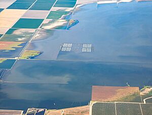
The soils around Corcoran are often wet and can be salty. Corcoran can sometimes experience widespread flooding because it is located in a basin, which is like a low bowl-shaped area. There were big floods in 1983 and 2023.
Climate
| Weather chart for Corcoran | |||||||||||||||||||||||||||||||||||||||||||||||
|---|---|---|---|---|---|---|---|---|---|---|---|---|---|---|---|---|---|---|---|---|---|---|---|---|---|---|---|---|---|---|---|---|---|---|---|---|---|---|---|---|---|---|---|---|---|---|---|
| J | F | M | A | M | J | J | A | S | O | N | D | ||||||||||||||||||||||||||||||||||||
|
1.5
54
38
|
1.5
62
41
|
1.4
68
44
|
0.5
76
47
|
0.2
85
53
|
0.1
93
59
|
0
98
63
|
0
96
62
|
0.2
91
59
|
0.4
81
51
|
0.8
65
41
|
0.9
54
36
|
||||||||||||||||||||||||||||||||||||
| temperatures in °F precipitation totals in inches source: US Climate Data |
|||||||||||||||||||||||||||||||||||||||||||||||
|
Metric conversion
|
|||||||||||||||||||||||||||||||||||||||||||||||
Population Information
| Historical population | |||
|---|---|---|---|
| Census | Pop. | %± | |
| 1920 | 1,101 | — | |
| 1930 | 1,768 | 60.6% | |
| 1940 | 2,092 | 18.3% | |
| 1950 | 3,150 | 50.6% | |
| 1960 | 4,976 | 58.0% | |
| 1970 | 5,249 | 5.5% | |
| 1980 | 6,454 | 23.0% | |
| 1990 | 13,364 | 107.1% | |
| 2000 | 14,458 | 8.2% | |
| 2010 | 24,813 | 71.6% | |
| 2020 | 22,339 | −10.0% | |
| U.S. Decennial Census | |||
Corcoran is part of the Hanford–Corcoran Metropolitan Statistical Area. This means it's part of a larger area that includes Hanford.
2010 Census
The 2010 United States Census showed that Corcoran had a population of 24,813 people. The population density was about 3,323 people per square mile (1,283 people per square kilometer).
About 50.7% of the people lived in regular homes. The average household had about 3.50 people. Many households (55.1%) had children under 18 living in them.
The population included people of various ages:
- 17.9% were under 18 years old.
- 10.9% were between 18 and 24 years old.
- 41.1% were between 25 and 44 years old.
- 24.8% were between 45 and 64 years old.
- 5.3% were 65 years or older.
The median age in Corcoran was 35.0 years.
2000 Census
In the 2000 census, Corcoran had 14,458 people. The population density was about 2,260 people per square mile (873 people per square kilometer).
About 49.7% of households had children under 18 living with them. The average household size was 3.44 people.
The population was spread out by age:
- 24.4% were under 18 years old.
- 13.0% were between 18 and 24 years old.
- 42.0% were between 25 and 44 years old.
- 15.3% were between 45 and 64 years old.
- 5.4% were 65 years or older.
The median age was 31 years.
Economy
In 2000, the average yearly income for a household in Corcoran was about $30,783. For a family, the average income was $32,852. The average income per person in the city was $13,458.
About 23.4% of families and 26.9% of the total population lived below the poverty line. This included 36.4% of those under 18 and 10.6% of those 65 or older.
Many people in Corcoran work in agriculture, which is farming. However, the community has faced challenges. These include the Great Recession, a decline in the cotton industry, and the California drought. In November 2016, the unemployment rate was 11.1%.
The biggest employers in Corcoran are the California State Prison, Corcoran, the California Substance Abuse Treatment Facility and State Prison, Corcoran, the Corcoran Unified School District, and the J. G. Boswell Company.
Education
The Corcoran Unified School District is in charge of public education in Corcoran. The school district has seven schools:
- Bret Harte
- John C. Fremont
- Mark Twain
- John Muir Middle School
- Corcoran High School
- Corcoran Academy
- Kings Lake Educational Center
Transportation
Railroads
Corcoran is served by the BNSF Railway. This railway line was originally built around 1898 by the San Francisco and San Joaquin Valley Railway. It connected the San Francisco Bay Area to Bakersfield, California.
Today, Amtrak California's San Joaquin train stops at the Corcoran station.
From 1910 to 1934, a different train line called the Kings Lake Shore Railroad ran southwest from Corcoran to what used to be Tulare Lake.
In 2010, the California High-Speed Rail Authority decided to start building the first part of the California High-Speed Rail line near Madera and continue it to Corcoran. Construction on this high-speed rail line began in 2012.
See also
 In Spanish: Corcoran para niños


