Cottonwood Canyon Road facts for kids

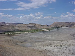
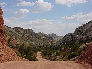
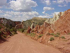
Cottonwood Canyon Road (also called Road 400 or Cottonwood Canyons Scenic Backway) is a beautiful 46-mile (74 km) or 47-mile (76 km) dirt road. It goes through Cottonwood Canyon in Kane County, Utah.
The road starts in Cannonville, near Utah State Route 12. It then heads south through Grand Staircase–Escalante National Monument. Finally, it connects to U.S. Route 89.
This road was first built to help maintain power lines in the canyon. Driving the whole road takes about two hours if you don't stop. You can find visitor centers in Cannonville (north) and Big Water (south).
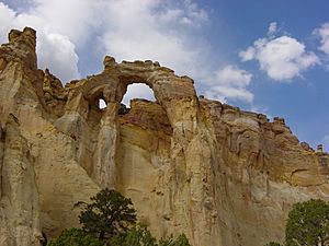
Along the way, you'll see amazing things like Navajo Sandstone cliffs and Grosvenor Arch. You can also visit Kodachrome Basin State Park. The road gives you access to fun hiking trails. Some popular ones are Cottonwood Wash Narrows, Yellow Rock, and Hackberry Canyon.
Driving on Cottonwood Canyon Road
Most of Cottonwood Canyon Road is unpaved. However, about nine miles between Cannonville and Kodachrome Basin State Park are paved. It's very important to know that the road can become impassable when it's wet. This can happen any time of year.
Many parts of the road are built on old seabed deposits. These are made of mud and clay. When these get wet, the surface becomes very slippery. Even vehicles with four-wheel drive can get stuck.
Also, many small streams cross the road. These can wash out parts of the road during flash floods. This is especially true during summer thunderstorms. Even when it's dry, some low areas can be muddy and hard to drive through. Always check road conditions before you go!
Where the Road Starts and Ends
- The southern end of the road is where it meets US-89 in Kane County. 37°06′18″N 111°50′49″W / 37.10500°N 111.84694°W
- The northern end is near Cannonville, at the Kane County line. Here, it becomes Kodachrome Road. 37°32′08″N 112°03′04″W / 37.53556°N 112.05111°W
 | Delilah Pierce |
 | Gordon Parks |
 | Augusta Savage |
 | Charles Ethan Porter |


